
A bit of a departure from my usual road-based cycle touring exploits, but during the Coronavirus lockdown I have been preparing my mountain bike (an On-One Scandal 29er with rigid fork) to try some off-road bikepacking. I was fairly confident that the frame and wheels could make a good off-road touring set up, but was finding it uncomfortable over longer distances. After fitting a new Brooks saddle, handlebar and tyres, I’m much happier with it. Recently, I’ve tried it on longer day trips from my home in Fife, including 47 miles along the Pilgrim Way to Ceres and a similar length outing between Leuchars and Kirkcaldy on the Fife Coastal Path. Having decided it was ready to try out on a multi-day trip, my friend, Darran, mentioned he was planning on undertaking the 150 mile ‘Capital Trail’ that looped from Edinburgh to the Borders and back, via Melrose and Peebles. That sounded ideal, especially as we’d canoed down the Tweed together before, and this would be a great opportunity for us to revisit some of the places we’d passed through on that trip.

The Capital Trail is a 150 Mile largely off-road bikepacking route, derived by endurance cyclist Markus Stitz. It starts at Portobello Promenade wends its way down to Selkirk in the Scottish Borders and back to Edinburgh, over a combination of forest trails, landrover tracks, disused railway lines, drove roads, country lanes, through fields, and over hilltops. Our plan was to start at Darran’s house in Corstorphine on the Friday night, cut across Edinburgh to Musselburgh to pick up the route, and then spend the rest of the weekend working our way around the route back to the start. It seemed feasible, although neither of us had done a similar bikepacking trip before, and we both had untested kit we were experimenting with for the first time…
Day 1: Edinburgh – Pentcaitland
Distance: 22.7 miles
Time: 2:33
Elevation: 898 feet
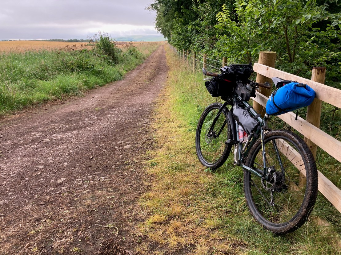
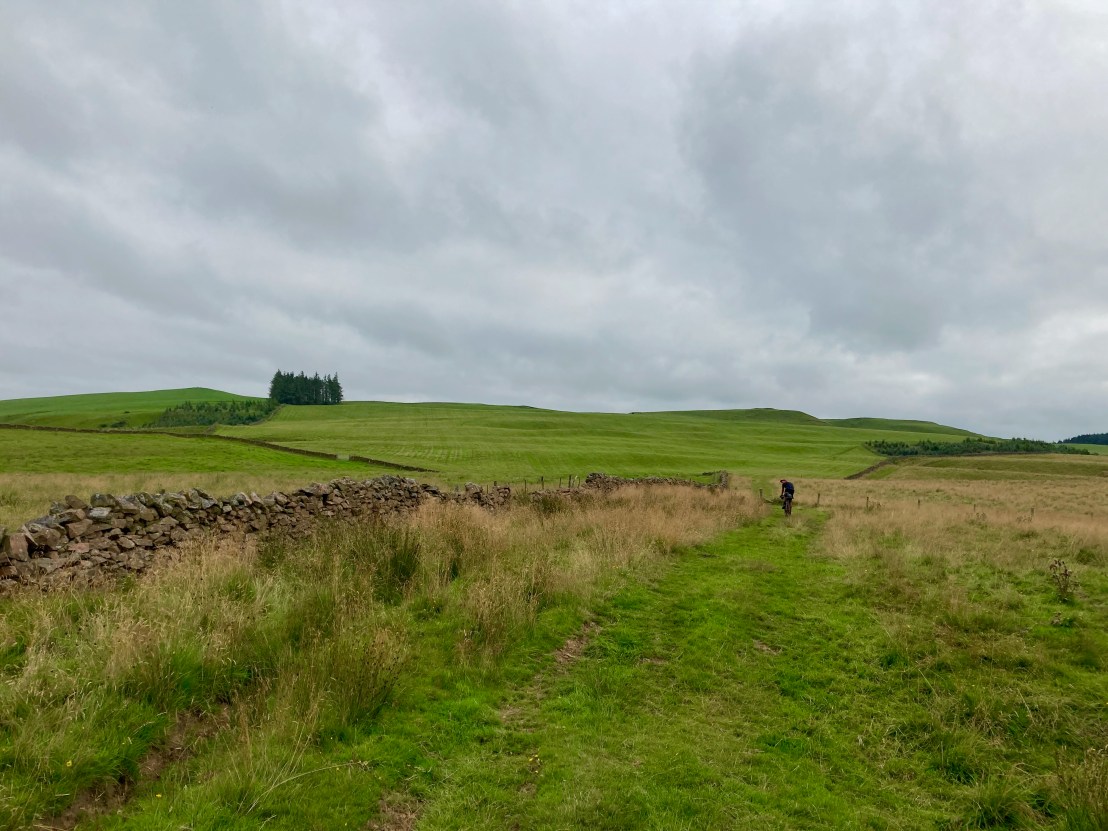
After packing as light as I could possibly bear, with a new bivvy bag in place of a tent, I headed to Darran’s where he was just starting to deliberate his own kit requirements. When he’d finished, the bags on his shiny new Sonder Camino bike were looking impressively empty, unlike mine which were filled to bursting, as always. Leaving at 6 PM, the plan was to get out of the city in time to find somewhere to camp by nightfall. We quickly worked our way across Edinburgh and down to the coast at Musselburgh where we picked up the Capital Trail route. We soon headed back inland on a path alongside the river Esk before hitting our first single track trails in the Carberry Estate. Following the GPS data track on my Garmin was a challenge, especially under tree cover, as the margin for error between the original GPX track and the device’s own GPS tracking quite often made it appear that we were no longer on the route, so there were a few false turns and some backtracking was required. Views back towards Edinburgh from the Carberry Estate were very pleasant, and showed us how quickly we’d managed to escape the city bounds.

After the Carberry Estate, we hit the Pentcaitland railway path, and had a few easier miles, stopping to talk to a fellow cyclist who intended to press on to Melrose overnight. It was soon approaching 9 o’clock and we were passing through thick woodland just shy of Pentcaitland when it started to get dark and we began the search for a camping spot. Finding a grassy spot by a river, we cooked up dinner on our stoves and enjoyed a beer to celebrate a successful start to the trip. Then it was time to settle down for my first night in a bivouac…
Day 2: Pentcaitland – Selkirk
Distance: 54.9 miles
Time: 7:41
Elevation: 5,542 feet

I had a fitful sleep during my first night in a bivvy bag, but reckoned I’d got at least 4 hours, and was confident that after a full day on the bike, I’d definitely sleep better tonight. It was not long after 7 AM when we hit the road, planning on reaching Lauder for breakfast. Going was slow, however, and ascending on the rocky single track through Saltoun Big Wood was energy sapping.
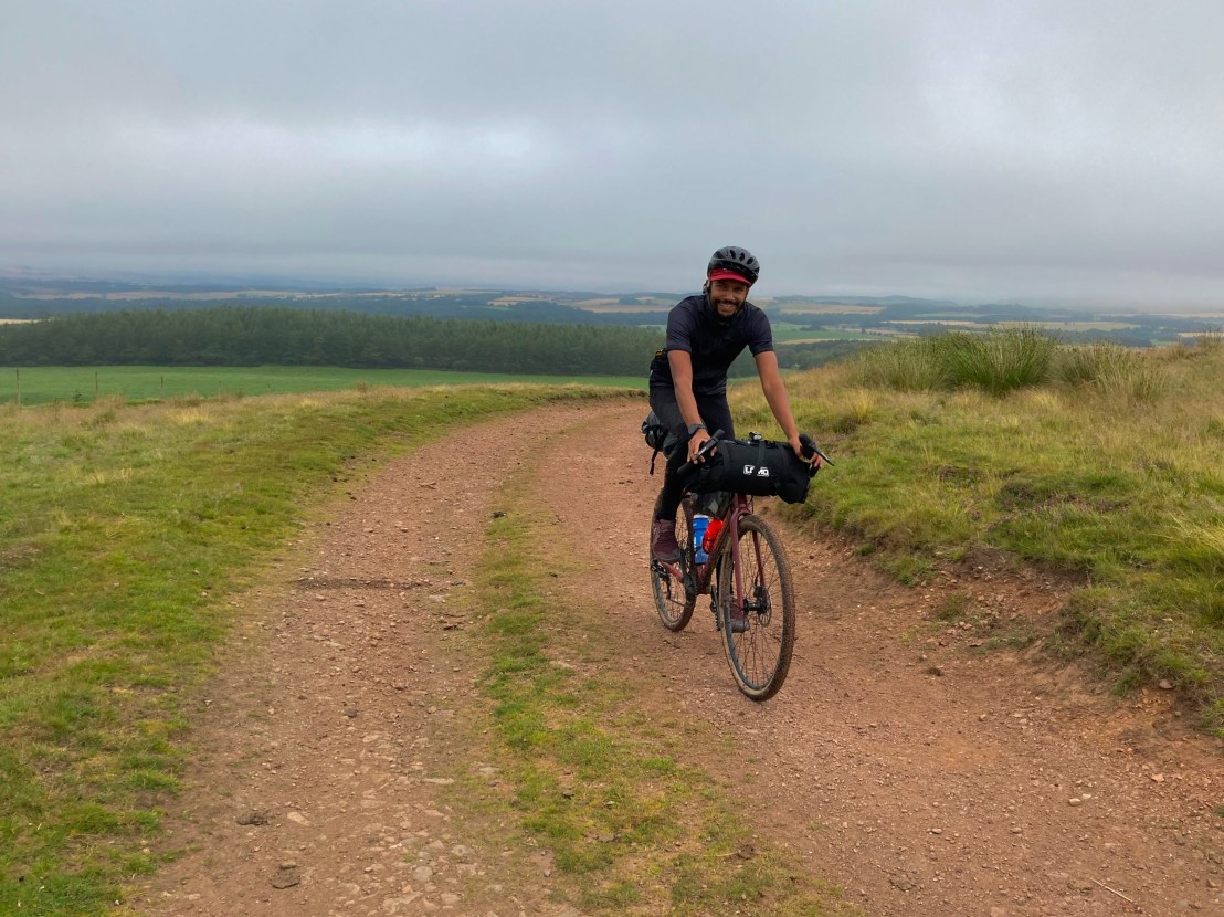
Soon we were out on the open road and climbing higher and higher into the Lammermuir hills, eventually the road petered out into a single track path that crested Lammer Law (529m), the last mile averaging over 9% gradient. We passed a group of dog joggers as we travelled along a high ridge, before soon being overtaken by them again as I rang out my socks after a particularly damp river crossing.

It felt like we’d had a big morning when we eventually reached Lauder at 11 o’clock, refuelling at the Flat Cat Gallery and Cafe. Ordering soup, a baguette and cake along with water, juice and coffee seemed excessive at the time, but ultimately the energy recuperated barely recovered that already spent during the morning.
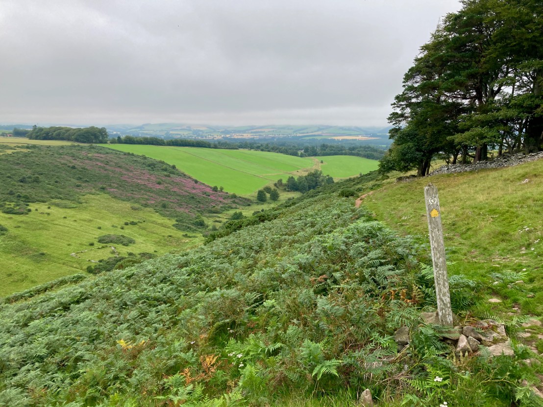
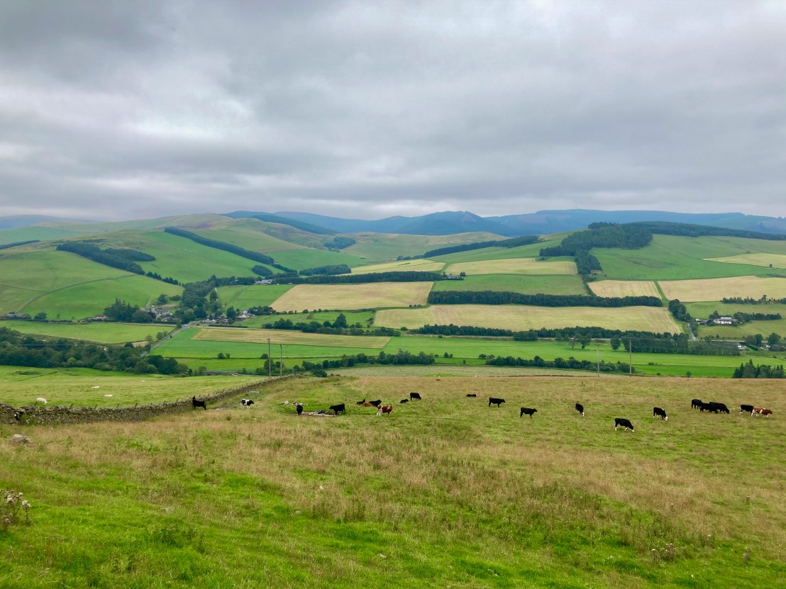
Leaving Lauder, and another steep climb under our belts, we were onto the Southern Upland Way for the first time. The terrain was varied as we traversed a high plateau south towards Melrose, finally thundering down an old drovers road, we made our final approach to Melrose. In town, the sun had started to break through the clouds, and we stopped for ice cream at the same shop that we visited during our canoeing trip the year before. Having now covered 40 miles for the day, we were feeling rejuvenated and stocked up supplies at the co-op before pressing on, following the Borders Abbeys Way along the Tweed and then over the hills to Selkirk.
Dropping down from Selkirk we crossed Ettrick Water and started to climb a steep rocky track through a forest. Eventually succumbing to the slope, we pushed on up the hill, suffering after an 11 hour day of steep hills and difficult terrain, river crossings and bike lifting. Having endured enough, we called it a day at 6 o’clock, setting up camp across the valley from Selkirk. After a very large bowl of pasta, I settled down after a very strenuous day.

Day 3: Selkirk – Edinburgh
Distance: 55.08 miles
Time: 7:32
Elevation: 4922 feet
Sleeping well in my bivvy, after yesterday’s exertions, it was ten to 9 before we hit the trail. Unfortunately, it was the same trail as yesterday, and that meant a stiff climb through the forest. Cutting across open farmland we then started the grinding climb up a tricky singletrack, over high moorland, to the Three Brethren summit at 464 metres. The last stretch was a push for me as I struggled to pedal over the part-muddy / part-rock-strewn terrain.
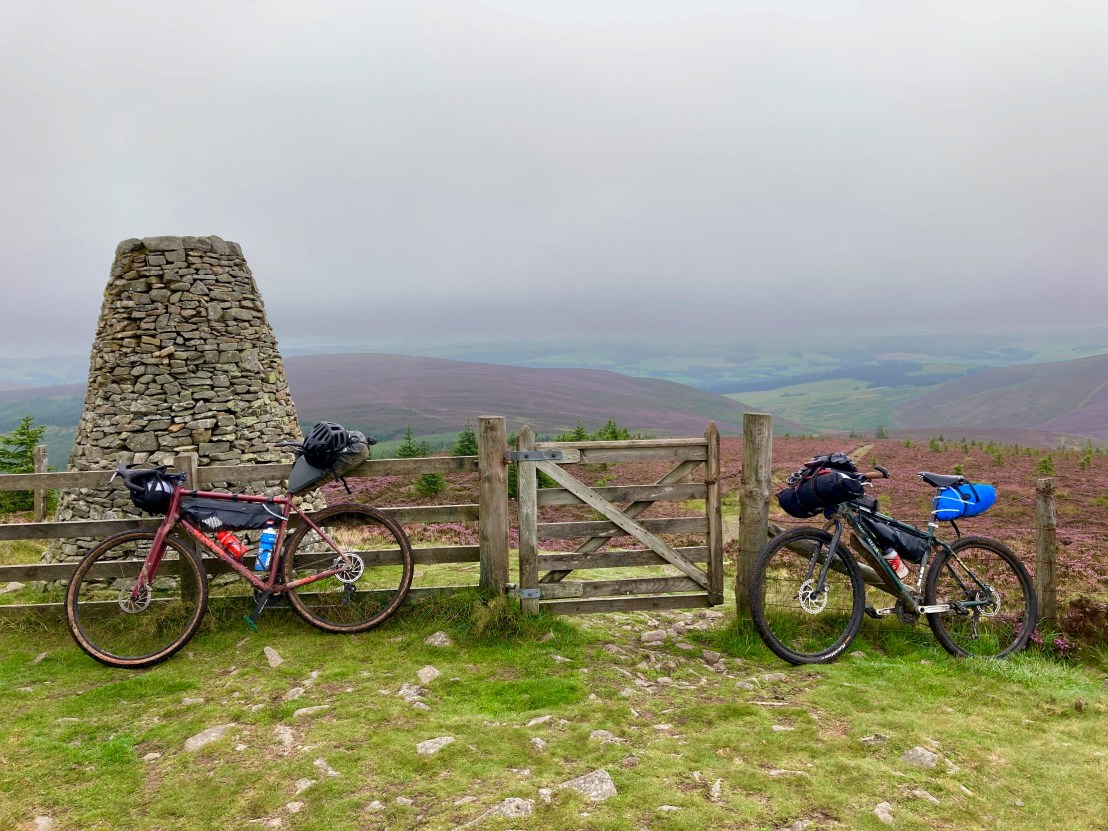
From the summit we set off west along the Southern Upland Way, passing an ultra runner out for a casual 32 mile fell run. The path was slow-going once again with the addition of heather and bog to slow our progress. Turning north through a forest we finally reached a familiar 7 Stanes signpost that suggested we’d reached the Innerleithen mountain bike trail centre. Having the route lead us down a series of MTB red runs on our fully-loaded bikepacking set ups seemed crazy, but in the end it was a fun addition to the route. It was also hard work, and by the time we reached Innerleithen after a tough three hour stretch we were famished. Calling in at the Traquair Arms hotel for lunch we both had the excellent Sunday roast, Rib-eye of beef, and afterwards, I had banofee profiteroles!
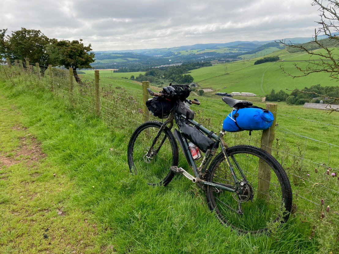
At this stage, a decision had to be made. At the current pace, we were going to struggle to make it back to Edinburgh by nightfall, and we could only assume the next stretch to Peebles would be just as slow (research suggests it’s probably the hardest part of the whole route, cresting 660 metres), so we opted to jump on the excellent, and busy, 7 mile cycle path between Innerleithen and Peebles. Departing Peebles on an old drove road we encountered another savage gradient, and combined with the rocky terrain it was difficult to keep the wheels turning. Unsurprisingly, we were soon high above Peebles on a good track across the moorland.
Back on the road for a few miles into West Linton, we made our final pit stop, for an ice cream and some juice at the local co-op. Lying on the grass at the local park, we started to feel like we’d almost completed our task, having just about reached the Pentlands, and more familiar territory. We left West Linton on an old Roman Road to Carlops, skirting along the edge of the hills before turning north once more and climbing steeply up to a cleft between the hills.

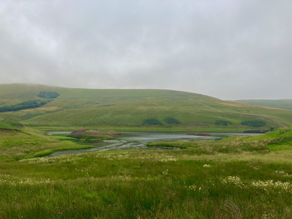
We passed the North Esk reservoir in the heart of the Pentlands, before traversing along steep slopes on a narrow path between Weather Law and Cock Rig, cresting a col at 400m, before flying down a good track all the way to Bavelaw on the edge of Balerno.
Cutting down through the grounds of the Heriot Watt University from Currie, we made our way to the Gogar roundabout and into Edinburgh passed the Maybury junction and back to our starting point in Corstorphine. It was 8 o’clock by the time we finished and it had been another hard 55 mile day, largely off-road on difficult terrain. Overall we had covered around 133 miles and had successfully made it back to the start, relatively unscathed, but sore, very sore.
Overall the Capital Trail is a fantastic route, over very challenging terrain. The hills didn’t let up, but either did the scenery. We had a great few days in the wilderness, without having to stray far from home. Definitely worth considering for anyone looking for a great bikepacking adventure in Scotland!
