Category: Uncategorized

Day 26: Bodega Dunes – Samuel P. Taylor State Park

Day 26: Bodega Dunes – Samuel P. Taylor State Park

Distance: 45:63 miles.
Time: 4:36.
Average Speed: 9.9 mph.

One of the reasons I opted to cycle the Pacific Coast route, other than the fact it is renowned as being a beautiful route, and its linear simplicity on a map, was the portrayal of the small town of Bodega Bay, in the film ‘The Birds’. Ignoring the deviant avian behaviour, It had a pleasant small town appeal that would suit me fine, if it was an example of places along the coast.

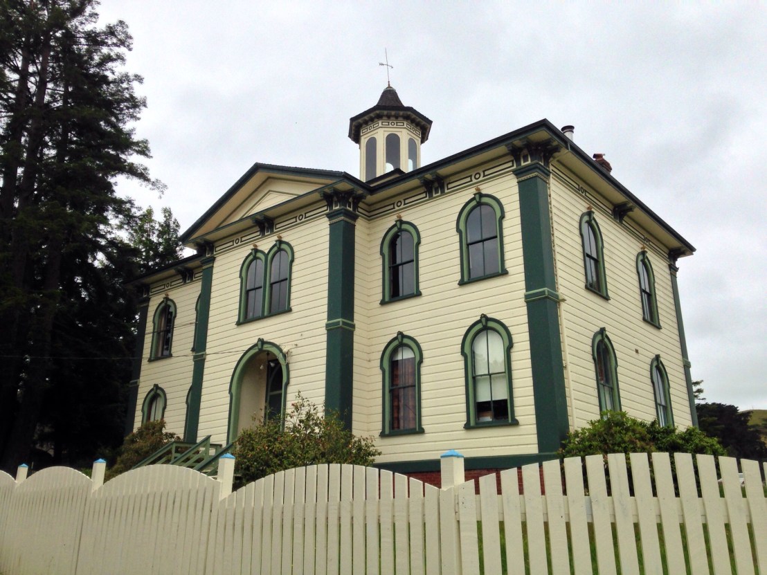
Popping into Bodega Bay last night, I discovered ‘Taylor Street’, a steeply banked residential street that looked reminiscent of a street used as a location in the film. Indeed it was, but the school that was up the hill in the film wasn’t there. Checking afterwards, I discovered that the school was in Bodega, just off today’s route.

Today, I ended up riding with the guys who I’d met on the way to the campsite last night, Matt from Oakland, and Joe from Gilroy, who were cycling, for a few days, from Mendocino to San Francisco. We went for breakfast at a cafe in Bodega Bay before setting off for what would, hopefully, be a slightly shorter day. It turned out that Matt and Joe both played guitar and had met while playing in a band together. They both also had musical instrument making fathers.

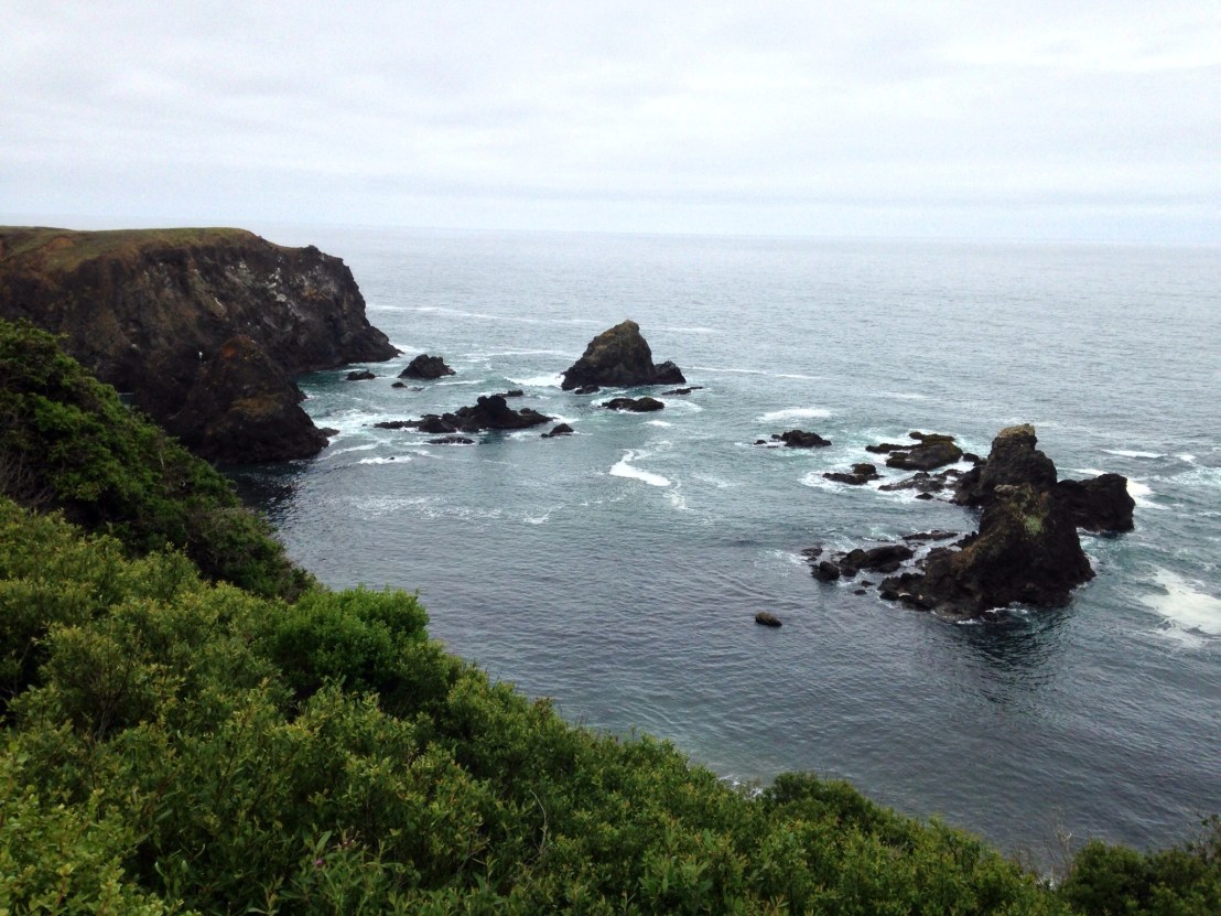
We rode along the coast through Bodega Bay before turning inland and over a couple of short climbs, then I took a short detour to Bodega, where the Potter Schoolhouse – that was used for the infamous school scene in The Birds – was filmed.

image.jpg

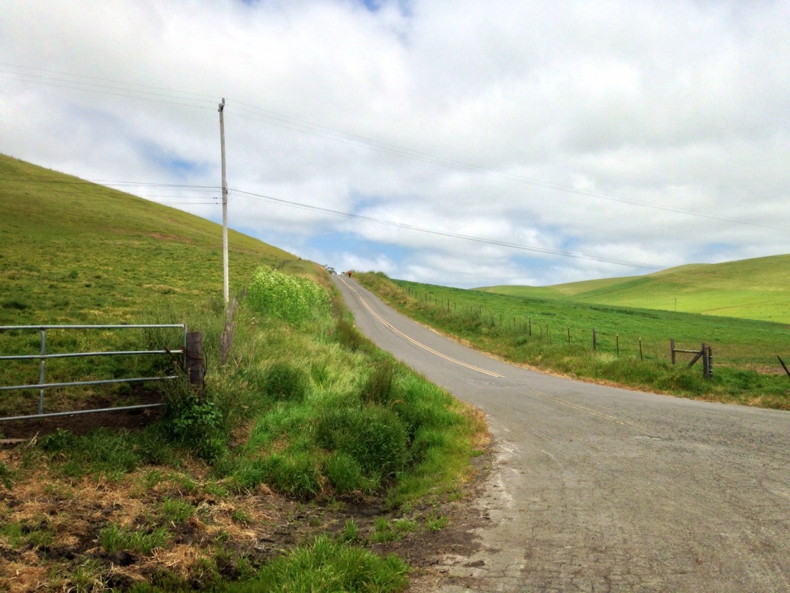
Shortly after, at Valley Ford, Matt suggested an alternate route, away from the highway. It was through beautiful countryside but with some severe climbs thrown in.

image.jpg
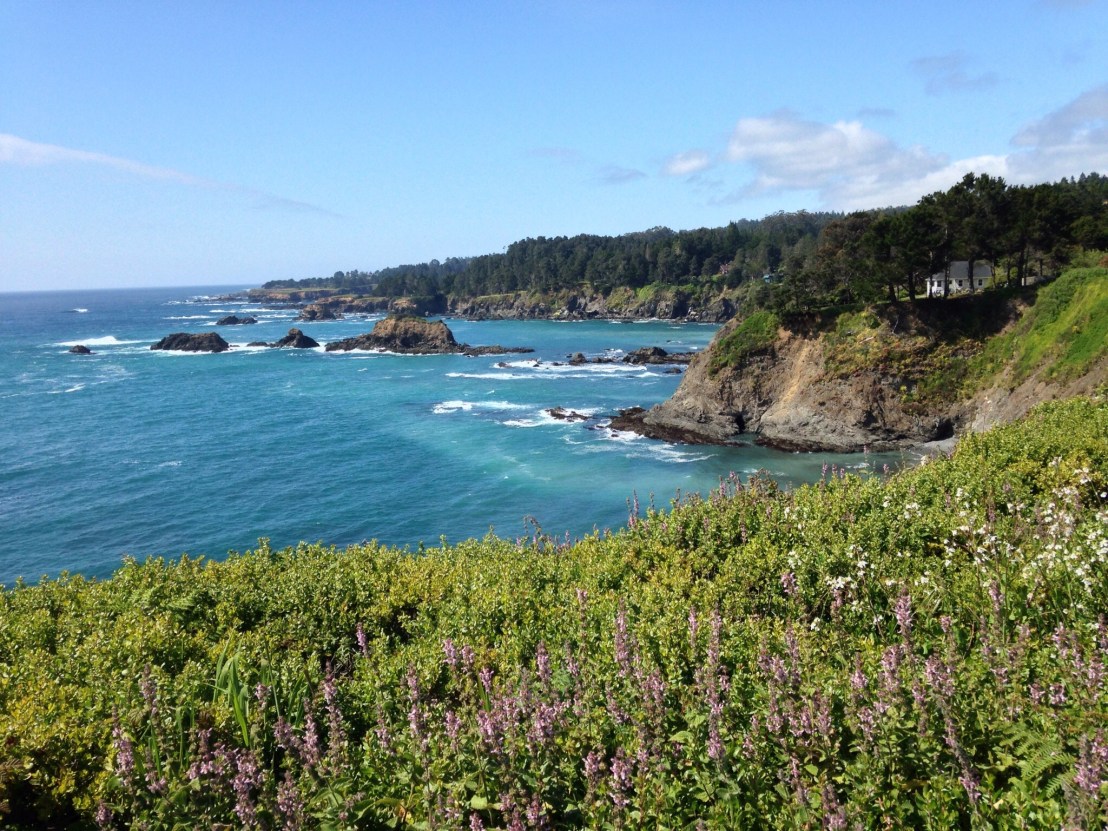
Back on highway 1, we stopped for lunch in Tomales, the sun was out and the restaurant had a nice patio area at the side.

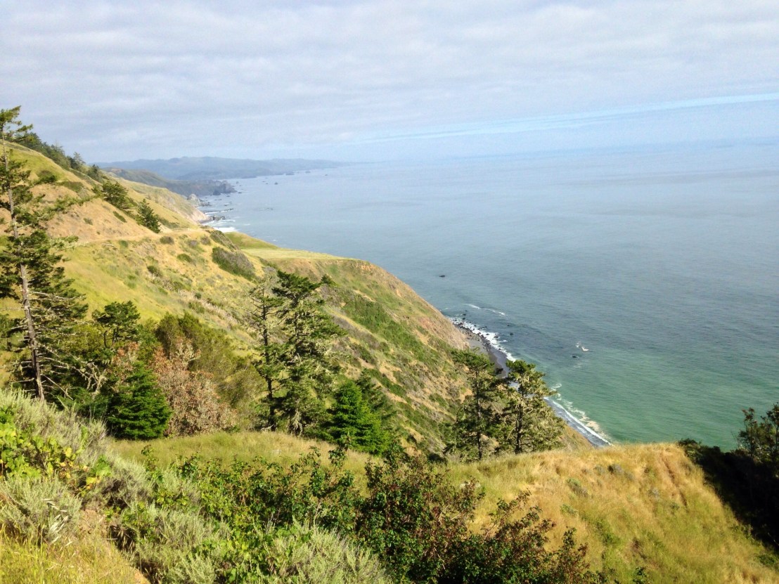
We continued down the long sea inlet of Tomales Bay, passing numerous busy oyster bars en route. Then we climbed over to Point Reyes Station where we picked up Burritos and a few beers from a local deli, before winding along Point Reyes Petaluma Road to our campsite for the evening, Samuel P. Taylor State Park. We were lucky, 3 hiker/biker sites were already full, and we were in the back-up site, along with a couple who’d also just arrived, Kelly and Dan. They were from San Francisco, and this was a trial run for a trip to Iceland later in the summer.

After an enjoyable day’s cycle, it was a nice way to end the day, with a few beers with my site-mates.

Day 25: Manchester Beach – Bodega Dunes

Day 25: Manchester Beach – Bodega Dunes

Distance: 74.70 miles.
Time: 7:35.
Average Speed: 9.8 mph.

I know I’ve said this before, but today was tough. It was a long route, completely on Highway 1. There were small hills, medium hills, big hills, steep hills, shallow hills. Hills.

As I was packing up, a Dutch couple, Kris and Bernadette, came to say hello, they had set off from Los Angeles, and were on their way north to Anchorage, Alaska. A four month trip. That was nothing compared to Kevin, the other member of the campsite’s hiker/biker ‘club’. He had set off to walk the Appalachian trail two years before and was still walking. Planning to walk north up the Pacific Coast before taking a break for a year. After that, he would set off to walk the Great Divide and Pacific Crest trails too.

Finally setting off, at 20 past 10, it was cold and drizzly. I stopped to put on my waterproof overshoes, and was asked if I was ok by a dog walker. When I responded, she asked if I was Scottish, debating whether I was from Glasgow, before deciding my accent was a little more subtle. It turned out she’d played a courtier in a rendition of Mary Queen of Scots and had studied the accent for that!

Cool and damp, through nondescript farmland, it was a good time to put some miles in. I decided I’d do the 20 miles to Gualala before lunch. But the going was slow with a number of steep inclines sapping my energy reserves. I managed 12 miles, then stopped for a couple of rolls.

Carrying on, the hills didn’t let up and I struggled into Gualala. Finding a Bakery/ Mexican/ Pizzeria in a small shopping centre, I ordered a large slice of pizza and enchiladas as well. The pizza was good and the enchiladas came as a huge plateful with refried beans, rice and salad.

It was good fuel for cycling, but I felt terrible for the first couple of miles, as my body tried to process the massive amount of food. By the time I was feeling better, the route had become a procession of rolling hills, which was much more pleasant. Then, just when I was getting comfortable, a river inlet would indent the coast, with the road dropping steeply down to meet it, and climbing back up the other side.

image.jpg

At half past 3, having just past 40 miles for the day, my front gear cable snapped. Luckily, it was an easy fix and I was back on the road in quarter of an hour. I was keen to press on, concerned that, as it was a holiday weekend, camping might be an issue, a concern supported by the string of ‘full’ campsites I past on the route.

At 50 miles, the road started to climb, continuing on for quarter of a mile through roadworks and then over some cattle grids, eventually I realised I was at 185 metres, then the road dropped slightly, before plateauing and rising back up over the top of a ridge, with a fast twisting descent down the other side. All with great views along the coast.

image.jpg

Just past Jenner, I passed a couple of cyclists on a bridge, just before the last big climb of the day. After the climb, one of them passed me then sped off ahead. A few miles later, as I headed towards Bodega Bay, he returned going back the other way, explaining that the Hiker/Biker camping was this way. Following his lead, we returned 2 miles back to Wrights beach. It had camping, but not hiker/Biker, so we turned round again, and headed back along the road to the Bodega Dunes campsite.

Bodega Dunes was also ‘full’, but not for cyclists. On a very busy weekend for campsites, the hiker/biker section had one other tent in it when we arrived.

Day 24: MacKerricher Beach – Manchester Beach

Day 24: MacKerricher Beach – Manchester Beach (KOA)

Distance: 46.5 miles.
Time: 5:05.
Average Speed: 9.1 mph.

As it was a relatively short day, I took it easy this morning, fixing yesterday’s punctured inner tube and stitching the seam of my shorts. It was after 12 by the time I left the campsite and pedalled along an old haul road for the few miles into Fort Bragg. I stopped for a lengthy lunch at a Pizza Buffet restaurant and by the time I really got going it was almost 3.

Despite the short miles, it was still meant to be a tough day because of the climbs, but by the time the road had been predominantly flat for 15 miles, I was feeling complacent.

As the morning’s clouds dissipated, the sun broke through and the – already – staggering scenery became bewildering. I took a short detour around Mendocino headland, affording me stunning views back along the coast.

image.jpg

Arriving in the quaint town of Mendocino, an artist’s haven with its own film festival, I stopped at a cafe, off the Main Street, for an Ice Cream, it was idyllic.

Soon I was back on the highway, and the bubble burst. The hills started, with a vengeance. It took an age for the miles to go by, as the road made its way, agonisingly along the coast.

The scenery remained astonishing, and along a winding road with no shoulder, it reminded me of the Outer Hebrides back home.

Finally arriving in Elk, after 30 miles, a thought crossed my mind. It had been lucky, that so far all the shops I’d gone to had been open, even when arriving in the evening. The one in Elk was shut, great. It was only 13 miles to the campsite now, I was sure I’d manage.

Just outside Elk, I arrived at, allegedly, the steepest climb on the route, instantly I knew why. The straight section at the start ramped up to well over 10 percent, and then, as I crawled around the outside of the first switchback, I gasped: the inside of the corner must have been 25 percent, astonishingly steep for a major road. Then it was my turn, for the second corner, I was on the inside, and as I entered the corner it looked like a wall in front of me. Standing to force through the pedals, the chain skipped, and before I had a chance to react, I had tumbled off the road and into the verge, the bike flipping 180 degrees and landing on top of me.

image.jpg

Dusting myself down, I seemed to be ok, just having banged my elbow. Remarkably, the bike seemed fine too, I reattached the panniers, which had fallen off in the crash, and tentatively pedalled on up the road, on the outside of the bend. Summiting the climb, the adrenaline was pumping and I laughed out, of all the things that could have scuppered my trip, falling off going uphill wasn’t high up on my list of predictions.

I arrived at the Manchester Beach KOA campsite, just after the office should have closed, but my luck was in, the shop was still open, and, amazingly, they had a $10 Hiker /Biker rate.

Tomorrow, I will be largely staying on my bike, hopefully, all the way to Bodega Bay!

Day 23: Richardson Grove – MacKerricher State Park

Day 23: Richardson Grove State Park – MacKerricher State Park

Distance: 58.30 miles.
Time: 6:27.
Average Speed: 9 mph.

I woke late, but the plethora of flying insects in the campsite had me on the move quickly. Setting off at 20 past 10, I stopped for a hotdog at a garage a mile in. The heatwave appeared to be continuing and the route was largely uphill, through a stunning river valley.

image

After ten miles, descending a steep slope on the highway, I hit a stone and there was a loud hiss from the front wheel. Dragging the bike off the road, I began repairs. Shortly after, Vincent – who I’d met yesterday – came around the bend. I thought it likely our paths would cross again, as he starts early and gets a move on, whereas I start late and slowly. We chatted while I changed the puncture before he headed off for his final few miles of the day. I probably had 50 still to do.

As I began the long climb to the high point of the route, 2000 feet, over Leggett Hill, I joined Highway 1 for the first time, and mileage markers showed it was now only 199 miles to San Francisco.

image

Climbing higher and higher up hairpin bends, it was fiercely hot, and I was drinking a lot of water, for the first time on the route. At 430 metres altitude, I started to get concerned, I had been hoping to stop at Leggett for lunch, surely it wasn’t this high up the road, when had I missed the town? I had a few Peanut M&Ms and a cereal bar to do me until Westport, 25 miles later: and even more concerning, half a bottle of water.

I continued up the hill, reaching the summit at 570m, then dropped quickly down the other side, down a very twisty road. The road continued to rise and fall, and finally climbed a second steeper hill before dropping back to the coast 10 miles north of Westport. It was cold, breezy, and foggy, so completely different from an hour ago. My lack of water, suddenly not a problem.

image.jpg

The climbing didn’t stop, however, the road rising and falling steeply along the coast. Eventually, I reached Westport, looking for food. There were 2 closed hotels and a shop. Decision made. Luckily, the shop had WiFi, and sold burgers, sandwiches, and ice creams. I bought quite the picnic, before finding a stool and sitting in the corner gorging myself and frantically uploading posts that had been waiting on my return from the wilderness of the Redwoods.

It was another 12 miles to final destination, MacKerricher State
Park, with some steep hills along the way. Stopped on one slope, a 4×4 driver pulled over to ask if I was ‘happy riding on’. It was a gloomy evening, but only half past 7, so plenty of daylight yet!

Arriving at 8 o’clock, I set up camp. Soon after, another cyclist showed up, Mark from New Mexico. He’s heading north from San Francisco, up to Vancouver and then East across the country. A long trip, and he was just getting started.

I had undoubtedly finished one of the toughest days of the trip. Although only 58 miles, the climbing was significant, and, hopefully, it shows I’m in good shape for the weeks ahead.