Lejog Day 4: Crediton – Bridgwater

Distance: 58 miles

Time: 5:39

Elevation: 2342 feet

I didn’t have much food left for breakfast, so pasta it was, and then the tortuous process of loading up my kit began. Quarter to 11 was the wholly unimpressive start time today, perhaps my body stealing back as much recovery as possible.

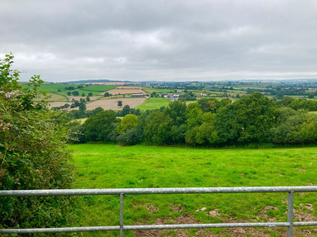
Today was to be a day of two halves, with the remaining hills of Devon making way for the Somerset levels later on. I was all set for a morning as hard as yesterday’s, but luckily, that didn’t really materialise.

For the first few miles I wound my way between the fields as I made my way back towards the route, joining it at Thorverton, where I stopped at a quaint little shop for something healthy and nutritious, and came out with a chocolate orange brownie.

The going remained fair and as the miles ticked by I started to worry, where were all the hills? But, I needn’t have worried, and 14 miles in, leaving Bradninch, the road headed skywards, a 16% gradient sign staring me in the face. But, I slowed my cadence and with my heart rate in check, rode all the way to the top; redemption for the hill in Penzance I’d walked.

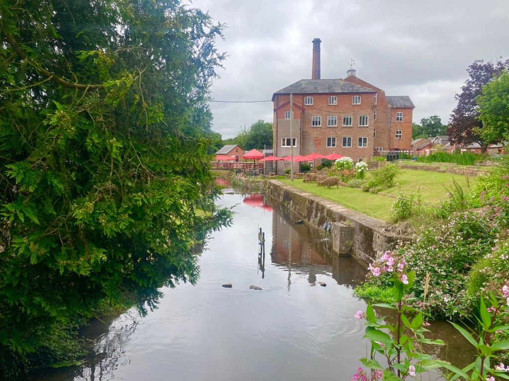
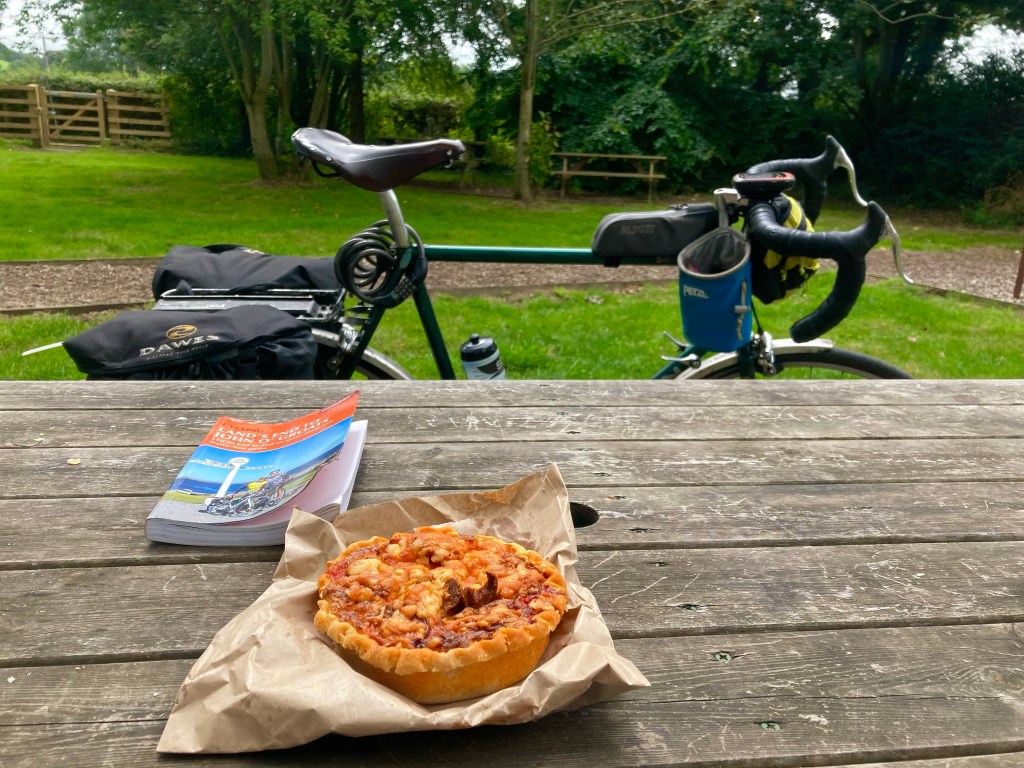
After picking up a chorizo and sweet pepper quiche at The Little Bakery in Cullompton, I ate it near the Uffculme wool mill, before setting off for the last few miles of Devon, which unceremoniously ended as I crossed the M5 Motorway.

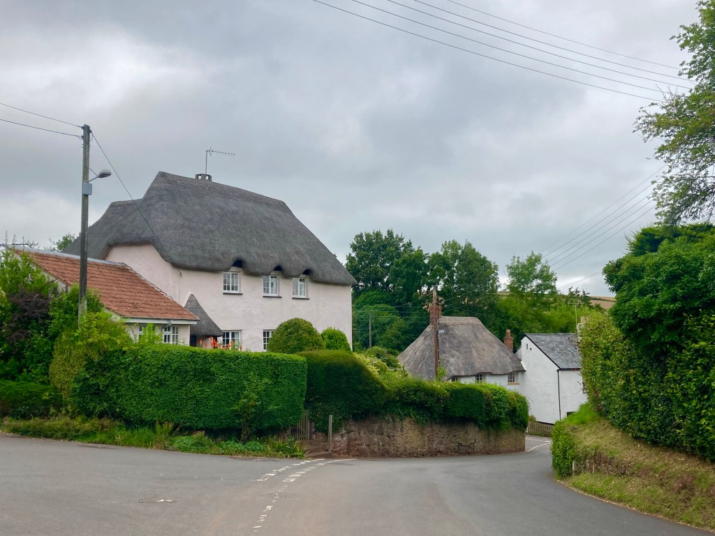
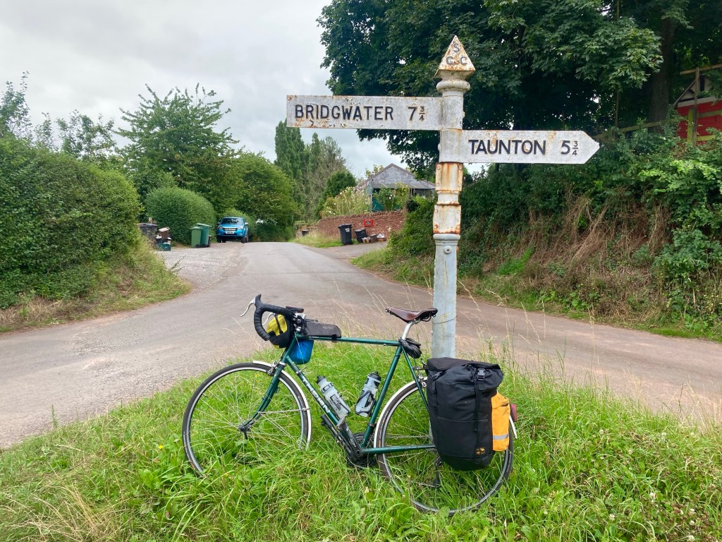
Passing through leafy Bradford-on-Tone, I finally reached Taunton, where I tried to navigate its labyrinthine cycle ways before bailing out at Hubbox for sweet potato fries and a milkshake.

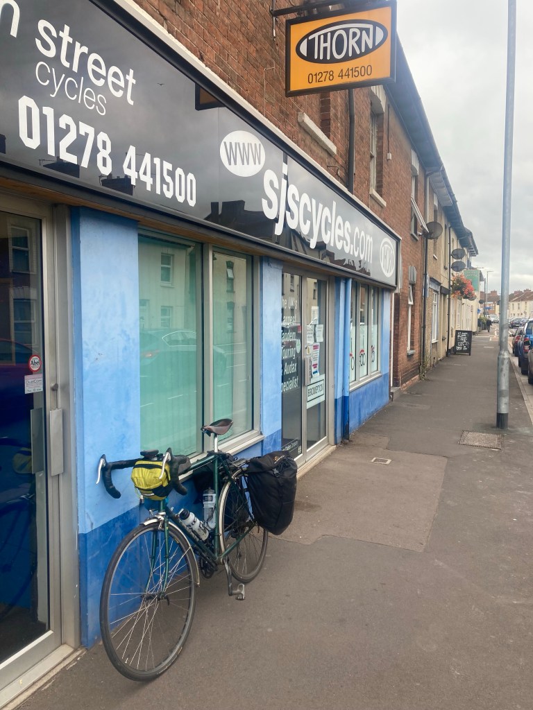
The route ahead was to follow the Taunton to Bridgwater canal for the next 14 miles, but a brief sortie along the towpath suggested that, if I wanted to avoid any further punctures, I would be doing no such thing. Instead, I freestyled it a little, heading further west, before making a detour into Bridgwater, to swing by SJS Cycles, the home of Thorn bicycles, and indeed, where my noble steed doth originate. Naturally, it was closed.

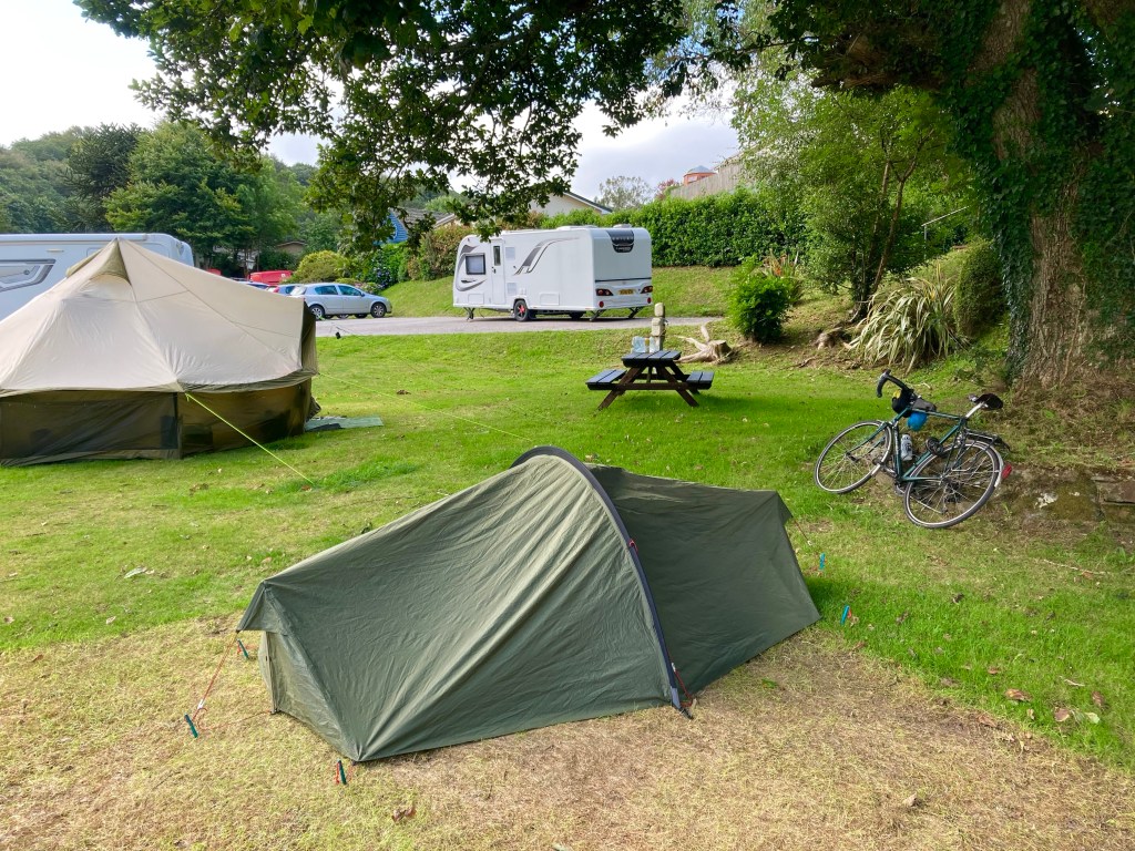
Out of Bridgwater, my only remaining goal for the day was to find a campsite, and when the host of the one I’d hoped to stay at emailed to say they were fully booked, I opted for the nearest one available. I’d already booked it when I realised there weren’t any showers, and the ground was so hard I could barely pitch the tent, but hopefully, I’d be somewhere else tomorrow.

Lejog Day 3: Liskeard – Crediton

Distance: 55.4 miles

Time: 5:34

Elevation: 4096 feet

The day started well when the campsite owner, Kathryn, brought me over some porridge and a coffee. I was on the road at 10 o’clock and had unfinished business with the climb up to Bodmin Moor.

A brisk descent through Pensilva followed and then another stiff climb up to Golberdon, where my alternative accommodation for the previous evening had been. Down and up again through anonymous country lanes, then another brake-busting descent led to Horsebridge, where a medieval bridge aided my passage to a new county, Devon.

Devon welcomed me with a grinding climb; from 50m Horsebridge to 300m and the edge of Dartmoor. Under the shadow of Brent Tor and its ancient church, I chatted to a cyclist on a few day tour around the moor, laden with four panniers and with a rucksack strapped atop his rack.

The road dropped down to Lydford Gorge, and I stopped at the visitor centre cafe for ice cream and a scone. As I sat preparing my scone on the grass, I realised that I was at risk of committing a huge cultural faux pas, by ignorantly applying the clotted cream and jam in an order wholly incognisant of the Devonian methodology. I carried on regardless, if any interested party, Devonian or Cornish, wanted to see how a scone should be prepared, this could be a lesson to them. As it happens, the right way is the Devonian way, but I’d desecrated tradition anyway by having a fruit scone, and raspberry – not strawberry – jam.

Soon there was a distinct improvement in proceedings as I turned onto ‘The Granite Way’, a tarmacked former railway bed that crept around the edge of Dartmoor for 8 gloriously flat miles between Lydford and Okehampton. The cycle path was busy with other users and one man in particular appeared to be having a tough time of it, with a fixed wheel tagalong attached to his bike, his son seemed to be having a great time back pedalling up the climbs!

After popping into a shop on the edge of Okehampton for provisions, I committed myself to aim for Crediton, another 20 miles further on. Thankfully, the road stuck to major roads to Whiddon Down, and I felt good riding the shallower gradients. The going remained good until a sharp climb a mile from Crediton, and instantly the fatigue in my legs returned. When a further 9% ramp followed shortly after, I opted to push, after 48 miles I’d given up the battle for today.

The nearest campsite was 5 miles to the East, and with no response to my phone call I headed there regardless, largely because the route looked flat. Arriving at the Langford Bridge campsite at 20 to 7, the sign stated that reception was open ‘til 7, and the campsite was largely empty, I’d found my abode for the night.

Luckily, after the exertions of the day, my dinner couldn’t be simpler, a tin of Heinz beans and sausages, and, finally, a use for the stove I’ve been carrying.

Lejog Day 2: Ponsanooth – Liskeard

Distance: 51.4 miles

Time: 5:33

Elevation: 5244 feet

By the time I’d packed up camp this morning, my start wasn’t much earlier, and still to have breakfast, I made for the Norway Inn, waiting impatiently for my fry up to arrive. Now 10:40, I found myself on the busy A39, holding up a truck, before a cycle lane appeared just before the lengthy hill to Devoran. Thankfully, I was exiting here to rejoin the route and swept along some country lanes to King Harry Ferry, a chain ferry across the Carrick Roads.

Climbing steeply away from the slipway, I momentarily reached some higher ground, before the road plummeted again, a pattern that would continue for most of the ride. Much like yesterday, the roads were narrow, and lined with high hedges on either side, I considered the wisdom of choosing an ‘optimal’ route solely on the criteria of minimising traffic, and distance. I had other variables to throw into the mix, like avoiding going over every hilltop, and ensuring that there was occasionally something other than a hedge to look at.

I was thankful for the lack of traffic, though, and as I slogged up the first few climbs there was no one to be seen. Eventually, my luck ran out, and it became a regular occurrence that, no sooner had I started up a climb, a car would come over the brow of the hill, tuck into the verge somewhere near the top, and I’d have to spin up the hill as fast as I could to get past.

On the last few miles into St Austell, the route branched off onto a cycle path of loose gravel and stones, and instantly I regretted following it. I bailed out half a mile later, for the good of my tyres, but, it was too late, and shortly afterwards, my front wheel started to go squidgy. I hauled the bike off the road, through a patch of nettles, and set to work changing the inner tube, resolving to avoid any off road detours in future.

Eventually, I reached St Austell, but not spotting anywhere for lunch, I continued to St Blazey, popping into a shop for provisions. One more climb saw me reach the short Ferry crossing between Fowey and Bodinnick, but the climbing didn’t stop there, and where the hills had been 100 metres high before they now pushed 200.

Passing 43 miles for the day, the relentless climbing caught up with me, and after a tricky 17% descent, the road climbed steeply back up the other side, and I was defeated. 3 times I got off and walked, not ideal on a narrow country lane, but there was nothing else for it.

The miles passed ever more slowly, and I realised that I wouldn’t even make the first of my potential campsites by their check in time of 6pm. One by one, I interrogated Google Maps for alternatives, and one by one, the options disappeared. Passing through Liskeard, I strapped a fish supper to the back of my bike, and set off in the hope that the kind people of Fursdon Farm would forgive my late arrival. At just after 7, I was standing by the campsite entrance when the owners drove in. Head on in they said, and would you like a coffee?

Lejog Day 1: Penzance – Land’s End – Ponsanooth

Miles: 47.9 miles

Time: 5:03

Elevation: 3696 feet

After a pleasant breakfast in my room, at the Dock Inn in Penzance, I readied the bike and set off at half past 10. For the first mile – along the Penzance beachfront – I enjoyed the warm air as the sun started to break through the clouds, but there was a fiendish 17 mph headwind that clearly objected to my plan to reach Land’s End, and so did the hill at the end of the beach. The road up to Newlyn was unrelentingly steep, narrow, and littered with parked cars. At first I had to stop to let traffic clear in front of me, and then, as my heart rate soared, I had to get off and push. Not a promising start to a 1000 mile journey, but then, the reason I was here was to rebuild some fitness, so good to know that there was plenty of room for improvement!

Over the top of the hill, the route meandered along some quiet back roads as I battled on into the wind. Secretly I was pleased; after the 12 miles to Land’s End, I would be retracing my steps with a stiff tailwind to whisk me along. I passed through pleasant St Buryan and then over to Sennen Cove where the stunning sea views told me the beginning was nigh.

I rolled along the start / finish straight to Land’s End, stopping for the obligatory sign photo before realising that I didn’t really want to have to queue for anything else, so back I went towards Penzance. Reaching Newlyn, I prepared to career down the steep hill into Penzance, and was heartened to find a 16% gradient sign at the top of the hill I’d struggled up, that would always be a challenge.

Picking up a huge Cornish pasty from Warren’s bakery, I set off, back along the Penzance seafront, continuing round to Marazion and the impressive (and familiar looking) St Michael’s Mount.

Soon the road turned inland and I passed, for a while, along narrow country lanes, lined with hedges and well off the beaten track. The weather closed in and there had been a persistent light drizzle for a while, when I started pondering the problem of where to spend the night. Phone reception was extremely patchy and there was no way of stumbling upon a campsite on these quiet back roads, so I pressed on, keen to get a little closer to civilisation. By 20 passed 6 I was within striking distance of the Cosawes Park campsite, so giving them a call, I was relieved to find they had a space for me. Buoyed by this information, the final 6 miles flew by, and after a hard hilly day, the campsite’s hot showers felt fantastic.