Tag: bike touring

Day 20: Puerto Yungay – Villa O’Higgins

Distance: 62.94 miles

Time: 7:55

Elevation Gain: 5,525 feet

In the morning, Fabian and Noah were up early, and asked if I had any recommendations for food to eat on the road. Having some of the Bizcocho scones and a small tub of Manjar dulce di leche in my panniers, I passed forward the morish flavour combination that I’d been recommended by Pablo, right at the start of the trip. It seemed like there might be new converts to it too, as Noah took photos of the various packets to remember for the future.

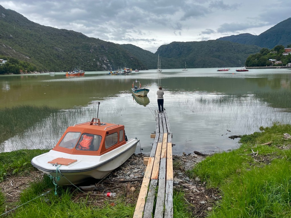
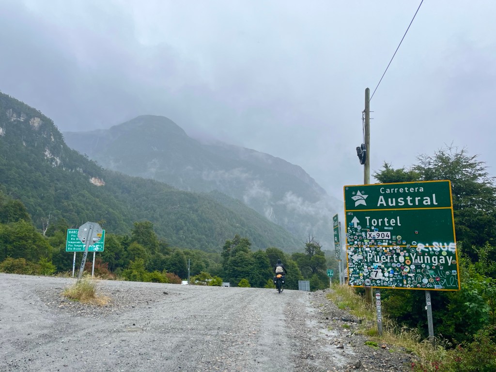
Soon, they were gone, heading north towards Caleta Tortel, and for me, I was waiting for the first ferry of the day, at 10 am. Well, the first passenger ferry of the day, a boat for dangerous loads, had already left at 8 am, carrying the Copec petrol tanker, presumably to service the filling station in Villa O’Higgins.

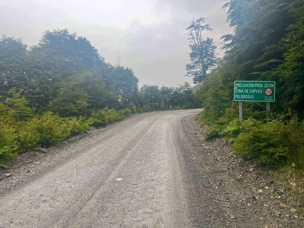
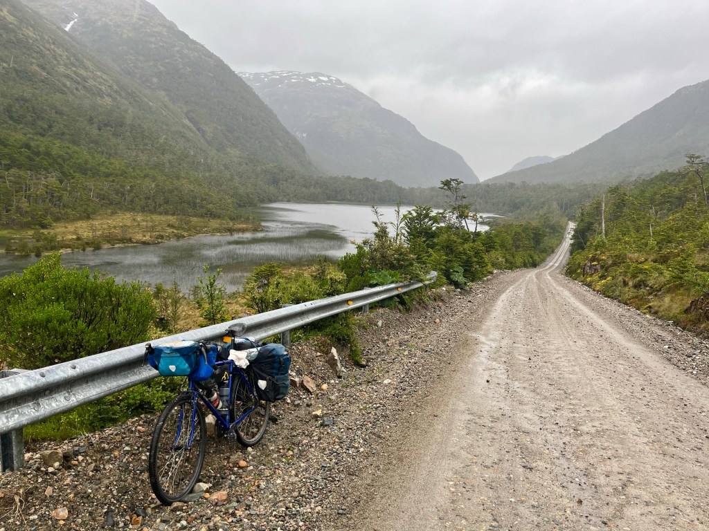
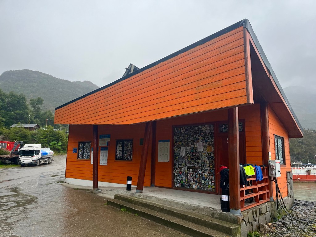
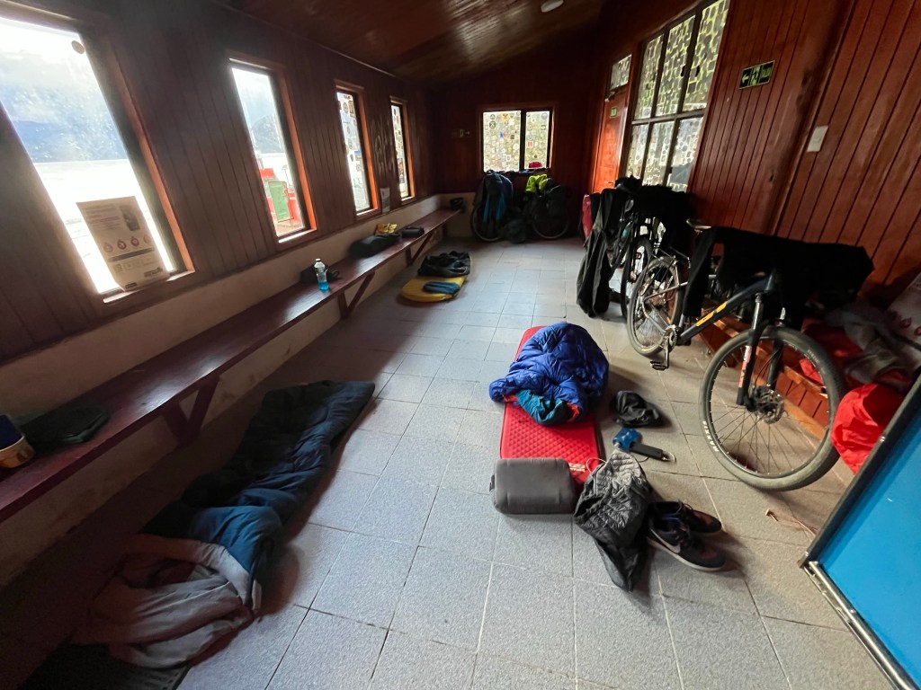
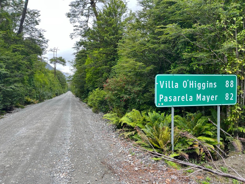
On reaching the other side, at Río Blanco, there was another little cyclists’ shelter, but this one with toilets. It was a quarter past 11 by the time I left for what was undoubtedly going to be my longest cycling day of the trip, 100 km on gravel roads.

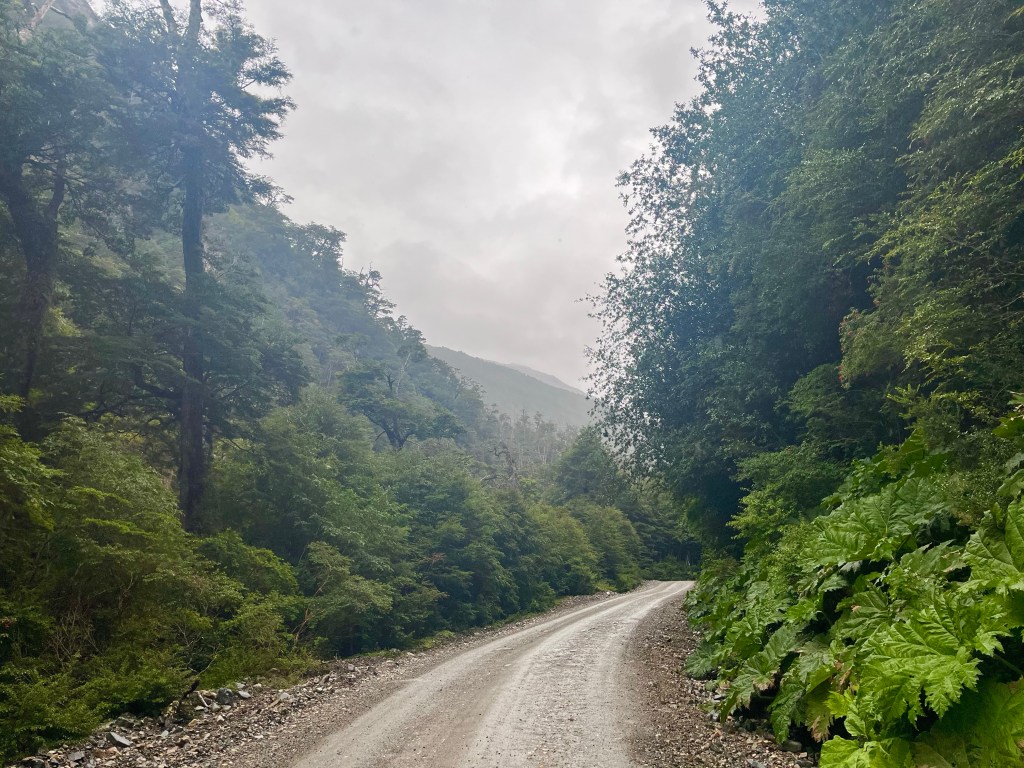
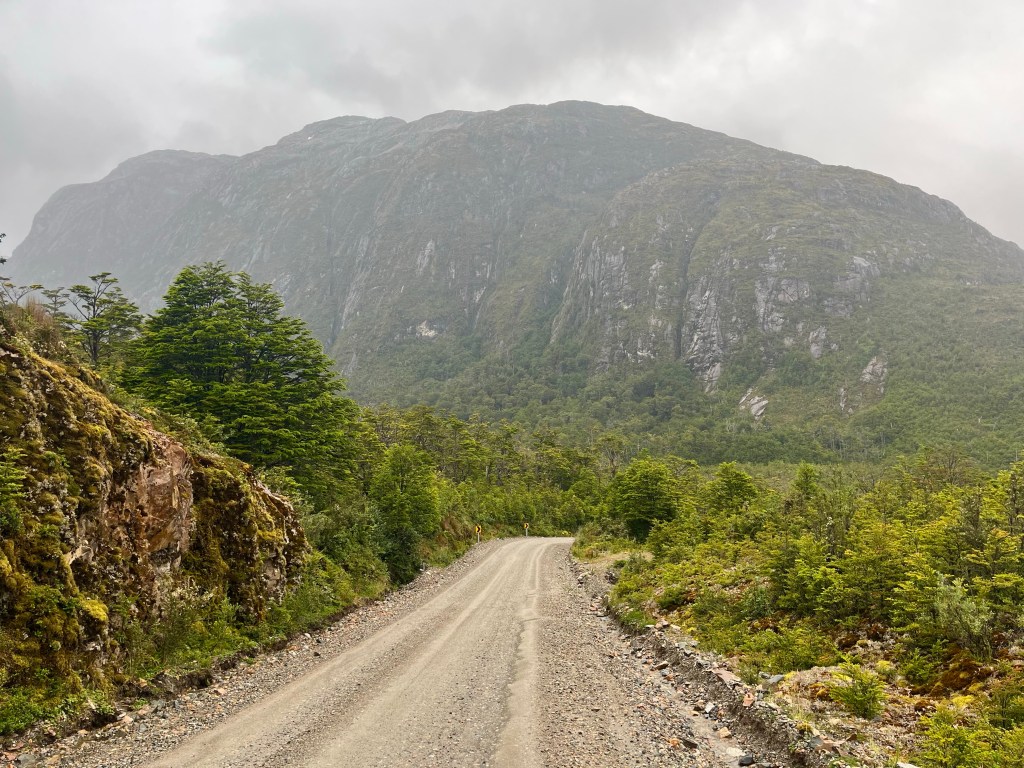
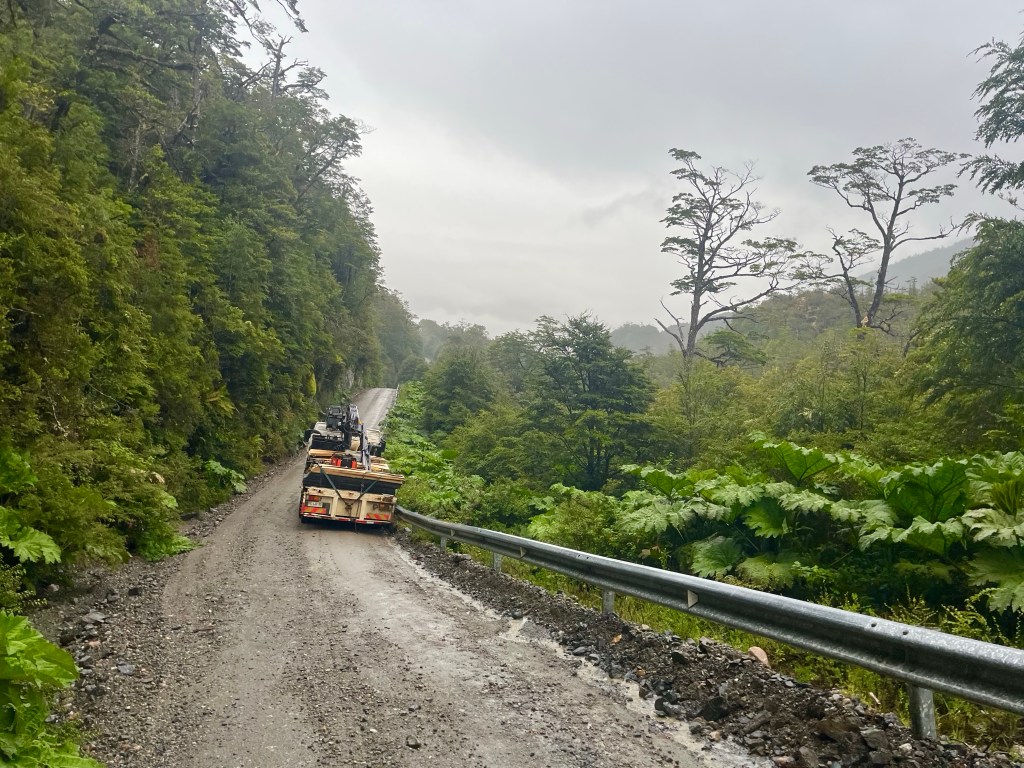
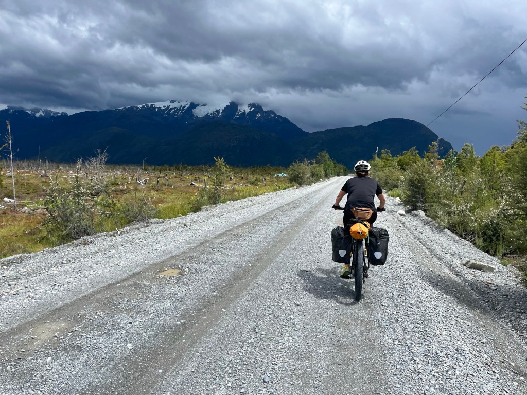
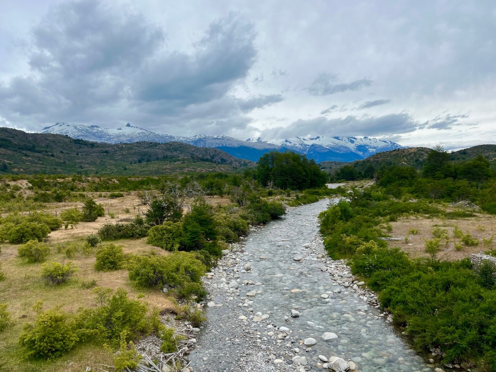
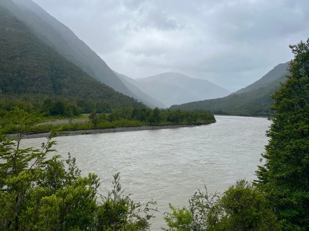
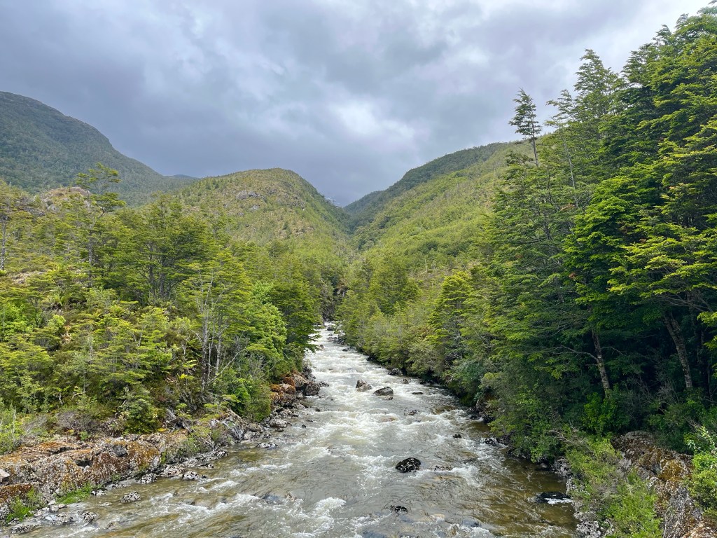
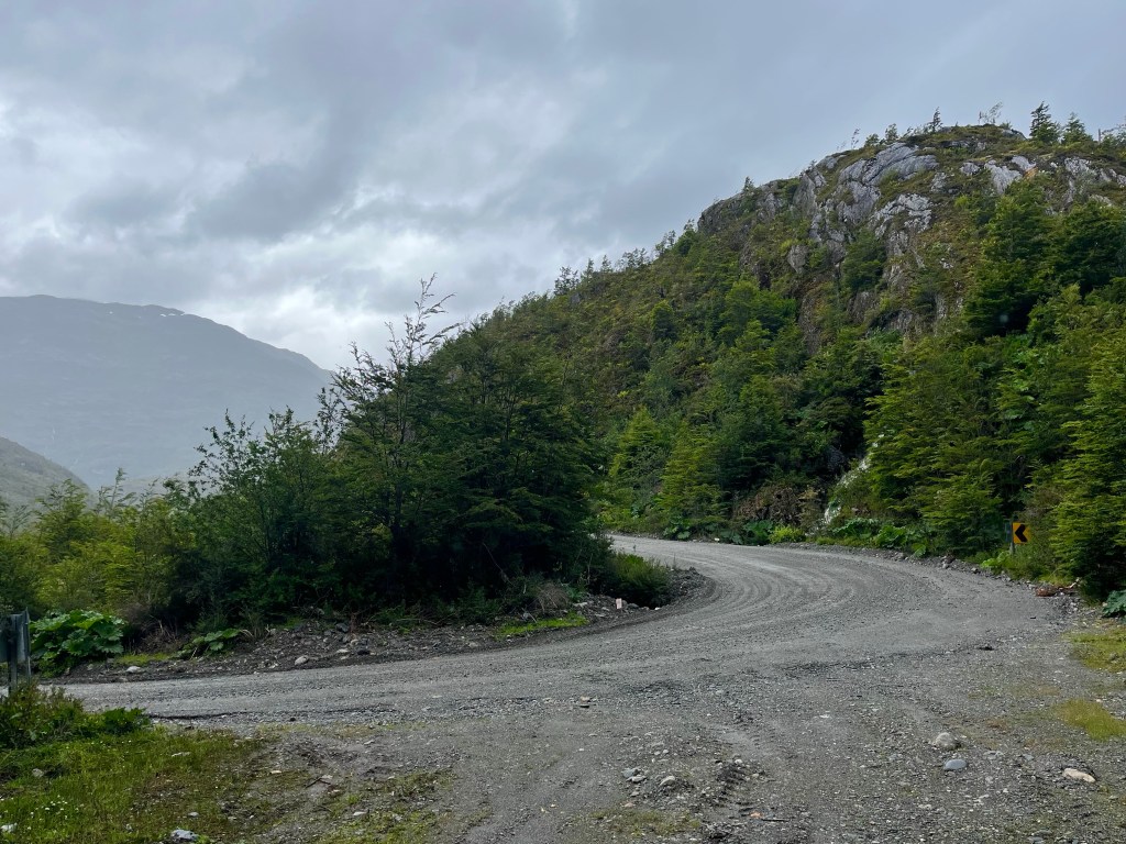
The first few miles passed quickly enough, and the road was relatively flat for the 8 miles to the Río Bravo María campsite, after that the terrain became far more challenging, with a series of tough climbs dragging me quickly away from the river.

It was a wild day, with regular showers and a strong cool wind, thankfully blowing in a favourable direction. To combat the cold, I was wearing extra layers, but in turn, each time I reached a hill, I quickly overheated and got off the bike to push. I knew that pacing myself was the key to making it all the way to Villa O’Higgins today.

22 miles in, after an energy-sapping sequence of steep climbs, I reached a refugio, or shelter, near the top of a hill, in an exposed spot. There were a Chilean couple already cooking up some lunch when I arrived, and they were generous enough to bring me over a cup of coffee while I prepared my own.

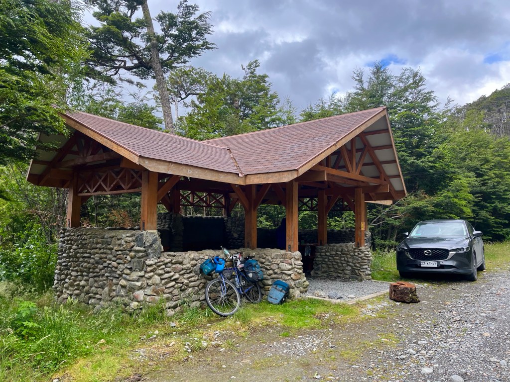
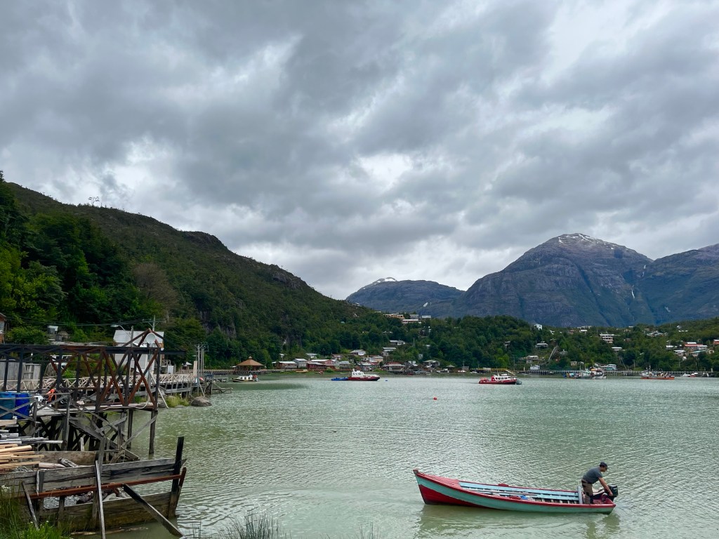
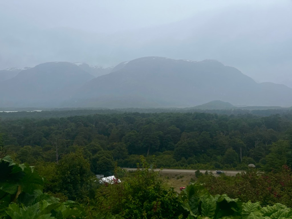
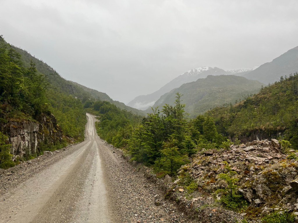
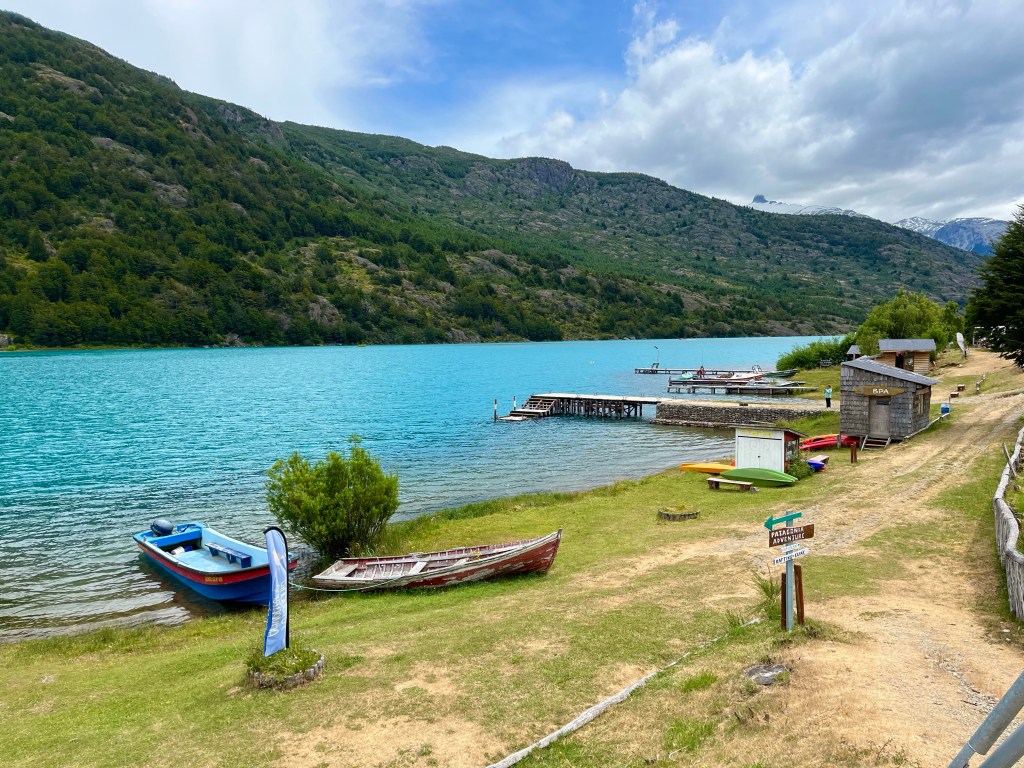
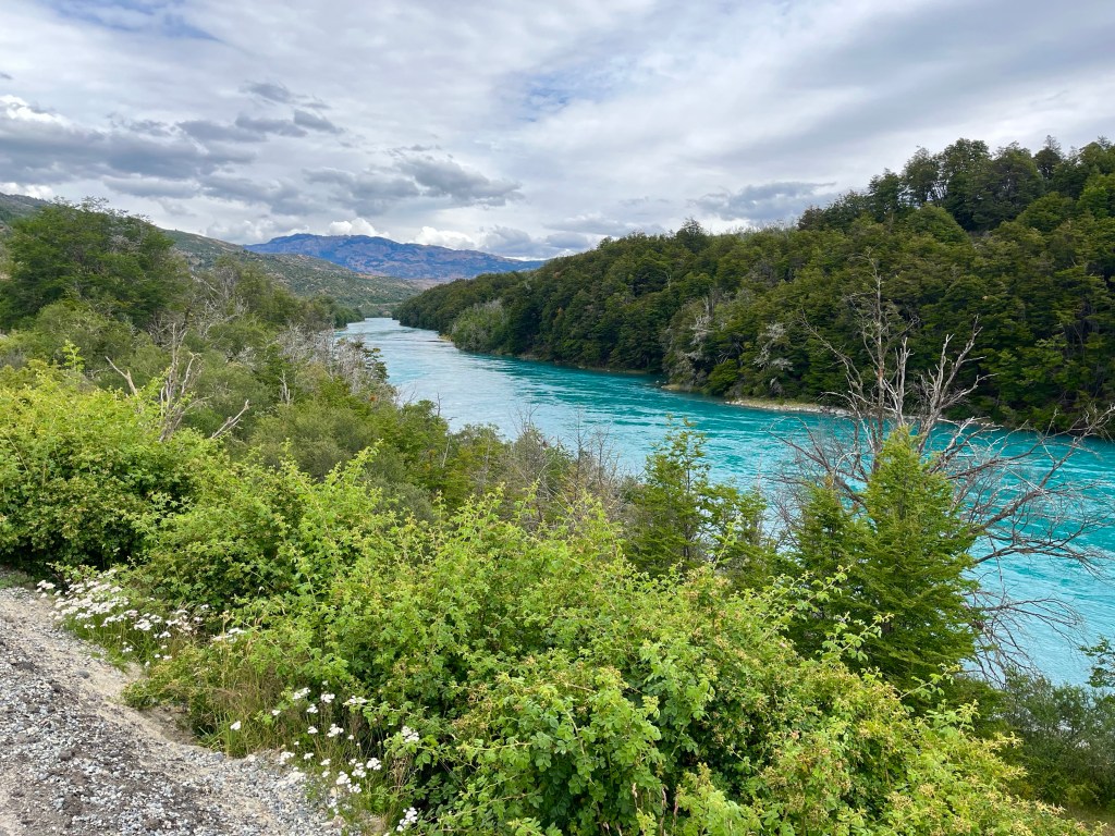
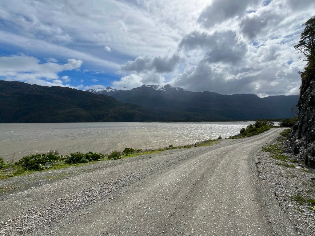
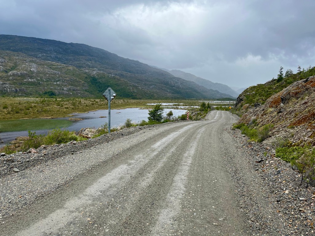
10 miles later there was another similar shelter, after which the road dropped and flattened out along the side of a lake. The tailwind whisking me along at a speed rarely accomplished on this trip.

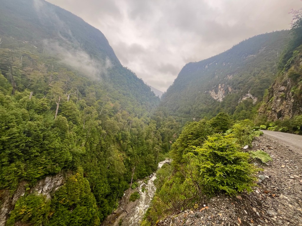
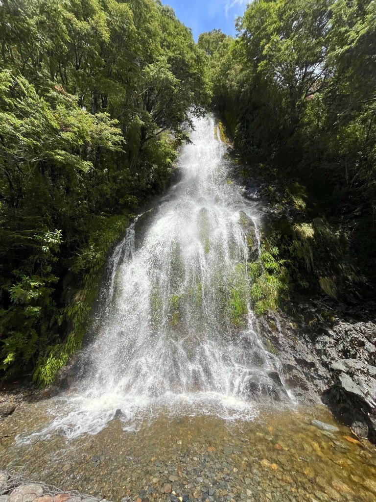
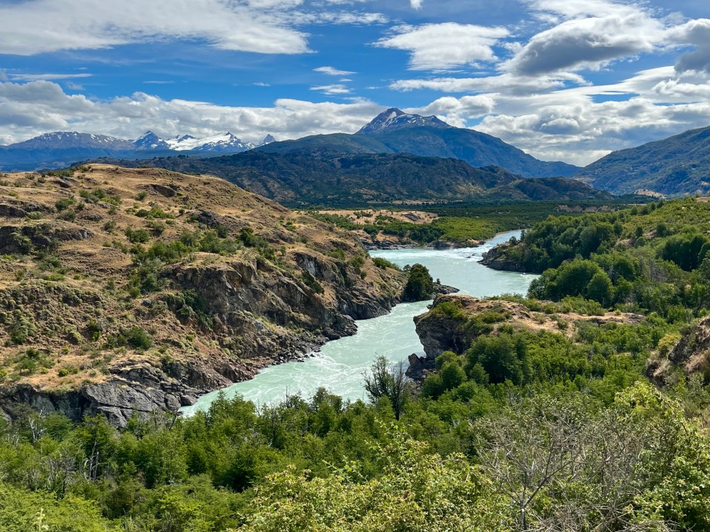
I stopped at a thunderous waterfall, being asked if I’d like my picture to be taken by a man. On offering to return the favour, the man politely declined, before climbing back into one of two police cars parked nearby.

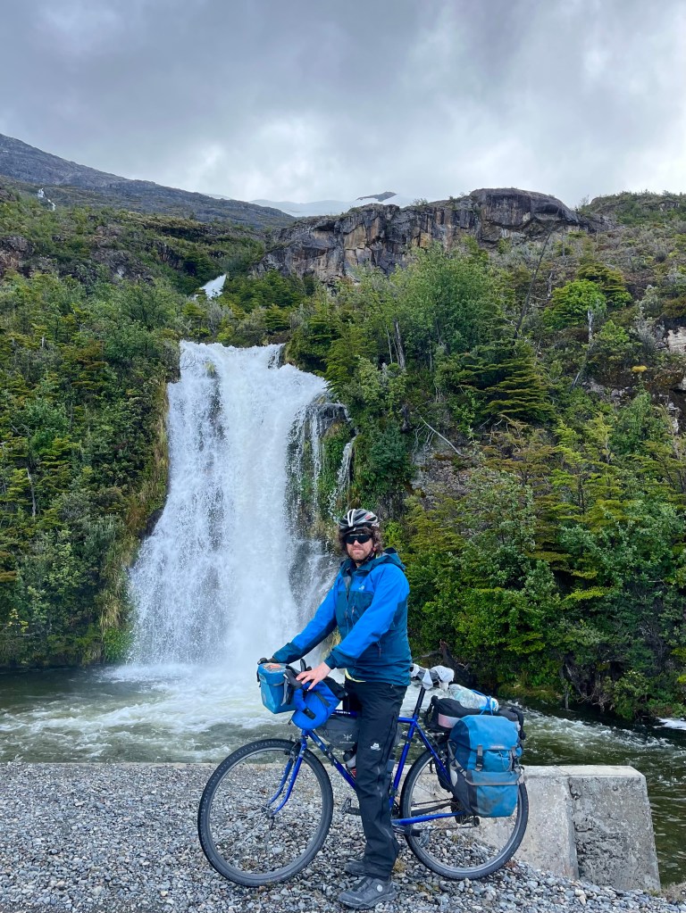
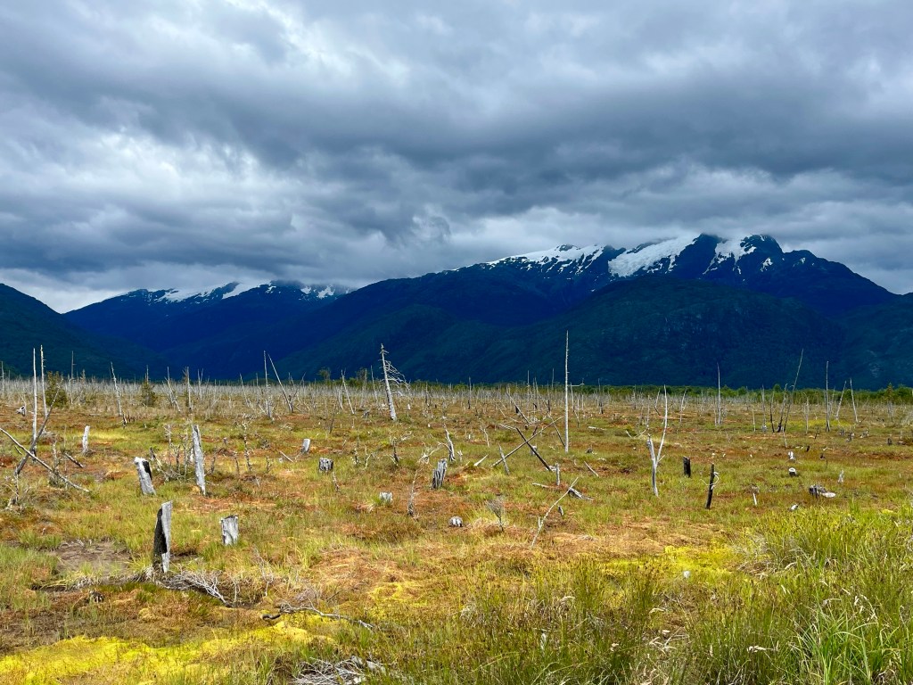
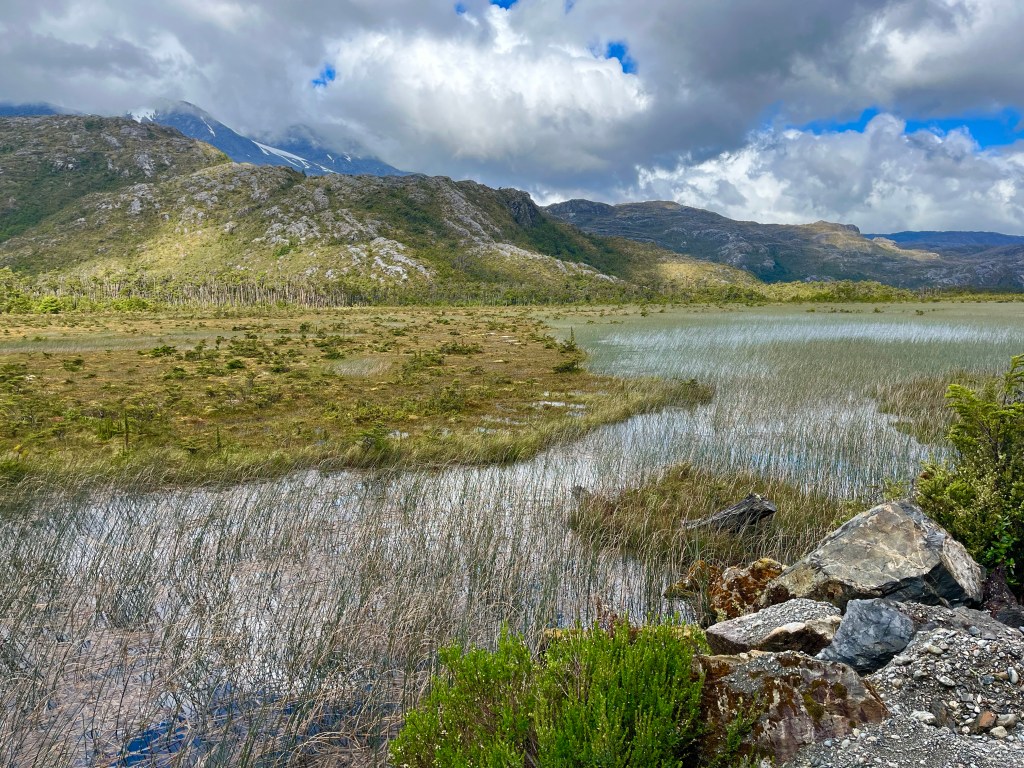
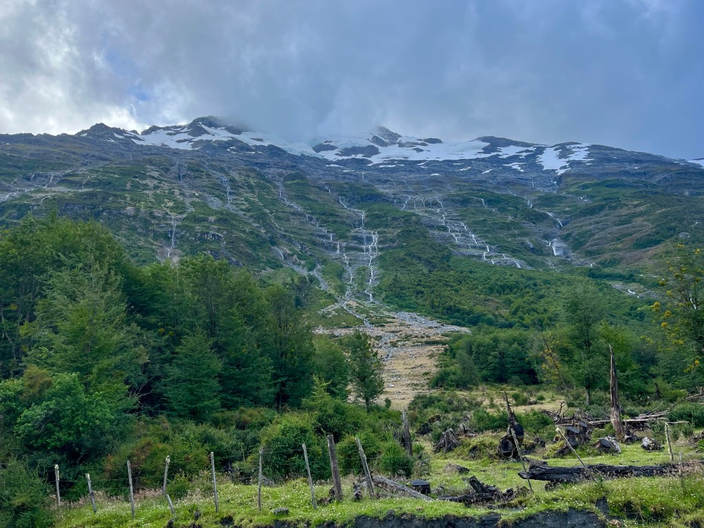
It wasn’t long before I spotted the glaciated cap of the mountain high above from where the cascading water was originating, the hillside shining with the many streams of glacial melt running down its slopes.

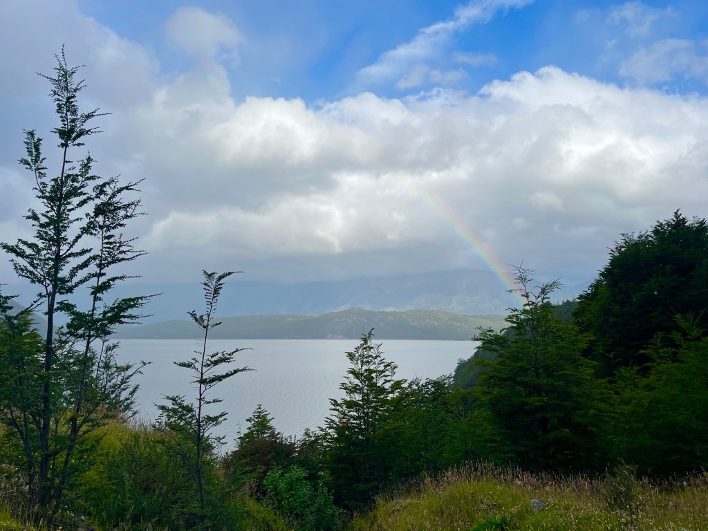
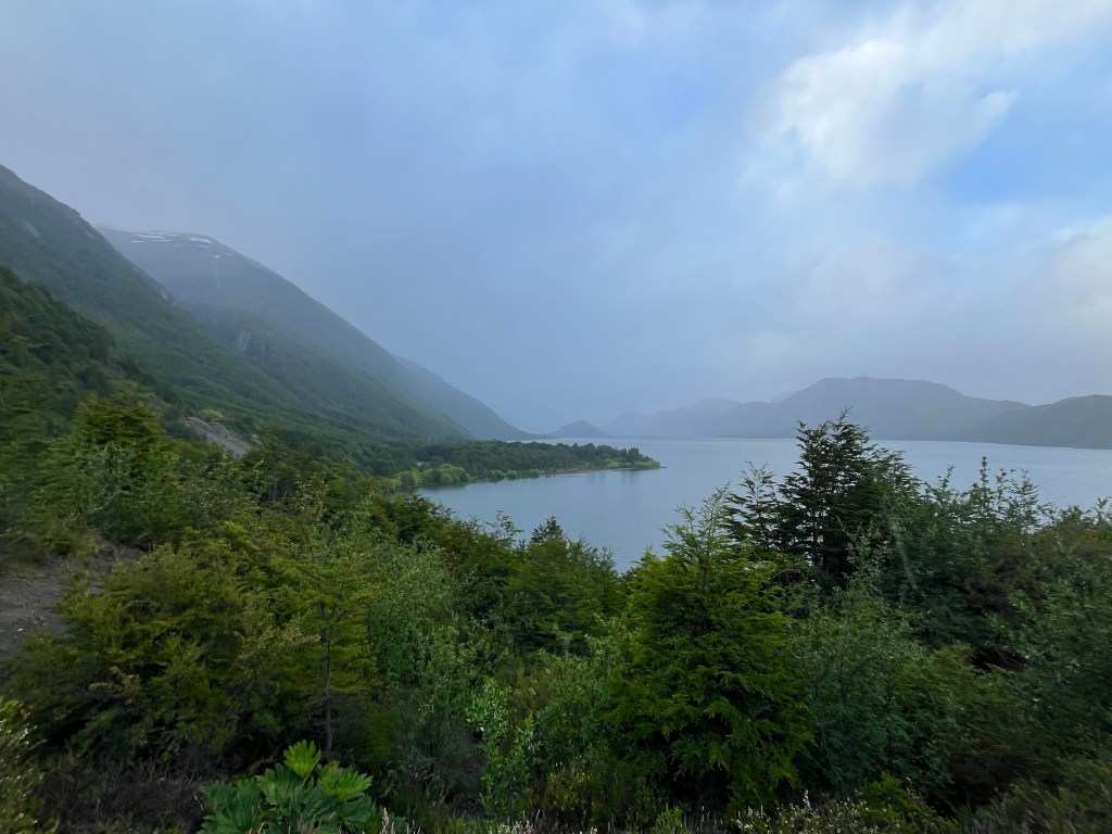
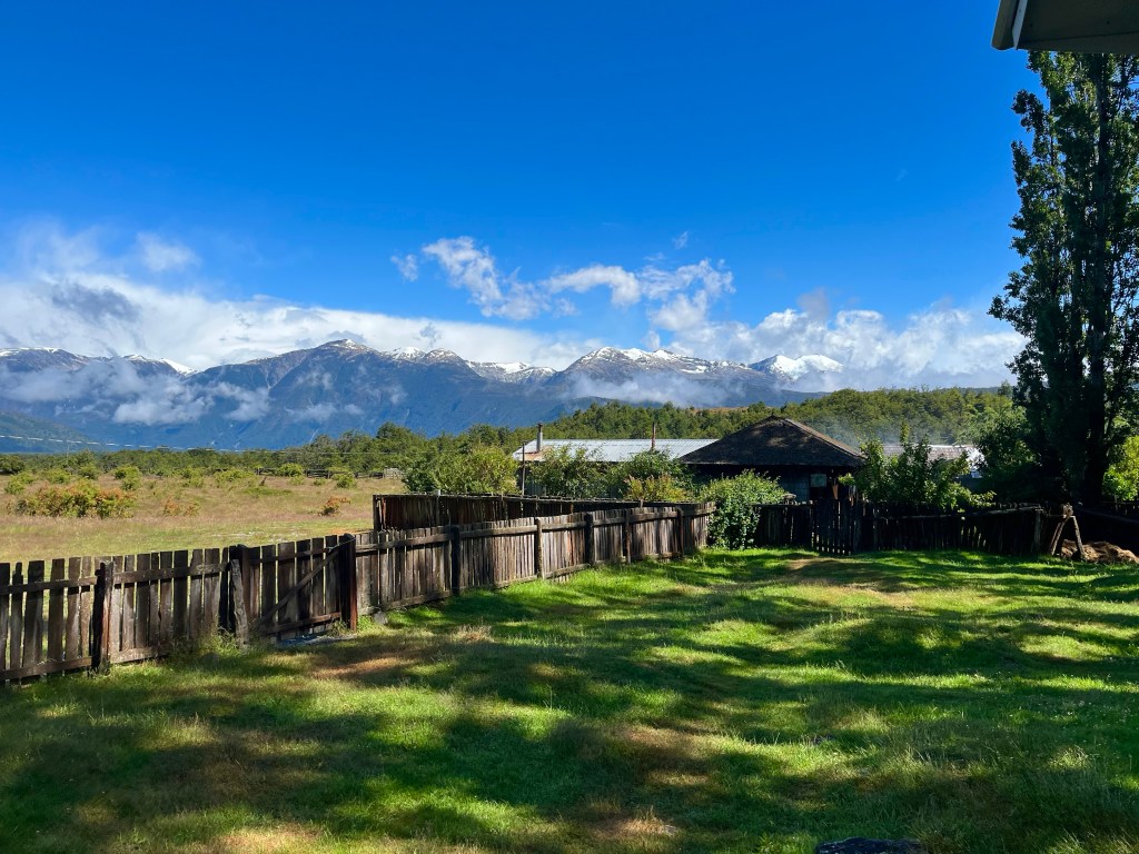
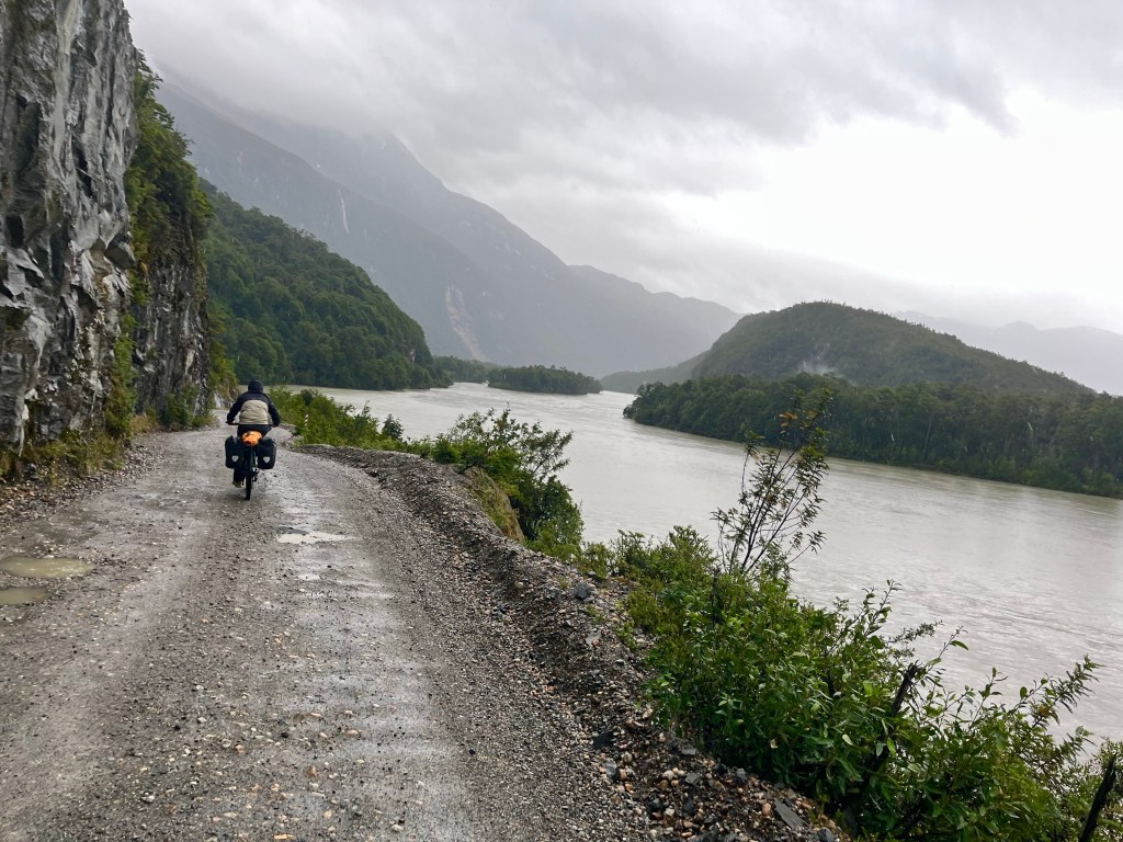
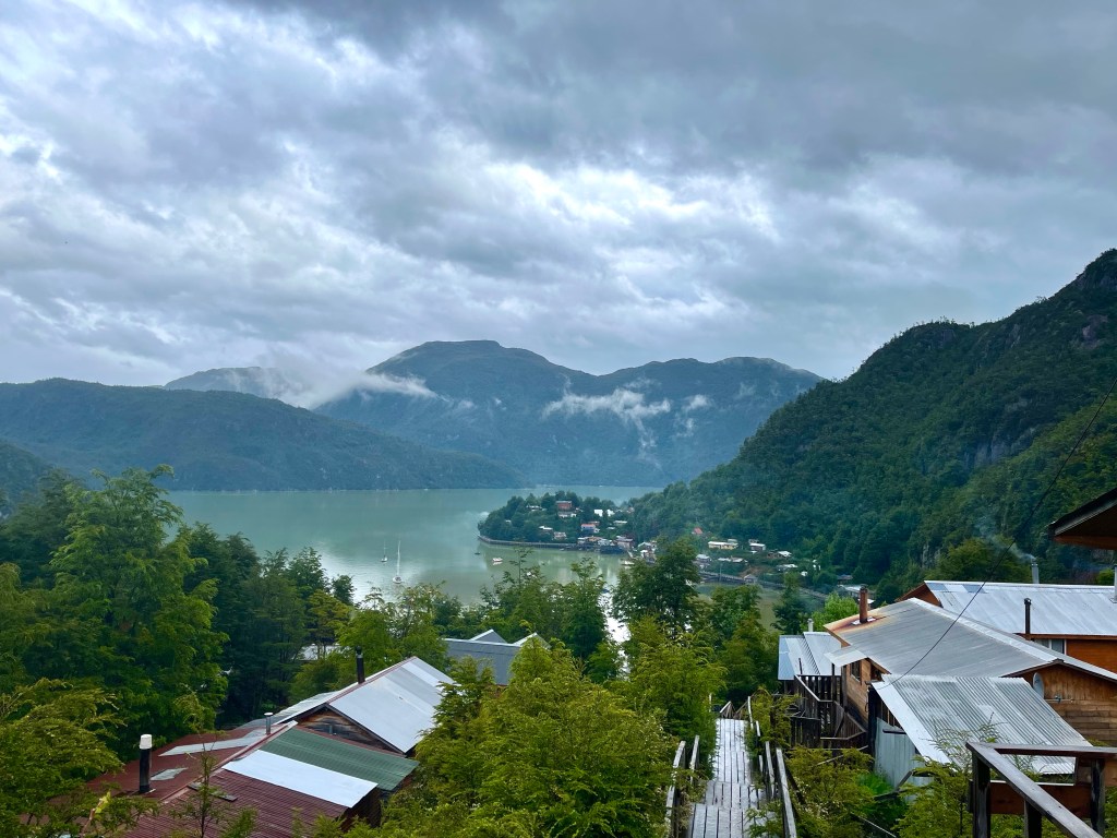
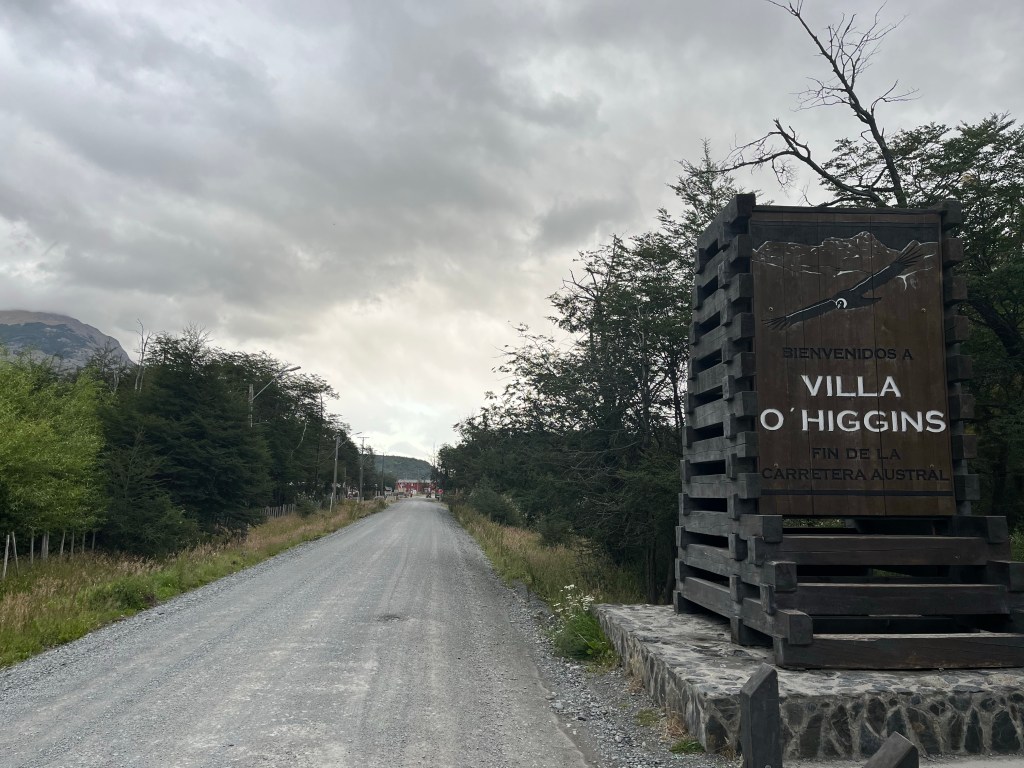
Towards the end, I rose slightly once more, with fine views offered up over Lago Cisnes, before the road took a long detour along the side of Río Meyer, before making the last approach to Villa O’Higgins.

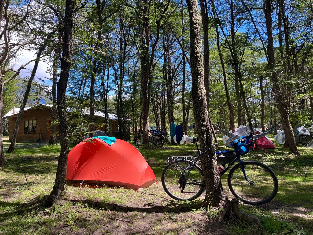
After checking in at Los Pioneros campsite, I made to pitch the tent, quickly realising that my tent pegs must have escaped during the short period that I rode with one of my bags accidentally open on the rough roads. Scavenging some sticks from around the site, I managed to do a reasonable job of staking it out.

Afterwards, I made for the kitchen to prepare some food, and was introduced to a fellow cyclist called Belén. She offered me a huge bowl of salad that she’d made and had plenty left of, and I was happy to accept.

She told me that she was waiting on the boat to Candelario Mancilla, that she was booked on the Saturday sailing, that it had already been postponed until Sunday, and that most of the other people on the site were waiting on the ferry too. She did also know of somebody that had successfully got a place on the Monday sailing earlier in the day, so for tomorrow, visiting the Ruedas de la Patagonia office, to book the boat, was a massive priority.

Day 19: Caleta Tortel – Puerto Yungay

Distance: 27.18 miles

Time: 3:55

Elevation Gain: 2,336 feet

The next day, Desiree was taking a rest day, and I was pushing on the 45 km or so to Puerto Yungay ferry terminal, ideally in time to make the last ferry at 7 o’clock, and continue the 8 miles to Río Bravo María campsite.

By the time that we headed out for lunch though, that was already seeming optimistic, and I soon started to realise that it was likely I’d be arriving at the ferry port after the last ferry had already left, and I’d be camping in the vicinity of the port.

This feeling was reinforced quite quickly, when Desiree, liking the look of the Calafate cake in a craft shop, proposed the idea of having coffee and cake first, and then going for lunch straight after. Sounded like my kind of plan.

The cake was delicious, and the boardwalk around the harbour offered up fantastic views of the layout of the town, as it reached upwards from the coast. A short chat with some construction workers informed us that the wooden boards used in the creation of the walkways required to be replaced every 12 years, no doubt maintaining the place was a year round occupation.

We moved on to El Mirador restaurant for lunch, and when the waitress pointed out that there were only 3 items on the menu, and one of them was salmon, it was a fairly easy choice in what to have, for both of us.

It was almost 4 PM, before I finally moved on, but it had been a very pleasant day so far, so I wasn’t regretting not getting back on the road in the morning when the forecast was good.

It was a tough stretch back out of Caleta Tortel, into the wind, and I hadn’t got very far at all, when I passed the Colombian couple from 2 nights before on their way into town.

If I thought that the initial part was tough, I hadn’t seen anything yet. Conditions had worsened when I reached the bottom of the climb over to Puerto Yungay, and the sign at the bottom warned of 20 km of dangerous curves. Sounded fun.

The opening hairpins were unrideable and I was forced to push up what seemed like a steep open boulder field. As the road climbed, the views back down towards the river had virtually disappeared into the gloom.

The next part was direct, steep and narrow, and with the addition of a few cars making their way over the pass, it was a tricky part to navigate, but eventually the road climbed onto a plateau and swept past Lago Caiquen.

Dropping down the other side, I had to manoeuvre my way around a truck that had skidded into the safety barrier, and was now stuck, at times having to battle with my bike to stop it doing the same, thanks to brakes that were struggling in the wet conditions.

Eventually, at almost 9 o’clock, I rolled down the hill towards the ferry port at Puerto Yungay, dragging my bike up a ramp towards a building with a porch which offered some shelter from the rain, while I looked for somewhere to pitch my tent.

Soon after, I heard voices from inside, and then someone opened the door. You can sleep in here if you want, said one of a pair of German cyclists, Fabian and Noah, who were inside a waiting area that was apparently there for the usage of cyclists.

Fabian and Noah had teamed up while waiting, for several days, for the boat, at Candelario Mancilla, perhaps a precursor of things to come for myself as I’d be taking the same boat in the opposite direction. Yes they had the phone number for the ferry company they said, and that was the first I’d had the correct one, it was evidently a very popular service, I didn’t have a booking and now I was stuck a day away from Villa O’Higgins, without any signal. There was a boat scheduled for the day after next, and unless I was very lucky, I wouldn’t be on it.

Day 18: Camping El Risquero – Caleta Tortel

Distance: 32.21 miles

Time: 4:17

Elevation Gain: 1,270 feet

Unsurprisingly, given the bleak conditions the previous evening, there weren’t many other inhabitants at the campsite, just a Colombian couple who had been sheltering from the rain, and had been on the road for two years already, having pedalled from Colombia all the way across Brazil and then started south from there.

Whilst I was packing up my bike, I was taken aback to find that a weld had failed on my seemingly hard-wearing Brooks saddle and now the leather had lost all tension and was lying limply on the steel support rails. It did not look comfortable at all.

A weather window of warm sunshine rather took us aback, and we rushed to get going, before it started raining again before we’d even begun.

Along the roadside there were constant reminders that it had rained, a lot. Firstly, when we past a heavily gushing waterfall, and secondly when we saw the heavily swollen Río Vargas.

We were forced to consider just how full the river was when Desiree’s bike slipped from its resting place against the side of the bridge, causing her cycling gloves to fall off her bag and into the water below. Watching them swirling in a pool underneath the bridge was distressing for her as the gloves had been gifted to her by Felipe, the campsite owner of El Nortino, in Villa Cerro Castillo, a full week before. She tried to see if she could rescue them, but the bank was just too treacherous.

Just as we were readying to leave, the rain came on much more heavily, and it was accompanied by a biting wind, that chilled us to the core.

We had been following the Río Vargas for some time now, and soon it joined forces with the far more substantial Río Baker, which we’d last seen some time before Cochrane, and would now be following out towards the sea, at Caleta Tortel.

We turned off ruta 7, at the junction with the road for Puerto Yungay, and took the extra rough X-904 towards Tortel, steeply downhill at first, but with it flattening out as it went along, the pronounced pooling of the stones on the road made it difficult to keep traction, and we struggled to find good lines to keep upright.

The conditions didn’t help, and it was noticeable that Desiree was suffering a bit in the wet and the cold, so I suggested that she put on another layer, as I thought that would help her. I was feeling uncomfortably comfortable, in that I was wet, but I was warm enough, but I knew that being cold and wet was a dangerous place to be.

Stubbornly though, she persevered, and despite the significant drop in her core body temperature, and her discomfort, she still kicked into action as soon as we reached the town, and while she pressed the tourist information assistant for information, she was interrupted by one of the owners of some Cabañas nearby, and they really weren’t far away at all.

And while Desiree made full use of the cabin’s gas heater and shower, virtually turning the place into a sauna by the time I returned, I tried to find my way around Caleta Tortel’s labyrinthine boardwalk network to reach a shop, and pick up a few hard earned bottles of Patagonia Brewery beer, with which to help her relax after a trying day.

Day 16: Camping y Cabañas Cerro Color – Cochrane

Distance: 40.71 miles

Time: 6:46

Elevation Gain: 4,055 feet

It had been a cold night, even more so as the campsite was on a plateau by a lake at 300 metres elevation. Thankfully, the campsite had a hot shower, and ample indoor space massively out of proportion with the number of guests, so I soon heated up.

Plan for the day, was an ambitious one, to reach Cochrane, 40 miles away, and with a significant amount of climbing alongside the Río Baker. Desiree had done incredibly well the day before, to back up kayaking in the morning with a hard hilly 35 mile ride in the sun, not bad going during her first week of cycle-touring.

We enjoyed a short flattish section alongside Lago Bertrand, before a significant climb took us away from the lake and, then swinging back down to its side once more at Puerto Bertrand, where we rolled steeply down to the shore, in search of somewhere for lunch.

Uninspired by the food trucks on offer, we continued out of town and climbed steeply back up the hill to a pizza restaurant, a short climb that was definitely worth the effort.

After lunch, we had a look at the mount for Desiree’s handlebar bag, which had evidently been installed wrongly by the bike hire shop and the bag was now bouncing up and down on the front wheel, over the rough roads.

Unfortunately, the cable was so badly damaged that we couldn’t fully rectify the situation, but we did find the perfect piece of wood to take up the slack.

The onwards route followed the Río Baker upriver, not content to stick by its side, the road climbed high above the gorge, through rocky and fertile terrain.

Sitting in the shade near the top of the climb, my lack of phone signal meant I missed the fact that Desiree had messaged to let me know she was having a ‘little demoralisation emergency that only chocolate could cure’, just around the corner.

Dropping down to cross the Río Chacabuco, the road switched back steeply up the other side, soon bringing us level with a large group of Guanacos, near the road. Guanacos being the wild near ancestor of the domesticated Llama.

A few more metres of elevation led to a mirador, looking out over the confluence of the rivers Baker and Chacabuco, after which the road seemed to continue eking out every extra metre of elevation gain out of the landscape, even within the last few kilometres before Cochrane, when the highly satisfying ‘Inicio Pavimento’ signalled the beginning of a dream-like concrete surface, the road climbed sharply before dropping down into the town.

Finding ourselves at the edge of the centre of town, we started looking for places to stay. Desiree, tried a Cabaña, I got the easier job of checking out the hostel. Desiree disappeared into a restaurant, I carried on down the street, trying to keep on brief, only to return to find that the restaurant had Cabins in behind and that Desiree had scoped out an ideal 2 bed cabin with bike parking down the side. Perfecto.