Tag: Land’s End

Lejog Day 3: Liskeard – Crediton

Distance: 55.4 miles

Time: 5:34

Elevation: 4096 feet

The day started well when the campsite owner, Kathryn, brought me over some porridge and a coffee. I was on the road at 10 o’clock and had unfinished business with the climb up to Bodmin Moor.

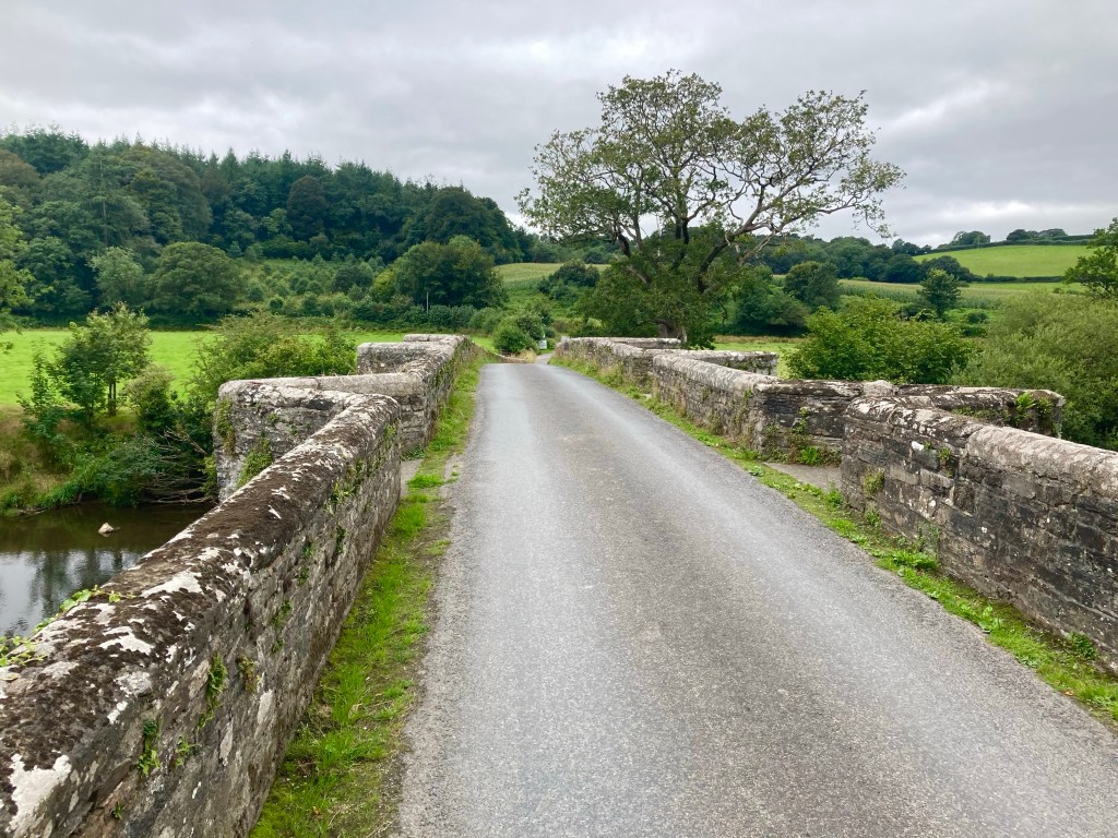
A brisk descent through Pensilva followed and then another stiff climb up to Golberdon, where my alternative accommodation for the previous evening had been. Down and up again through anonymous country lanes, then another brake-busting descent led to Horsebridge, where a medieval bridge aided my passage to a new county, Devon.

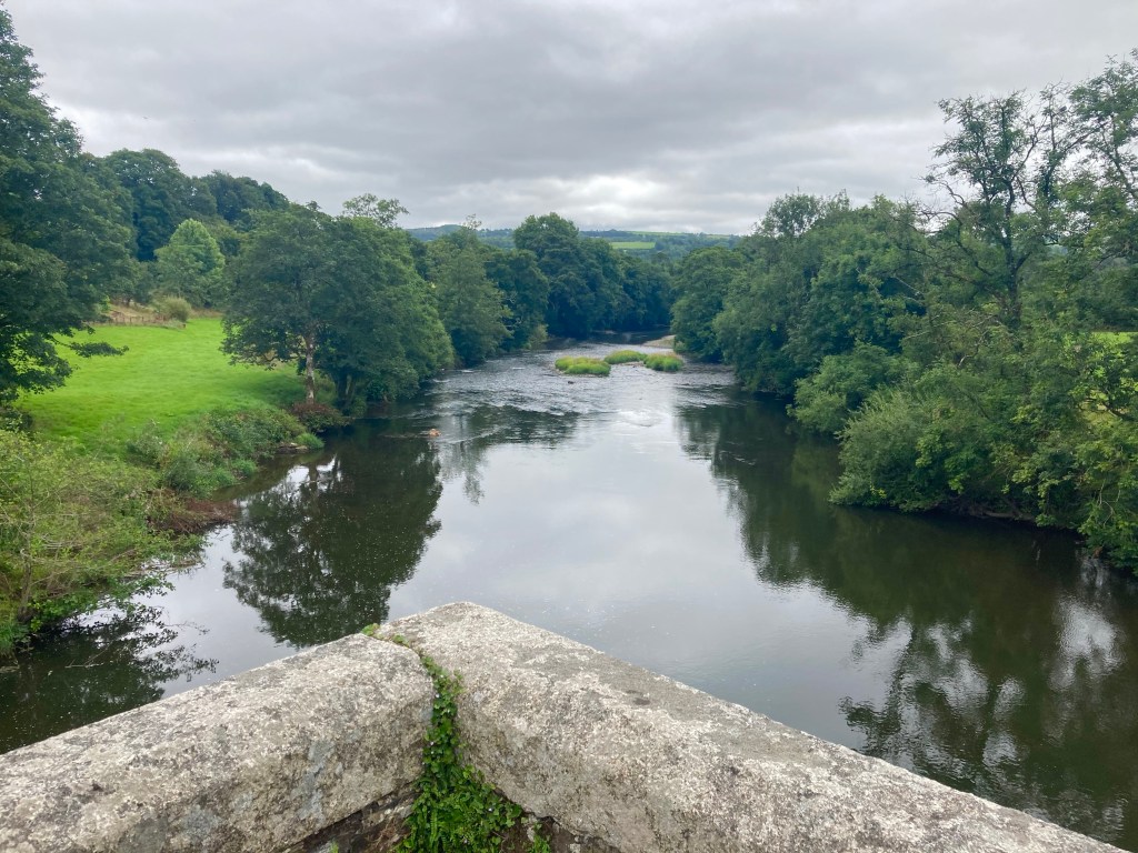
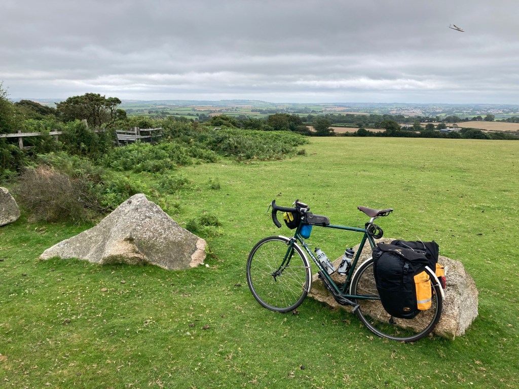
Devon welcomed me with a grinding climb; from 50m Horsebridge to 300m and the edge of Dartmoor. Under the shadow of Brent Tor and its ancient church, I chatted to a cyclist on a few day tour around the moor, laden with four panniers and with a rucksack strapped atop his rack.

The road dropped down to Lydford Gorge, and I stopped at the visitor centre cafe for ice cream and a scone. As I sat preparing my scone on the grass, I realised that I was at risk of committing a huge cultural faux pas, by ignorantly applying the clotted cream and jam in an order wholly incognisant of the Devonian methodology. I carried on regardless, if any interested party, Devonian or Cornish, wanted to see how a scone should be prepared, this could be a lesson to them. As it happens, the right way is the Devonian way, but I’d desecrated tradition anyway by having a fruit scone, and raspberry – not strawberry – jam.

Soon there was a distinct improvement in proceedings as I turned onto ‘The Granite Way’, a tarmacked former railway bed that crept around the edge of Dartmoor for 8 gloriously flat miles between Lydford and Okehampton. The cycle path was busy with other users and one man in particular appeared to be having a tough time of it, with a fixed wheel tagalong attached to his bike, his son seemed to be having a great time back pedalling up the climbs!

After popping into a shop on the edge of Okehampton for provisions, I committed myself to aim for Crediton, another 20 miles further on. Thankfully, the road stuck to major roads to Whiddon Down, and I felt good riding the shallower gradients. The going remained good until a sharp climb a mile from Crediton, and instantly the fatigue in my legs returned. When a further 9% ramp followed shortly after, I opted to push, after 48 miles I’d given up the battle for today.

The nearest campsite was 5 miles to the East, and with no response to my phone call I headed there regardless, largely because the route looked flat. Arriving at the Langford Bridge campsite at 20 to 7, the sign stated that reception was open ‘til 7, and the campsite was largely empty, I’d found my abode for the night.

Luckily, after the exertions of the day, my dinner couldn’t be simpler, a tin of Heinz beans and sausages, and, finally, a use for the stove I’ve been carrying.

Lejog Day 2: Ponsanooth – Liskeard

Distance: 51.4 miles

Time: 5:33

Elevation: 5244 feet

By the time I’d packed up camp this morning, my start wasn’t much earlier, and still to have breakfast, I made for the Norway Inn, waiting impatiently for my fry up to arrive. Now 10:40, I found myself on the busy A39, holding up a truck, before a cycle lane appeared just before the lengthy hill to Devoran. Thankfully, I was exiting here to rejoin the route and swept along some country lanes to King Harry Ferry, a chain ferry across the Carrick Roads.

Climbing steeply away from the slipway, I momentarily reached some higher ground, before the road plummeted again, a pattern that would continue for most of the ride. Much like yesterday, the roads were narrow, and lined with high hedges on either side, I considered the wisdom of choosing an ‘optimal’ route solely on the criteria of minimising traffic, and distance. I had other variables to throw into the mix, like avoiding going over every hilltop, and ensuring that there was occasionally something other than a hedge to look at.

I was thankful for the lack of traffic, though, and as I slogged up the first few climbs there was no one to be seen. Eventually, my luck ran out, and it became a regular occurrence that, no sooner had I started up a climb, a car would come over the brow of the hill, tuck into the verge somewhere near the top, and I’d have to spin up the hill as fast as I could to get past.

On the last few miles into St Austell, the route branched off onto a cycle path of loose gravel and stones, and instantly I regretted following it. I bailed out half a mile later, for the good of my tyres, but, it was too late, and shortly afterwards, my front wheel started to go squidgy. I hauled the bike off the road, through a patch of nettles, and set to work changing the inner tube, resolving to avoid any off road detours in future.

Eventually, I reached St Austell, but not spotting anywhere for lunch, I continued to St Blazey, popping into a shop for provisions. One more climb saw me reach the short Ferry crossing between Fowey and Bodinnick, but the climbing didn’t stop there, and where the hills had been 100 metres high before they now pushed 200.

Passing 43 miles for the day, the relentless climbing caught up with me, and after a tricky 17% descent, the road climbed steeply back up the other side, and I was defeated. 3 times I got off and walked, not ideal on a narrow country lane, but there was nothing else for it.

The miles passed ever more slowly, and I realised that I wouldn’t even make the first of my potential campsites by their check in time of 6pm. One by one, I interrogated Google Maps for alternatives, and one by one, the options disappeared. Passing through Liskeard, I strapped a fish supper to the back of my bike, and set off in the hope that the kind people of Fursdon Farm would forgive my late arrival. At just after 7, I was standing by the campsite entrance when the owners drove in. Head on in they said, and would you like a coffee?

LEJOG Kit List

My kit for this adventure is a fairly traditional cycle-touring set up as detailed below.

The Bike:

Thorn Brevet

⁃ Reynolds 531 steel frame.

⁃ 700C wheels (Mavic Open Pro rims, Shimano Deore hubs, 32 spokes)

⁃ Chainrings: 48/36/26

⁃ Cassette: 32t (8 speed)

⁃ Downtube shifters

⁃ Brooks B17 saddle

⁃ Continental Grand Prix 4 Season tyres (700C x 28mm)

⁃ Topeak Super Tourist DX bike rack

⁃ SKS Chromoplastic mudguards

⁃ Dawes Panniers

⁃ Terra Nova handlebar bag

⁃ Garmin Etrex 20x

Cycling Kit:

⁃ Icebreaker merino baselayer

⁃ Pearl Izumi lightweight cycle jersey

⁃ Padded undershorts

⁃ Rapha Randonee shorts

⁃ Gore Windstopper short sleeve top

⁃ Btwin cycling shoes with Look Keo cleats

⁃ Sunglasses

⁃ Padded gloves

⁃ Helmet

Pannier 1:

⁃ Vaude Terralight tent

⁃ Vango ultralight 200 sleeping bag

⁃ Thermarest ProLight inflatable mat

⁃ Silk sleeping bag liner

⁃ Inflatable pillow

⁃ Alpkit titanium stove and 1l aluminium pan.

– Anker solar panel

Pannier 2:

⁃ Waterproof trousers and jacket

⁃ Waterproof socks

⁃ Down vest

⁃ Spare boxers and merino cycling socks

⁃ Spare change of off bike clothes (softshell trousers, running top, light fleece, trainers)

⁃ Bike spares and tools (2 x inner tubes, puncture repair kit, multitool (Allen keys, chain tool) chain links, spare screws, 2 spare gear cables, brake pads), pump.

⁃ Bike lights

⁃ Headtorch

⁃ Spare rechargeable batteries, AA, AAA, li-ion camera batteries.

⁃ 2 power banks (1 x Anker 15,000 mah), cables, usb power supply.

⁃ Very small first aid kit!

Handlebar bag:

⁃ Camera

UK 2021: Land’s End to John o’ Groats

So, what does your average globetrotting cycle-tourist do during a world pandemic I hear you ask? Unsurprisingly, look for the nearest suitable challenge not necessitating the use of an Aeroplane and get packing is the answer.

And here I am, packed. Packed off on the 9:08 train from Edinburgh Waverley and with over 12 hours to kill before I arrive in Penzance. My challenge is – of course – Land’s End to John o’ Groats. 1000 miles, from the south-western tip of the British mainland to the north-eastern one.

The route I am intending to follow is the one presented in the Cicerone LeJoG guidebook, and is described as the ‘optimal’ route by none other than the author himself. Optimal because it keeps to quiet roads without adding greatly to the overall mileage.

To this stage, my planning has been minimal. I booked a train – and accommodation for my first night in Penzance – and that’s about it! Hotels in England look expensive, so I’ve brought my tent and hope to camp most nights, but not having planned where I hope to reach each night, I’ll need to seek out my accommodation options as I go. Hopefully this isn’t complicated too much by the English school holidays or lingering Covid restrictions…