Tag: Lofoten Islands

Norway Day 18: Stokmarknes – Nøss

Direction: 62.77 miles

Time: 6:01

Elevation Gain: 1,695 feet

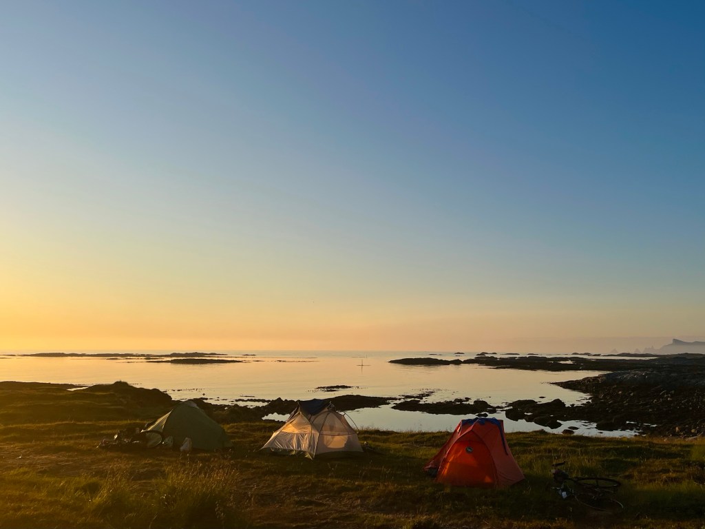
While I was finishing setting up camp for the evening, another cyclist turned up looking for a flat piece of ground on which to pitch his tent, not an easy task at LOVE (Lofoten and Vesterålen Islands) Campsite. He was called Hans, and he was from Belgium, he was a seasoned touring cyclist who, after 30,000 km of use, was contemplating swapping out some of the componentry on his fancy Rohloff hub and gates belt drive touring bike set up. He’d never flown with his bike though, so he was inspired by the fact that I’d taken my bike to Vietnam and Morocco.

The next morning, I was in the campsite kitchen, talking to a pair of Swedish cousins, one of who I’d spoken to outside the shop in Melbu the day before. One of them asked me if I was doing the detour today, to which I responded that I probably would be.

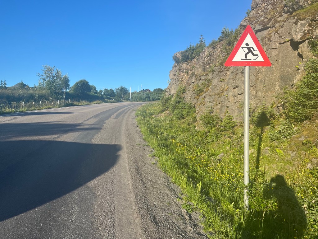
After I’d set off though, I realised that they were referring to an alternative cycle route that would be a very long way around to Sortland, so having watched as the two Swedes and another big group of cyclists all headed off on the detour, I headed along Highway 82, wondering if I was the only cyclist planning on carrying on along the main road.

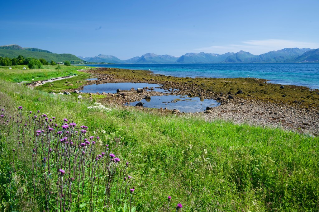
But on stopping to photograph the different aesthetic that the east side of the Vesterålen Islands was providing over the one the west had the day before, the group of 6 Norwegians from the previous few days yelled a greeting as they breezed on by, there were enough cyclists around for all the available routes it seemed.

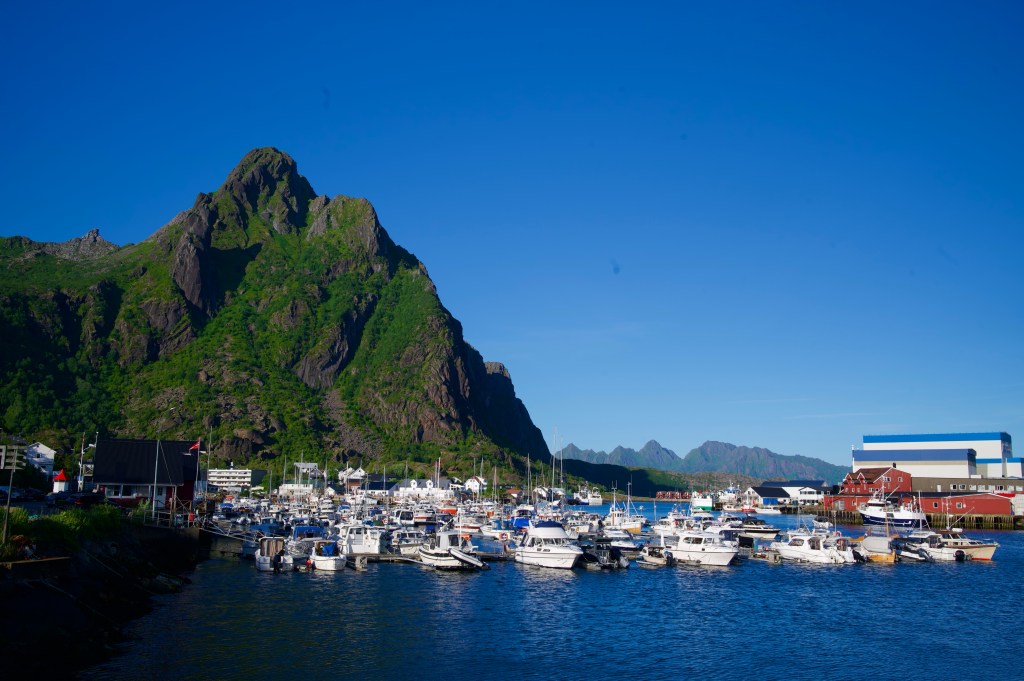
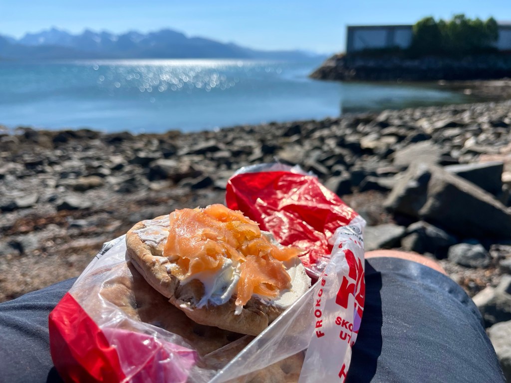
On arriving in Sortland, after 16 miles, it was time for lunch, and taking inspiration from Hans, as he had done from me, I decided to copy his dinner from the night before, picking up some smoked salmon and cream cheese, and pairing them with some bread I was carrying in my pannier.

After Sortland, it was time to get my head down and power through a few miles. The closer I could get towards the ferry port of Andenes today, the better chance I had of getting there for a ferry earlier in the day tomorrow.

Still not quite able to shake off the urge to stop to take the odd photograph, however, I was soon passed by the squad of three that I’d last seen early the day before. But then, almost as soon as I’d started up again I found them stopped along the road, and that started a new game of leapfrog as we kept passing each other, until eventually, after we’d all surmounted the extra steep bridge over to Risøyhamn, we all ended up at the local Joker store at the same time. As I’d expected, the group was Polish, but what was a surprise, was that it was a family unit, father Conrad, his wife, and their 13 year old son. It was amazing that they were riding along so strongly together, and quite an undertaking for their son that they would be spending two and a half weeks travelling from Bodø to Nordkapp, apparently it had been a long time in the planning.

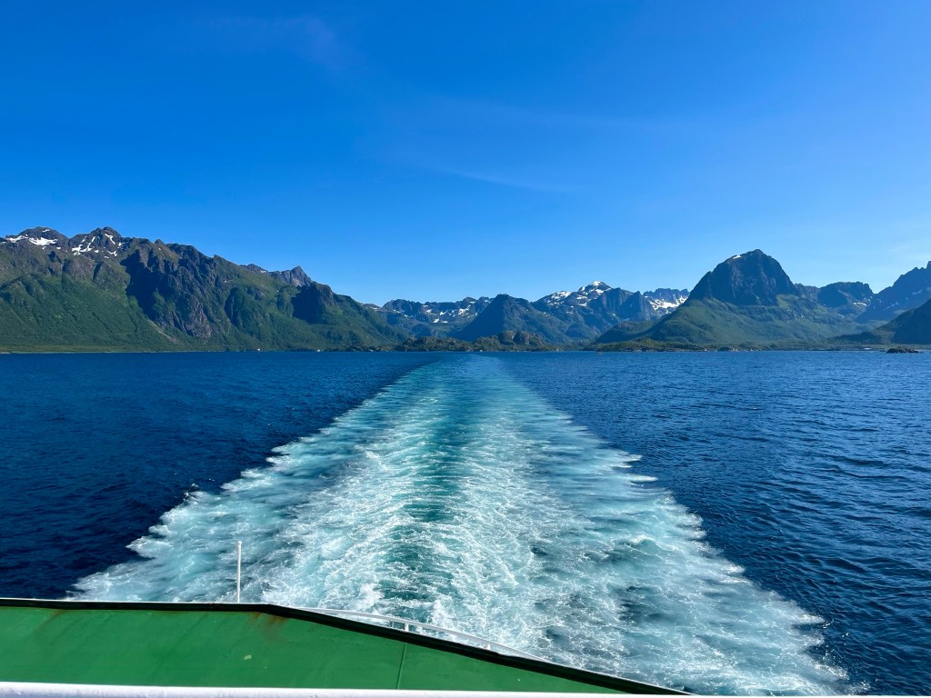
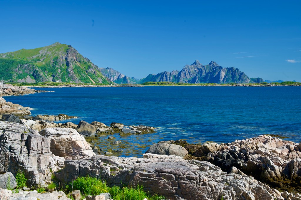
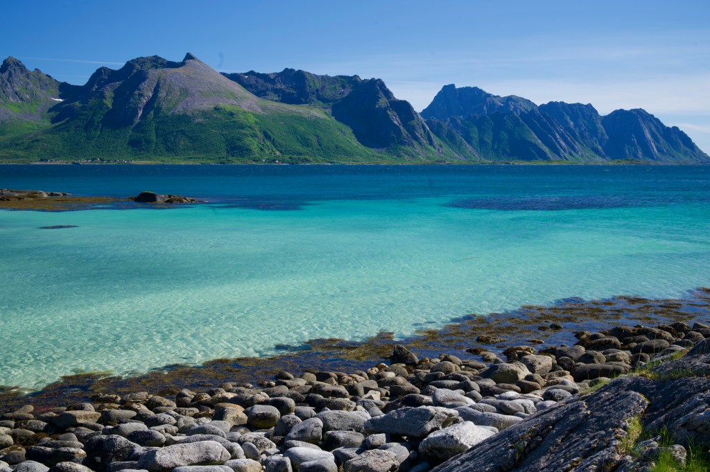
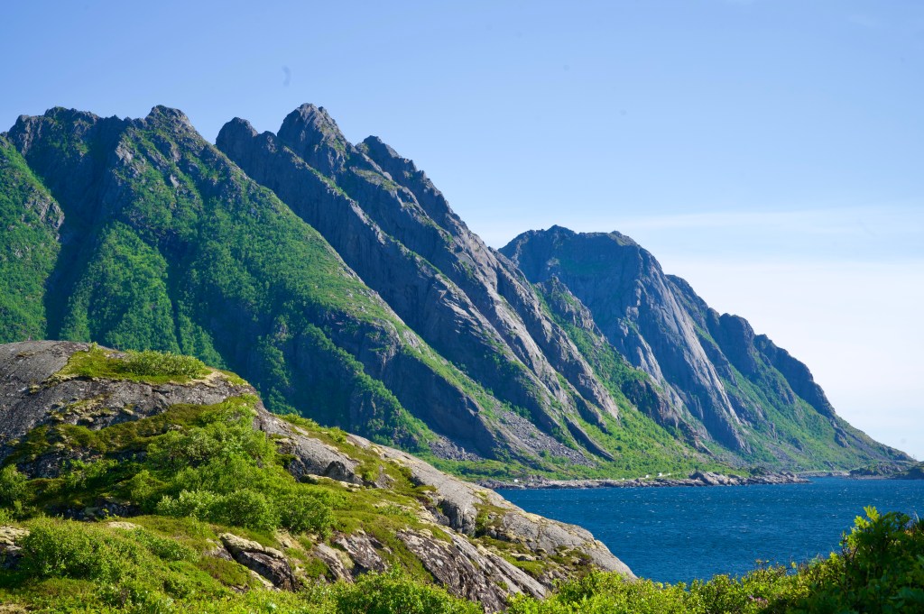
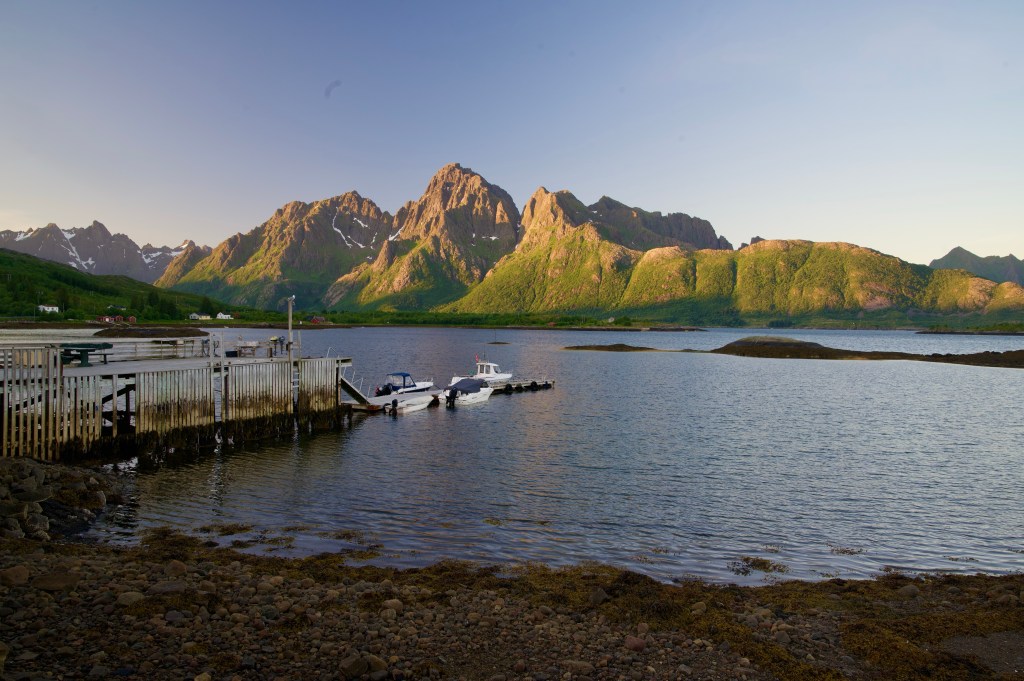
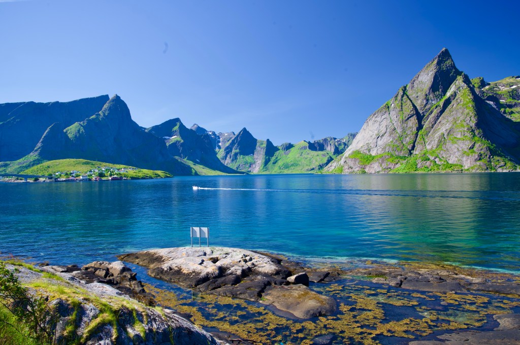
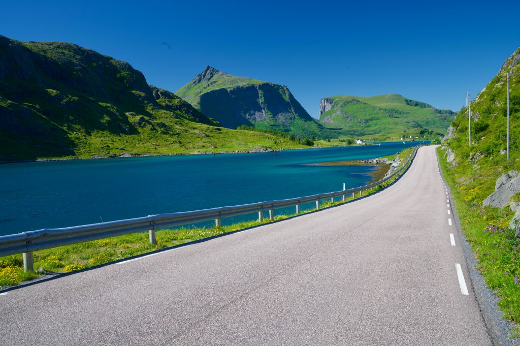
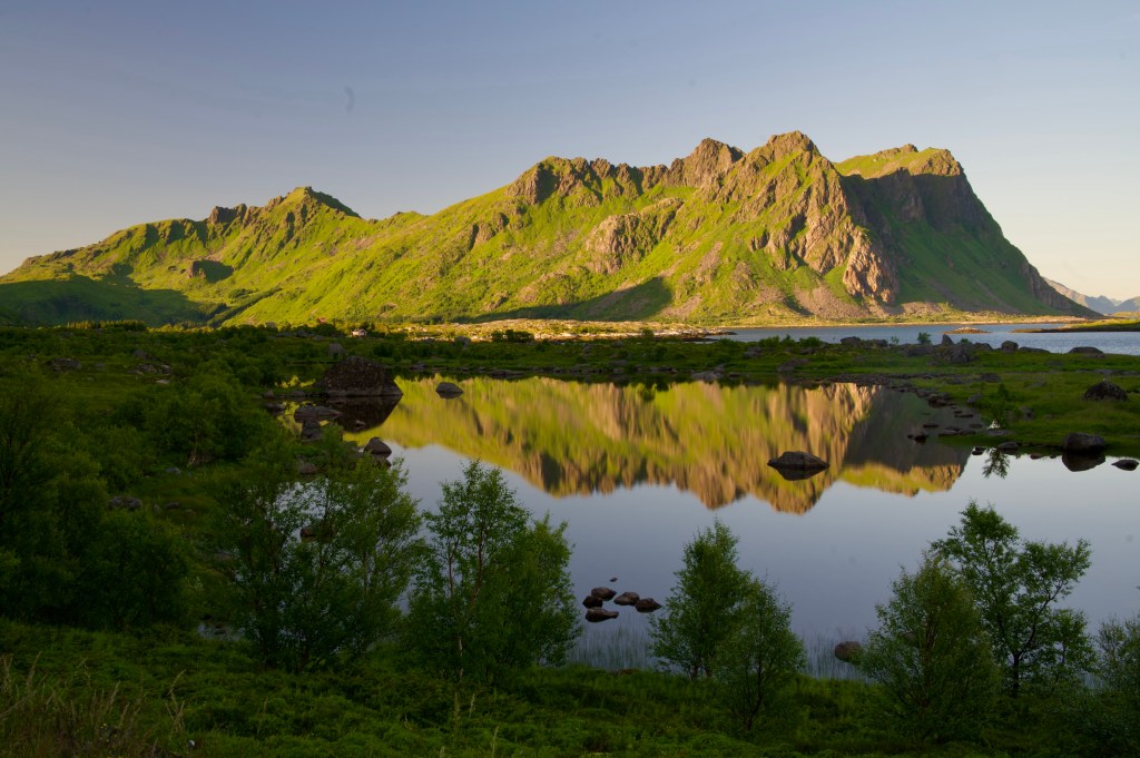
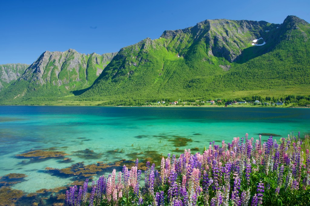
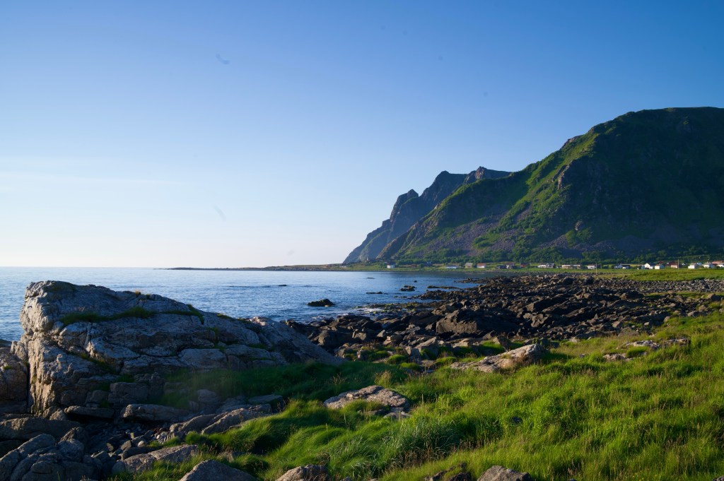
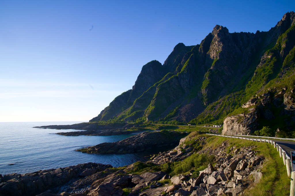
After Risøyhamn, it was all about banking a few extra miles for the day, but as the road crossed to the west coast, the landscape became something very special indeed, the land interfacing with the sea in a way that reminded me of, not only, those islands on the edge of the Atlantic in Scotland, the Outer Hebrides, but also where the Pacific meets the Oregon coastline, in America.

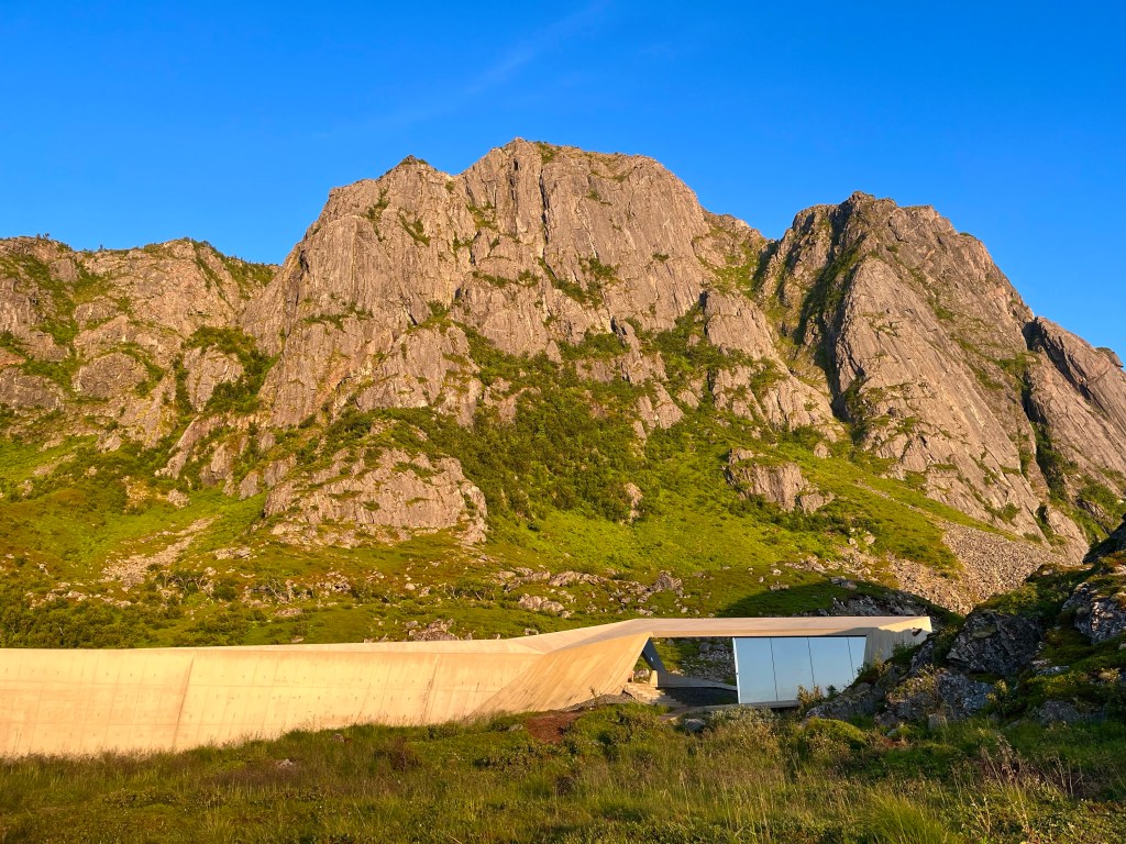
The area around Nøss was clearly a very popular wild camping area, with lots of great spots, but I was running low on water so looked to see if there were any public toilets up ahead. Then I found one just 1 km away, a toilet block, with sea views. I would be able to get water to cook my dinner, not that it mattered as it seemed I’d run out of gas.

Norway Day 17: Hammerstad Camping – Stokmarknes

Distance: 51.7 miles

Time: 4:50

Elevation Gain: 1767 feet

Perhaps Hammerstad Campsite wasn’t the best in terms of facilities, the toilet block was tiny and tagged onto the end of one of the camping cabins, and if there was a kitchen area, I still never found it. But the view was spectacular and I enjoyed sitting out as the midnight sun set, watching clouds roll across the mountains. It was the first night of the trip that I can remember seeing the moon.

The wind strengthened overnight, and it was gusting quite strongly by the morning, and definitely in a direction that would hinder my onwards travel.

Rolling along the Austnesfjorden, I stopped to take a few pictures when a trio of riders whizzed by. They sounded Polish from the snatch of conversation I heard, and were riding strongly in formation, so I thought it likely that I might not see them again.

But, up ahead, there was a hill and the woman at the back of the group started to drop back, so they slowed up, and my tempo took me past them on the ascent. Shortly afterwards I stopped at a view point to take some more photos and assumed that the group would pass me again. But they stopped too, and when I turned off to follow the 30 mile ‘scenic route’ to Fiskebøl, I looked back and saw that they’d carried straight on along the main road. Maybe I’d see them again down the road.

After a few more miles of ploughing away, into the wind, in a degree of frustration, I stopped to have something to eat. Almost immediately after setting off again, a Swedish rider called Hans pulled alongside me, and asked if it was ok to chat. He had set off from Sweden and ridden to Trondheim. He’d then ridden from Trondheim and was also on his way to the Vesterålen Islands, but was then cutting off to Narvik. At some point during all of this, he was stopping in at his brother’s, and potentially some other relatives as well.

Once or twice he remarked about how fast I was riding, and that he could go this fast because he was on an 8 kg road bike, and clearly had a lot less equipment. Certainly my bike weighed 11.5 kg, as for the rest of my equipment, I couldn’t possibly say.

After 10 miles of riding together, and now having forgotten to notice whether there was a headwind or not, we rounded a corner, and the view was spectacular. Spectacular enough that I had to stop to take a picture. Saying as much to Hans, he said, ok see you, and he was off!

Further along the road, having stopped to take another photograph, a girl hiking, called out, ‘this might sound strange, but would you like me to take your picture for you with this lovely view’? It didn’t sound strange at all, and I instantly offered to return the favour. She was off to hike some of the nearby peaks for a few days, looking up at them, I wouldn’t even know where to start.

Into the next fjord, and I’d stopped for yet another photo opportunity when 4 of the group of 6 that I’d seen swimming the day before flew past. Soon afterwards the road turned around the end of the fjord and suddenly the wind was in their face, and as the road started to ramp up, the group began to slow and I pulled alongside. ‘Hi again’ said the guy at the back, ‘are you going for the ferry too’. Yes, I said, do you happen to know when the next one is? ‘In 50 minutes time, and it’s 13 km away’, came the response. Suddenly, I saw what the rush was about.

We kept chatting at the back of the group, they were a group of 3 friends from university, and their respective plus ones, who all now lived in Oslo, and were doing the trip from Bodø to Tromsø together. Eventually the strong gusting wind started to push the group back, so I felt duty bound to take a stint on the front, battling on over the last few hills towards the ferry terminal. And there was Hans to greet me, ‘you caught up’, he said.

Arriving into the small port town of Melbu, in the Vesterålen Islands, there was a steady stream of cyclists popping into the supermarket for supplies, and when I finally got back underway, I had to decide whether to take the long road or the short road to Stokmarknes.

In the end, I decided on the long road, and 15 miles later I rolled under the arch of the impressive looking Hurtigurten Museum building, an exhibit dedicated to Norway’s coastal cruise ferry, which began in 1893, and runs daily, back and forward between Bergen and Kirkenes near the Russian border.

Norway Day 16: Brustranda Fjordcamping – Hammerstad Camping

Distance: 39.6

Time: 3:55

Elevation Gain: 1,438 feet

In the campsite, a German man quizzed me about my trip, before apologising that his English wasn’t better. Unfortunately I didn’t know the German for ‘I’m sorry that my German isn’t better’, so left it unsaid.

He was driving, from Germany, all the way to Nordkapp and back, down through Finland and Sweden one way, and back through Norway and Denmark, all in a 1960s VW Beetle. I tried to find out its vintage from its registration plate, but only succeeded in finding that, in Germany, the letter H is appended to plates of cars over 30 years old.

The wind had picked up a little this morning, and it was coming from the North, so luckily my route didn’t keep me pointing in the same direction for long.

I set off along the quiet 815, emerging from the fjords onto a pleasant stretch of coastline.

Seeing a handwritten sign for ‘kaffe og vafler’ outside a building at the side of the road, I went inside, finding myself in a small jumble sale with a few stallholders all standing around looking unoccupied. I asked the lady nearest the door about coffee and waffles and was directed to a kitchen hatch, where she served me a small cup of coffee and handed me a plate with a waffle on it, and pointed me in the direction of some jam, sour cream, and brunost cheese, obviously trusting me to know what best to do.

Just before the 815 rejoined the E10 again I saw the beautiful turquoise waters of a sandy beach off to the right hand side, so grabbing a few things to eat, I sat overlooking a very pleasant view. Shortly afterwards a group of 6 cyclists emerged out onto the beach down below, having some lunch, and one by one, tempted out into the inviting looking, though it appeared chilly, waters.

Soon, the 815 turned onto the E10, and the road crossed onto the island of Grimsøya, and back off again, on a pair of new looking bridges, with a fine looking range of mountains providing the backdrop.

The E10 along this stretch provided some of the least enjoyable riding of the whole route, on what was actually quite a busy road. The patient, courteous driving that I’d encountered for most of the route, seemed to have gone out of the window for a while, it seemed that most of the traffic was keen to get back towards the major town of Svolvær for the evening.

Arriving there myself around 18:00, I was in the mood for a pizza, and found the ideal spot at Fellini’s, down near the harbour. Enjoying a Calzone with yet more impressive mountain views in the background.

I set off in yet more blustery conditions, intending to do another 10- 15 miles for the day, but 5 miles later, wearied by the heat and the wind, I arrived at Hammerstad Campsite, and it was in such a pleasant spot that I thought I should stay.

Norway Day 15: Moskenes – Brustranda Fjordcamping

Distance: 54.01 miles

Time: 5:45

Elevation Gain: 2,590 feet

Moskenes campsite looked like a veritable gold mine, and as I sat on the terrace at just gone 10 o’clock, sipping an £8.71 half litre of Nordland Pils, and watched another raft of potential clientele rushing up the hill from the ferry, it seemed like business was booming.

In the morning, I’d just been to the kitchen to clean my pans when I overheard a group of 4 men readying their bikes to leave. They sounded Scottish, and what’s more, one of them was also riding a British racing green Thorn bicycle, what were the chances?

Going over to say hello, I ascertained that they were from Glasgow, they’d been in Moskenes long enough to do some kayaking and a midnight sun hike, they were now setting off to Tromso by bike, and were flying back to Scotland a week on Monday. So the day after me.

Most of the site had emptied again by the time I left, and that seemed like no bad thing, as I was happy to share the road with as few campervans as possible. I felt like I might be looking to stop quite often.

On leaving the campsite, the views came quickly and often, and as I rounded a corner a cliff towered above me, and as I stopped to take a photo, I noticed a sinuous and almost completely unbroken line of people zig-zagging up the steep flank to the pinnacle of what must have been an incredible viewpoint, looking out over the fjord and the sea and the tiny village of Reine jutting out between the two.

Stopping at a viewpoint, near Reine, I was readying to take a photo when I was taken aback by a ‘hello Michael’ from behind me. It was Simon, and Margot, who I had shared the Atlantic tunnel bus to Kristiansund with a week ago. When I had last seen them, as they left the town, we commented that we might see each other in the Lofoten Islands – as I was skipping ahead to cycle to Bodø, and they were continuing to Trondheim, but then taking the train to Bodø – well that was quick!

It turned out that they had only just arrived off the ferry, at 10 o’clock the night before, quickly pitching their tent and nipping up Reinebringen – the midnight sun hike – on the trail I’d just seen from the road. They’d got the sunset shots alright, with a cloud inversion, it looked incredible.

They recommended that I should take a look around Reine, so I rolled down the hill, stopping off at a rather souped up version of the Extra supermarket with a fast food counter and cafe area.

Quickly polishing off Norway’s unofficial national dish, the humble hotdog, I carried on around, and across, Reinefjorden, with an incredible, majestic backdrop of towering peaks, cobalt blue waters, all punctuated by tiny red and white stilted homes, the colours of the Norwegian flag found everywhere I looked.

After an incredible series of open tunnels, I found a few scattered people on a clifftop staring out to sea. Slowing up to take a look, I caught sight of what they were watching, the black fin of an Orca circling out in the open waters.

The E10 cut a swathe across the island, all the way to Ramberg in the north, where I found the four Scots returning from a side road where they had deviated to climb a hill.

Almost as soon as I hit the north coast, the road turned south again around a large fjord, I felt fantastic, I was flying along and my legs felt great. But then I remembered, if you feel great on the bike, there’s only ever one explanation, there’s a tailwind, and that’s exactly what I found as battled along the other side of the fjord.

Reaching a gap between two islands, I saw the Nappstraumtunnelen plummet into the ground, promising 1.8 km of underwater fun. Luckily there was a raised walkway for pedestrians and bikes, but it was still a damp inhospitable place to be, and that was before the climb back out.

Reaching Leknes, I was intrigued to find that the local Remo 1000 supermarket had a separate Sunday opening entrance and that you weren’t allowed into a large part of the shop. Even more interestingly though, although customers weren’t allowed into most of the shop, it did seem that they had shop assistants who would go and find things for you from the unopened section.

Leaving town on the 815, there was a serious hill right out of the traps, but I was feeling comfortable on the climb, and then amused, on seeing a ‘cross country skiiers crossing’ sign.

I spoke to a couple of cyclists from Oslo at a bus stop, I was interested to hear that they were pushing on south to do the tunnel tonight, hoping that it would be quieter than waiting for morning.

I pressed on into the depths of Rolvsfjorden, and on passing Brustranda Fjordcamping at a 20 past 9, I called it a night.

You can probably see too many great views in one day, so I was ending the day with just one more at the campsite.