Tag: michael

Day 17: Cochrane – Camping El Risquero

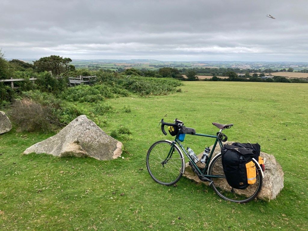
Distance: 48.17 miles

Time: 7:12

Elevation Gain: 3,704 feet

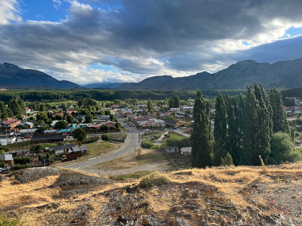
Being the last big town of the Carretera Austral route, it made sense to have a rest day in Cochrane, to prepare for the remote stretch ahead, so that’s what we did. Taking some clothes to the laundromat, stocking up on several days of food, and for my part trying to sort out my brakes, which now seemed to be stuck on in a position that barely allowed the wheels to turn and had made the day before quite a difficult pedal.

Fortunately we had plenty of time to manage all of these things, and for Desiree to take her bike for a check up that had been recommended by the bike hire company, and where she had to explain why there was now a piece of wood playing a vital role in the mounting system of her handlebar bag.

Whilst we were standing outside the workshop, another cyclist turned up with a bike to fix. He was German, but had been living in Canada until two years before, when he had set off back and forward across Canada before turning south and continuing onwards until he had met a partner, here in Chile. Now they were readying to move to Germany, and it sounded like he had been operating as part-competitor, part-business partner to the local mechanic while he had been living here.

The rest day also gave me an opportunity to find out a little bit more about Desiree as well, she was German, but now had Ecuadorean citizenship. She’d studied in Vienna and Barcelona, and also lived in Myanmar, Argentina, Ecuador and Peru, and after the trip she’d be moving her life back from Lima to Quito, where she was also the frontwoman of a punk band, who had just toured in the Southern United States. Other than commuting, she didn’t do a lot of cycling, but had done some climbing around Quito, including 5,897m, Cotopaxi.

On leaving Cochrane, we had stocked up for the three days that I’d originally planned to reach Villa O’Higgins in, but by the time we actually left, we’d already decided to aim for Caleta Tortel by the end of day two, a combined total of about 80 miles. This involved a detour for me, but was a heavily recommended side-trip, and Desiree was planning a rest day there. I would skip the rest day, and push on for Villa O’Higgins, in another two days, instead. Caleta Tortel would have been another resupply point if we’d planned for it, so our bikes were probably heavier than necessary.

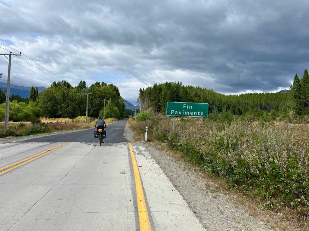
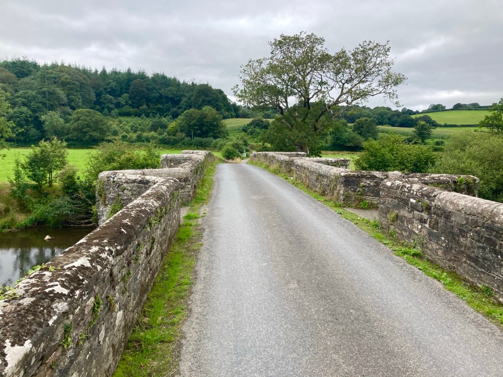
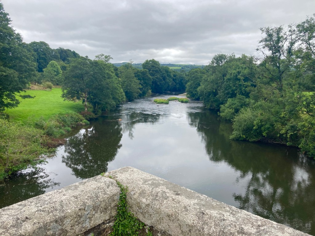
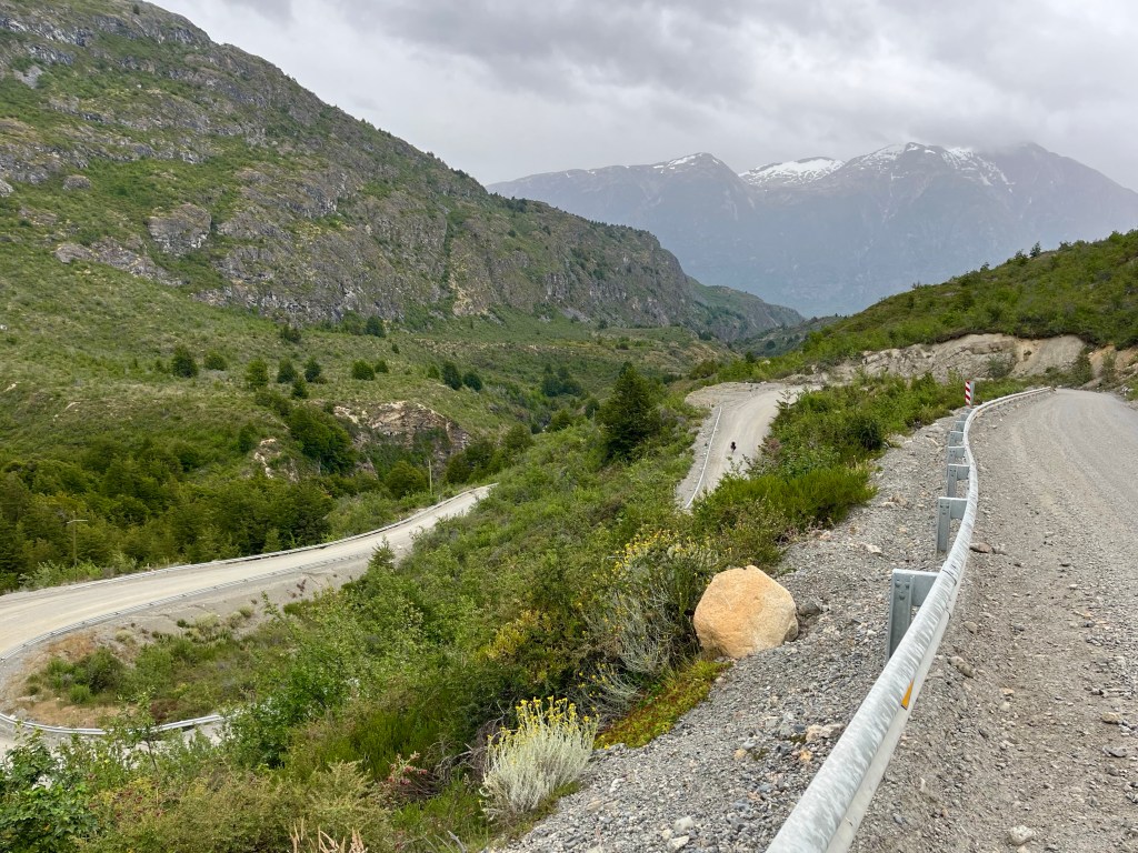
Setting off, it wasn’t long before we reached the dreaded ‘fin pavimento’ sign, on the outskirts of town, fortunately we received a stay of execution for many miles afterwards, with the tarmac continuing until we reached a bridge after Laguna Esmerelda.

Desiree was in good spirits, but I did get a bit of a surprise when I suddenly heard singing, back down the road. She broke into song several times during the day, and the highlight was, by common agreement, a rousing A cappella duet of the Radiohead song, Creep

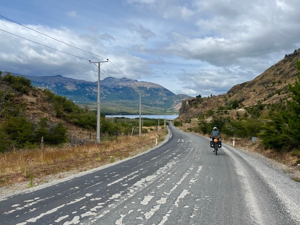
After the end of the pavimento, the ripio (gravel) track that continued, climbed high onto a wilderness plateau, and was rough and rutted, with a washboard consistency that was jarring on both, bikes, and riders. A steep hairpin bend opened up views of the glaciated top of Cerro Trunco, some 2000+ metres high.

Towards the end of this rough rolling section over the plateau, the next part was made more interesting by a pair of Andean condors circling high above the forest as we started to drop down alongside the Río Barrancoso on the way to the turn off towards Los Ñadis.

Beyond the turn off, the road levelled out, we were pleased with the progress we had been making for the day, and had already covered 30 miles, when we encountered 4 female German cycle tourists standing beside where a cafe was marked on the map. The gates to what looked like a farmhouse were closed, but soon one of the group made contact with the owners and we were all invited in for a feast of bread and jam, the best being rhubarb, and several flasks of coffee.

Having conversed in English initially, and in Spanish with our hosts, the girls, who were from Cologne, were surprised when they learned that Desiree was also German, from Aschaffenburg in Bavaria. Thankfully, they kept on speaking in English, for me.

The group were going to be travelling for several months, having just arrived in Caleta Tortel on the 3 day ferry from Puerto Natales, where they’d had to endure the whole trip from the comfort of a reclining chair. Their plan was to travel as far as Lima, so they took Desiree’s number in case she was still there when they got there.

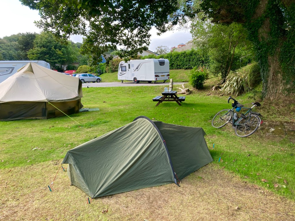
The break had been very pleasant, but the lengthy time off the bikes had allowed the weather to take a turn for the worse, and by the time that we reached the first campsite option Patigon Baucha, after 12 miles, we were starting to get rather wet. The sheltered tent spaces were occupied and the open field and lack of communal enclosed spaces, stopped us from lingering too long, and we carried on into the rain.

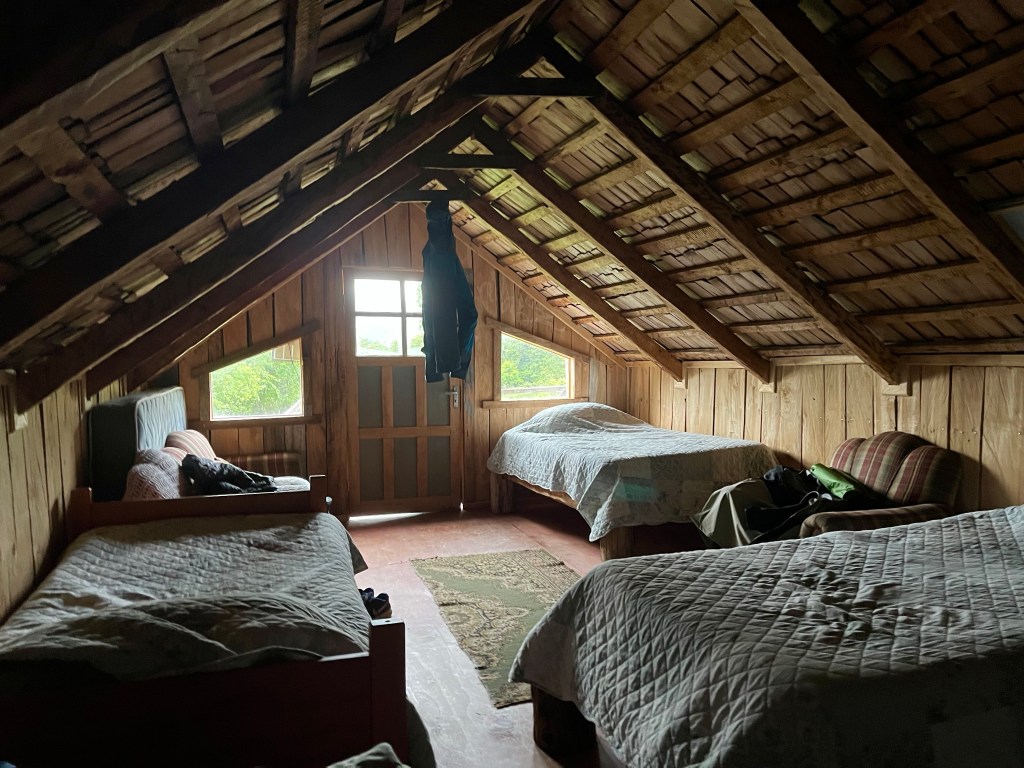
Another few miles saw us sheltering under a tree at the worst of the conditions, but eventually after 48 miles for the day, we found somewhere that looked like home for the night. El Risquero had camping in a field on a farm, but after a little negotiation from Desiree, we were offered the use of the old farm buildings to set up our tents, and that seemed ideal, until the lady pointed us in the direction of the empty six bed dormitory up the stairs.

Even better, as we were able to use the downstairs space to dry our clothes, and there was also a kitchen area, so while I went off to enjoy a highly-restorative hot shower, Desiree whipped up a hearty 2 course meal, comprising chicken soup, followed by polenta and salami. There was even hot chocolate for afterwards, to ensure that the recovery process had well and truly begun, after a hard day on the road.

Chile for January

It has not escaped my attention that 2026 will signify a decade since I started writing this blog, and so, I thought it would be a good opportunity to mark the occasion by ticking a fairly significant cycle-touring challenge off my list: namely, the Carretera Austral, or ‘Southern Highway’.

The Carretera Austral is an 800 mile sliver of tarmac and gravel, that cuts through a sparsely populated, and geographically complex, portion of Chile’s Patagonian Lake District. Begun by General Pinochet in 1976, the route was only fully realised in 2000, and links a series of tiny – previously isolated – coastal communities between Puerto Montt in the north, and Villa O’Higgins in the south.

As Villa O’Higgins is a long way from an airport that offers regular commercially-available flights, there is the added complication that I will need to push on farther south, via a combination of ferries and hike-a-bike, to reach a remote Argentinian border post near the popular trekking hub of El Chaltén, before continuing southwards and ultimately crossing back into Chile, ending the trip in Puerto Natales, which, conveniently, offers the dual purpose of providing a means to onward flights, and also acting as the perfect launchpad for visiting one of my longest-serving bucket list destinations, Torres Del Paine National Park.

It would be something of an understatement to say that I am extremely excited about having the opportunity to undertake this adventure, one that I had been contemplating for many years, before seriously considering it for last winter. Then, when I spotted that Pierre – who I cycled with in Vietnam in 2020 – was attempting the route, last year, I was determined to get – not only – some advice about the challenges he had encountered, but also an endorsement that I should do it too…

Lejog Day 3: Liskeard – Crediton

Distance: 55.4 miles

Time: 5:34

Elevation: 4096 feet

The day started well when the campsite owner, Kathryn, brought me over some porridge and a coffee. I was on the road at 10 o’clock and had unfinished business with the climb up to Bodmin Moor.

A brisk descent through Pensilva followed and then another stiff climb up to Golberdon, where my alternative accommodation for the previous evening had been. Down and up again through anonymous country lanes, then another brake-busting descent led to Horsebridge, where a medieval bridge aided my passage to a new county, Devon.

Devon welcomed me with a grinding climb; from 50m Horsebridge to 300m and the edge of Dartmoor. Under the shadow of Brent Tor and its ancient church, I chatted to a cyclist on a few day tour around the moor, laden with four panniers and with a rucksack strapped atop his rack.

The road dropped down to Lydford Gorge, and I stopped at the visitor centre cafe for ice cream and a scone. As I sat preparing my scone on the grass, I realised that I was at risk of committing a huge cultural faux pas, by ignorantly applying the clotted cream and jam in an order wholly incognisant of the Devonian methodology. I carried on regardless, if any interested party, Devonian or Cornish, wanted to see how a scone should be prepared, this could be a lesson to them. As it happens, the right way is the Devonian way, but I’d desecrated tradition anyway by having a fruit scone, and raspberry – not strawberry – jam.

Soon there was a distinct improvement in proceedings as I turned onto ‘The Granite Way’, a tarmacked former railway bed that crept around the edge of Dartmoor for 8 gloriously flat miles between Lydford and Okehampton. The cycle path was busy with other users and one man in particular appeared to be having a tough time of it, with a fixed wheel tagalong attached to his bike, his son seemed to be having a great time back pedalling up the climbs!

After popping into a shop on the edge of Okehampton for provisions, I committed myself to aim for Crediton, another 20 miles further on. Thankfully, the road stuck to major roads to Whiddon Down, and I felt good riding the shallower gradients. The going remained good until a sharp climb a mile from Crediton, and instantly the fatigue in my legs returned. When a further 9% ramp followed shortly after, I opted to push, after 48 miles I’d given up the battle for today.

The nearest campsite was 5 miles to the East, and with no response to my phone call I headed there regardless, largely because the route looked flat. Arriving at the Langford Bridge campsite at 20 to 7, the sign stated that reception was open ‘til 7, and the campsite was largely empty, I’d found my abode for the night.

Luckily, after the exertions of the day, my dinner couldn’t be simpler, a tin of Heinz beans and sausages, and, finally, a use for the stove I’ve been carrying.

Lejog Day 2: Ponsanooth – Liskeard

Distance: 51.4 miles

Time: 5:33

Elevation: 5244 feet

By the time I’d packed up camp this morning, my start wasn’t much earlier, and still to have breakfast, I made for the Norway Inn, waiting impatiently for my fry up to arrive. Now 10:40, I found myself on the busy A39, holding up a truck, before a cycle lane appeared just before the lengthy hill to Devoran. Thankfully, I was exiting here to rejoin the route and swept along some country lanes to King Harry Ferry, a chain ferry across the Carrick Roads.

Climbing steeply away from the slipway, I momentarily reached some higher ground, before the road plummeted again, a pattern that would continue for most of the ride. Much like yesterday, the roads were narrow, and lined with high hedges on either side, I considered the wisdom of choosing an ‘optimal’ route solely on the criteria of minimising traffic, and distance. I had other variables to throw into the mix, like avoiding going over every hilltop, and ensuring that there was occasionally something other than a hedge to look at.

I was thankful for the lack of traffic, though, and as I slogged up the first few climbs there was no one to be seen. Eventually, my luck ran out, and it became a regular occurrence that, no sooner had I started up a climb, a car would come over the brow of the hill, tuck into the verge somewhere near the top, and I’d have to spin up the hill as fast as I could to get past.

On the last few miles into St Austell, the route branched off onto a cycle path of loose gravel and stones, and instantly I regretted following it. I bailed out half a mile later, for the good of my tyres, but, it was too late, and shortly afterwards, my front wheel started to go squidgy. I hauled the bike off the road, through a patch of nettles, and set to work changing the inner tube, resolving to avoid any off road detours in future.

Eventually, I reached St Austell, but not spotting anywhere for lunch, I continued to St Blazey, popping into a shop for provisions. One more climb saw me reach the short Ferry crossing between Fowey and Bodinnick, but the climbing didn’t stop there, and where the hills had been 100 metres high before they now pushed 200.

Passing 43 miles for the day, the relentless climbing caught up with me, and after a tricky 17% descent, the road climbed steeply back up the other side, and I was defeated. 3 times I got off and walked, not ideal on a narrow country lane, but there was nothing else for it.

The miles passed ever more slowly, and I realised that I wouldn’t even make the first of my potential campsites by their check in time of 6pm. One by one, I interrogated Google Maps for alternatives, and one by one, the options disappeared. Passing through Liskeard, I strapped a fish supper to the back of my bike, and set off in the hope that the kind people of Fursdon Farm would forgive my late arrival. At just after 7, I was standing by the campsite entrance when the owners drove in. Head on in they said, and would you like a coffee?