Tag: Thorn

Jordan 2023: The King’s Highway

Up In The Air

At the culmination of my lap of Iceland in the summer, I was asked ‘what’s next’? I quickly responded that somewhere warmer might be nice, like a winter escape to Jordan… And it might be nice, I’ll find out very soon!

Usually, when I’m planning a cycling trip, it develops gradually into a vague outline and a smattering of half-formed ideas, then I book the flights, and quickly those half-formed ideas become a plan. On this occasion, after several months of agonising over which flights to book, a sudden price drop forced my hand, and only then did I think to check out the news flash about the Gaza strip which had just flashed across my phone screen.

From that moment, an air of uncertainty hung over my planning: firstly when British Airways extended the duration of the flights in and out of Jordan, presumably deeming it prudent to take steps to avoid flying directly over a war zone; and secondly when they cancelled my homewards flight, offering up the possibility to postpone my trip until a time when the region appeared slightly less volatile. On considering my alternatives, I quickly realised that I would almost certainly end up claiming a refund on the flights to Jordan, then immediately replace them with cheap flights to Egypt, a country also bordering Israel and the Palestine Territories, but in which I had done no research at all. So, Jordan it was…


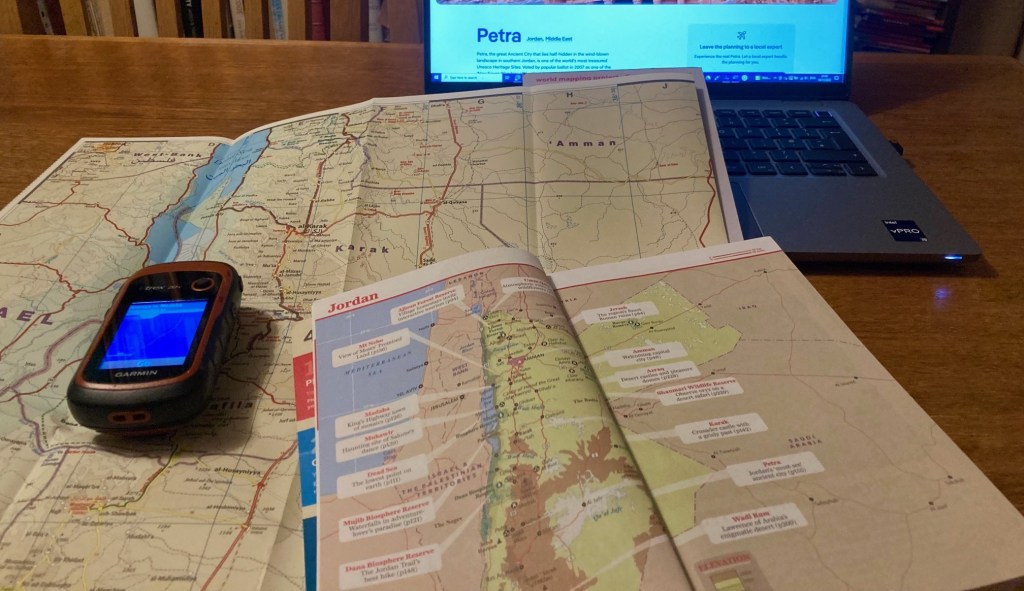
Jordan was somewhere that had appealed for many years, my interest piqued by photos of the red sandstone tombs of Petra glowing in the slowly-setting desert sun.
In recent years, the country had positioned itself as a safe haven for adventure in the middle of a turbulent region, so, when I first learned about the Jordan Trail, a mixed terrain mountain biking and trekking route running 400 miles down the middle of the country, I took notice. In calculating my remaining annual leave for the year, it was clear that I didn’t have enough days left to undertake the full thing, but surely I could find something to entertain myself?


In reading about the Jordan Trail route, there was regular mention of a road, ‘The King’s Highway’, an old communication path down the spine of the country, starting in Damascus, Syria, and finishing up at Aqaba on the Red Sea. Regarded as being one of the oldest roads in the world, it was documented in the bible and dotted with Roman ruins and Crusader Castles along its length.


The 250 mile stretch from the Jordanian capital, Amman, to Aqaba appeared to have some of the most impressive landscape features, bisected by the towering gorge of Wadi Mujib, tiptoeing around the edge of the Dana Biosphere Reserve, before descending to the spectacular desert landscapes of Wadi Rum on its final approach to the sea.


Oh, and in case I forgot to mention, it passes Petra along the way..

Iceland 2023: The Ring Road

Back in the Saddle…

When I cycled from Land’s End to John o’ Groats in August 2021, it was a targeted attempt to regain some fitness after a busy few months at work where sporting pursuits had fallen by the wayside. Since then, my main training focus has been running and the culmination of the last few years has been recent PBs in the 5K and Half Marathon of 18:37 and 1:25:40 respectively, and completing my first ever Marathon in Manchester in a time of 3:14:36. So, almost 2 years since LEJOG, I’m definitely fitter than I was, but I haven’t been doing much cycling, so it must be time for another adventure…

Last summer was largely spent working on bikes rather than cycling them, and I finally bought a new bike to replace my battle-scarred Thorn Brevet, the bike that has scaled the Atlas mountains and the Vietnamese highlands, while also rolling past the stunning Oregon coastline along the way. What is the new bike? Well, it’s another Thorn, a Club Tour, a heavier duty tourer with stronger wheels and wider tyres for exploring off the beaten track, perfect for its debut outing along the Fife Coastal Path last September.

So, when I started dreaming about where to travel next, my thoughts turned to the gravel trails of New Zealand and the dirt roads of the Carretera Austral in Chile, but, alas, I have a new job, and not enough holidays to spare, so I started to think of somewhere similar, but closer to home. An active volcanic landscape, sparsely populated, and only a two hour flight. That’ll be Iceland.

For those who have followed my previous tours, you’ll have spotted that I do like a good, old-fashioned, point to point route, they tend to look good on maps, and offer the greatest rate of change of landscape and culture. But, my second favourite is definitely a loop, and the fact that Iceland has a Ring Road that circumnavigates the whole country is almost as good! When I started to plan the trip I found statistics that suggested that the Ring Road still featured gravel stretches, and that as much as 30% of it could still be gravel. However, more recently I’ve found a more up to date source that shows that it has now been tarmacked all the way round, and now that I know that, it does make a difference to my choice of bike. And, with me being reluctant to take my new bike on a plane as of yet, the old one is being pressed into service once more.

What, then, is the plan? Well, I’ve booked my flights to Reykjavik, and I’ll stay in Reykjavik Campsite on the first night; storing my bike box there for when I return. Then, I’ll set off around the Golden Circle to Geyser and Gullfoss before joining Route 1 – the Ring Road – on the south coast, and following it anti-clockwise around the country. All in all, a distance of around 852 miles and with 16 days to complete it, it’s lucky there’s a lot of daylight…

Oh, and I leave tomorrow, so I’d best get packing!

Lejog Day 3: Liskeard – Crediton

Distance: 55.4 miles

Time: 5:34

Elevation: 4096 feet

The day started well when the campsite owner, Kathryn, brought me over some porridge and a coffee. I was on the road at 10 o’clock and had unfinished business with the climb up to Bodmin Moor.

A brisk descent through Pensilva followed and then another stiff climb up to Golberdon, where my alternative accommodation for the previous evening had been. Down and up again through anonymous country lanes, then another brake-busting descent led to Horsebridge, where a medieval bridge aided my passage to a new county, Devon.

Devon welcomed me with a grinding climb; from 50m Horsebridge to 300m and the edge of Dartmoor. Under the shadow of Brent Tor and its ancient church, I chatted to a cyclist on a few day tour around the moor, laden with four panniers and with a rucksack strapped atop his rack.

The road dropped down to Lydford Gorge, and I stopped at the visitor centre cafe for ice cream and a scone. As I sat preparing my scone on the grass, I realised that I was at risk of committing a huge cultural faux pas, by ignorantly applying the clotted cream and jam in an order wholly incognisant of the Devonian methodology. I carried on regardless, if any interested party, Devonian or Cornish, wanted to see how a scone should be prepared, this could be a lesson to them. As it happens, the right way is the Devonian way, but I’d desecrated tradition anyway by having a fruit scone, and raspberry – not strawberry – jam.

Soon there was a distinct improvement in proceedings as I turned onto ‘The Granite Way’, a tarmacked former railway bed that crept around the edge of Dartmoor for 8 gloriously flat miles between Lydford and Okehampton. The cycle path was busy with other users and one man in particular appeared to be having a tough time of it, with a fixed wheel tagalong attached to his bike, his son seemed to be having a great time back pedalling up the climbs!

After popping into a shop on the edge of Okehampton for provisions, I committed myself to aim for Crediton, another 20 miles further on. Thankfully, the road stuck to major roads to Whiddon Down, and I felt good riding the shallower gradients. The going remained good until a sharp climb a mile from Crediton, and instantly the fatigue in my legs returned. When a further 9% ramp followed shortly after, I opted to push, after 48 miles I’d given up the battle for today.

The nearest campsite was 5 miles to the East, and with no response to my phone call I headed there regardless, largely because the route looked flat. Arriving at the Langford Bridge campsite at 20 to 7, the sign stated that reception was open ‘til 7, and the campsite was largely empty, I’d found my abode for the night.

Luckily, after the exertions of the day, my dinner couldn’t be simpler, a tin of Heinz beans and sausages, and, finally, a use for the stove I’ve been carrying.

Lejog Day 2: Ponsanooth – Liskeard

Distance: 51.4 miles

Time: 5:33

Elevation: 5244 feet

By the time I’d packed up camp this morning, my start wasn’t much earlier, and still to have breakfast, I made for the Norway Inn, waiting impatiently for my fry up to arrive. Now 10:40, I found myself on the busy A39, holding up a truck, before a cycle lane appeared just before the lengthy hill to Devoran. Thankfully, I was exiting here to rejoin the route and swept along some country lanes to King Harry Ferry, a chain ferry across the Carrick Roads.

Climbing steeply away from the slipway, I momentarily reached some higher ground, before the road plummeted again, a pattern that would continue for most of the ride. Much like yesterday, the roads were narrow, and lined with high hedges on either side, I considered the wisdom of choosing an ‘optimal’ route solely on the criteria of minimising traffic, and distance. I had other variables to throw into the mix, like avoiding going over every hilltop, and ensuring that there was occasionally something other than a hedge to look at.

I was thankful for the lack of traffic, though, and as I slogged up the first few climbs there was no one to be seen. Eventually, my luck ran out, and it became a regular occurrence that, no sooner had I started up a climb, a car would come over the brow of the hill, tuck into the verge somewhere near the top, and I’d have to spin up the hill as fast as I could to get past.

On the last few miles into St Austell, the route branched off onto a cycle path of loose gravel and stones, and instantly I regretted following it. I bailed out half a mile later, for the good of my tyres, but, it was too late, and shortly afterwards, my front wheel started to go squidgy. I hauled the bike off the road, through a patch of nettles, and set to work changing the inner tube, resolving to avoid any off road detours in future.

Eventually, I reached St Austell, but not spotting anywhere for lunch, I continued to St Blazey, popping into a shop for provisions. One more climb saw me reach the short Ferry crossing between Fowey and Bodinnick, but the climbing didn’t stop there, and where the hills had been 100 metres high before they now pushed 200.

Passing 43 miles for the day, the relentless climbing caught up with me, and after a tricky 17% descent, the road climbed steeply back up the other side, and I was defeated. 3 times I got off and walked, not ideal on a narrow country lane, but there was nothing else for it.

The miles passed ever more slowly, and I realised that I wouldn’t even make the first of my potential campsites by their check in time of 6pm. One by one, I interrogated Google Maps for alternatives, and one by one, the options disappeared. Passing through Liskeard, I strapped a fish supper to the back of my bike, and set off in the hope that the kind people of Fursdon Farm would forgive my late arrival. At just after 7, I was standing by the campsite entrance when the owners drove in. Head on in they said, and would you like a coffee?