Tag: tour

Day 16: Camping y Cabañas Cerro Color – Cochrane

Distance: 40.71 miles

Time: 6:46

Elevation Gain: 4,055 feet

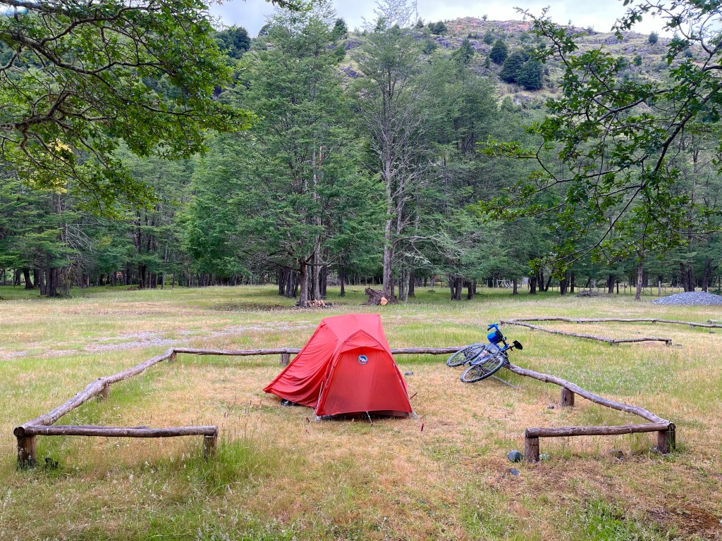
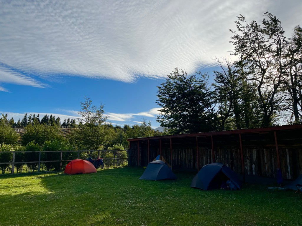
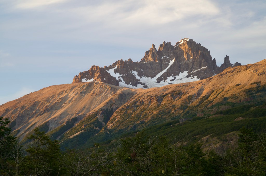
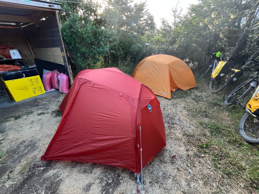
It had been a cold night, even more so as the campsite was on a plateau by a lake at 300 metres elevation. Thankfully, the campsite had a hot shower, and ample indoor space massively out of proportion with the number of guests, so I soon heated up.

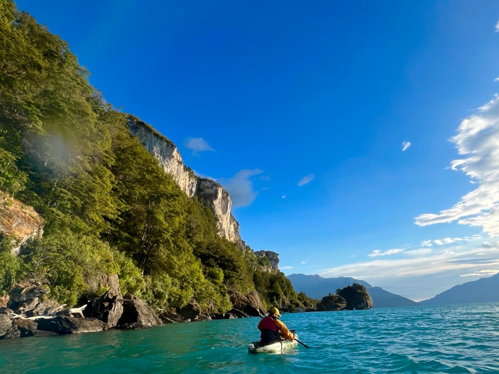
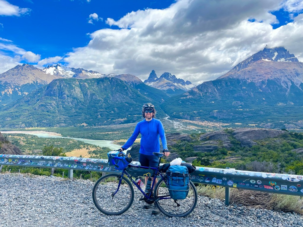
Plan for the day, was an ambitious one, to reach Cochrane, 40 miles away, and with a significant amount of climbing alongside the Río Baker. Desiree had done incredibly well the day before, to back up kayaking in the morning with a hard hilly 35 mile ride in the sun, not bad going during her first week of cycle-touring.

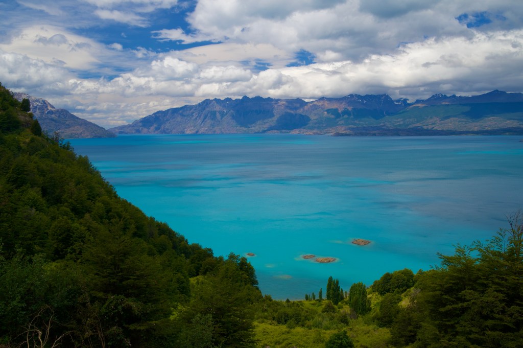
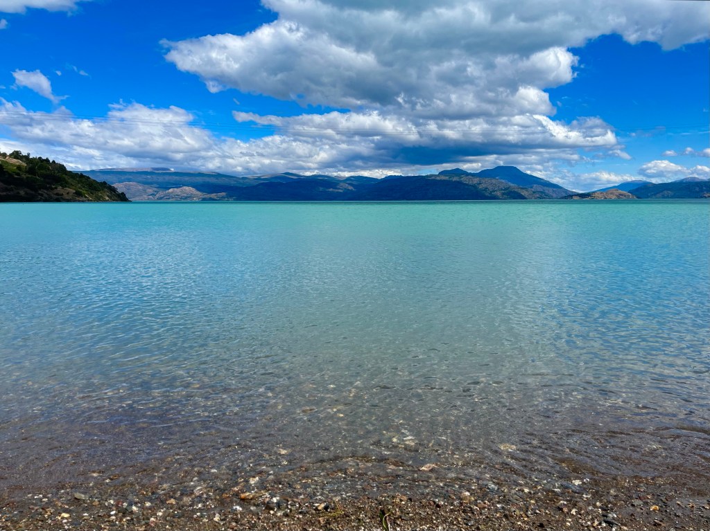
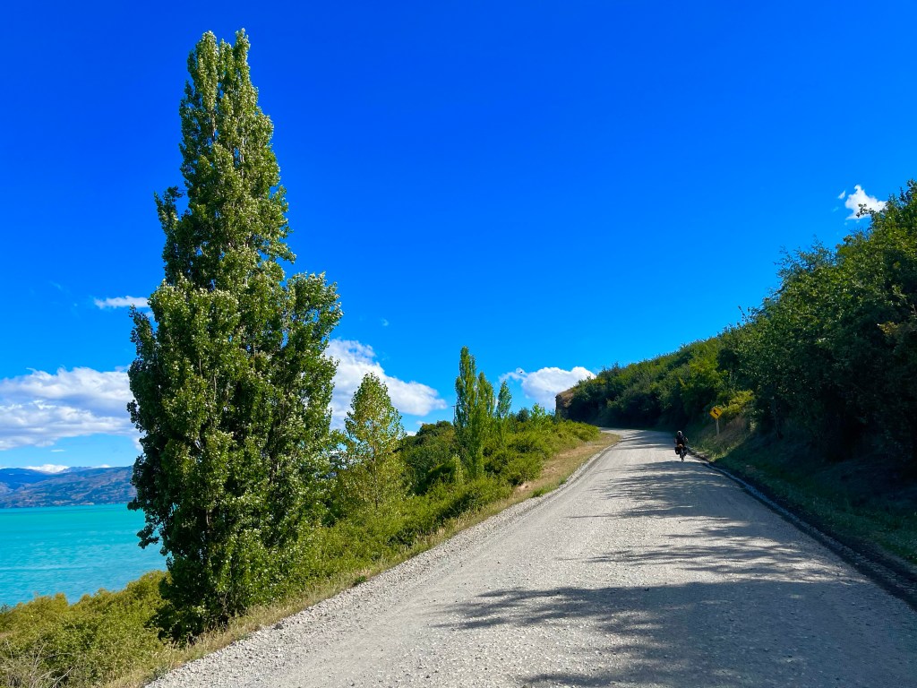
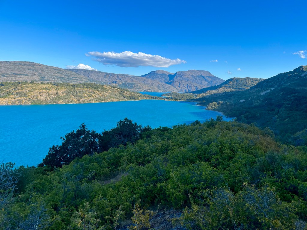
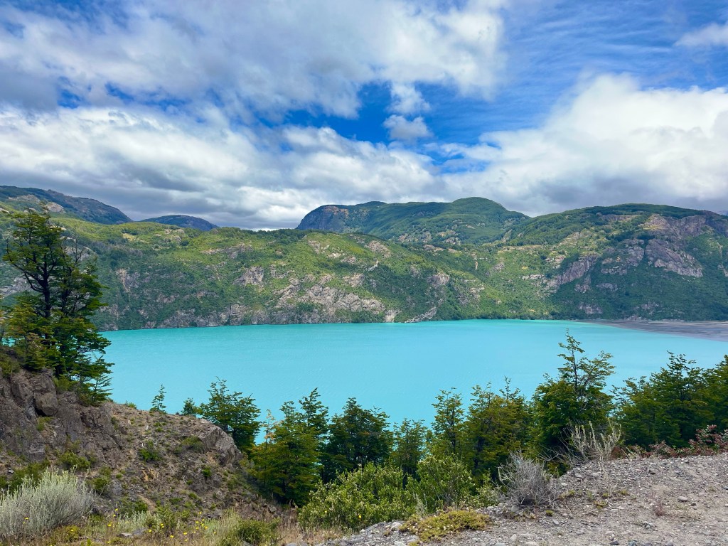
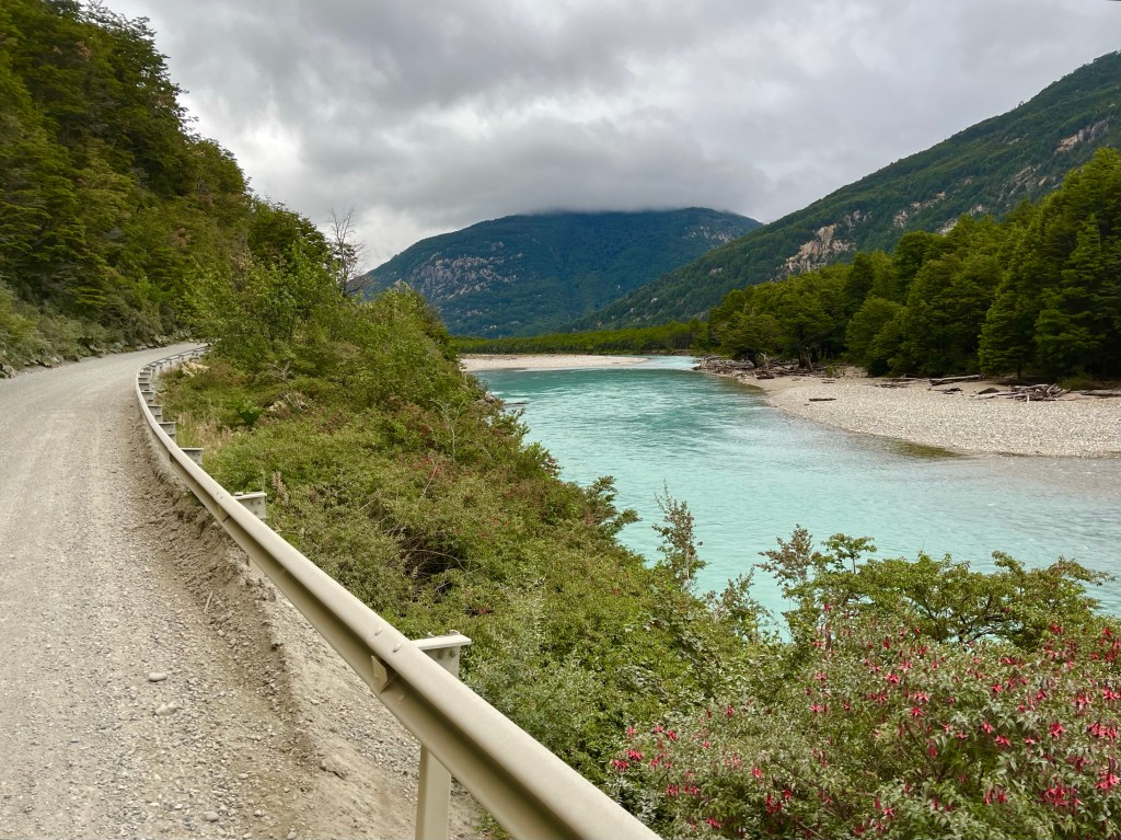
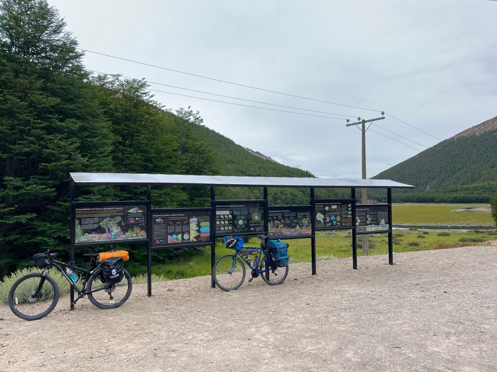
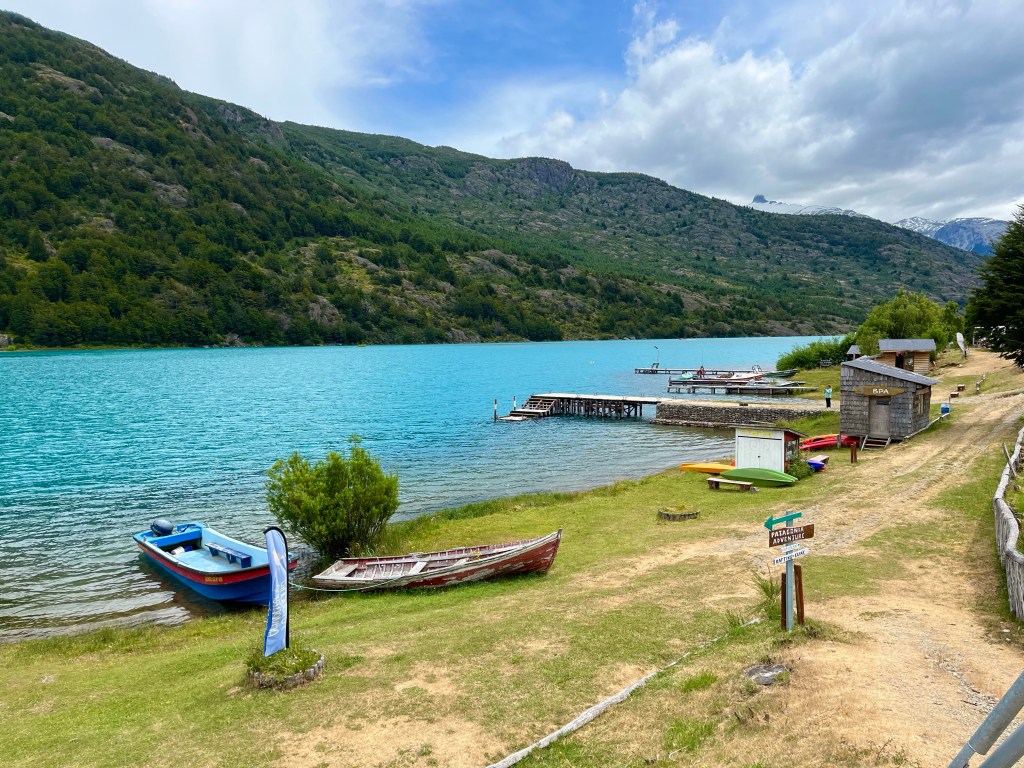
We enjoyed a short flattish section alongside Lago Bertrand, before a significant climb took us away from the lake and, then swinging back down to its side once more at Puerto Bertrand, where we rolled steeply down to the shore, in search of somewhere for lunch.

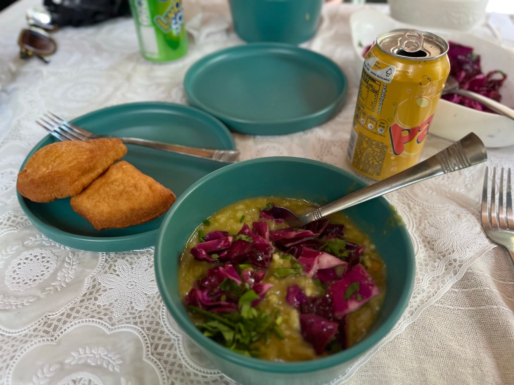
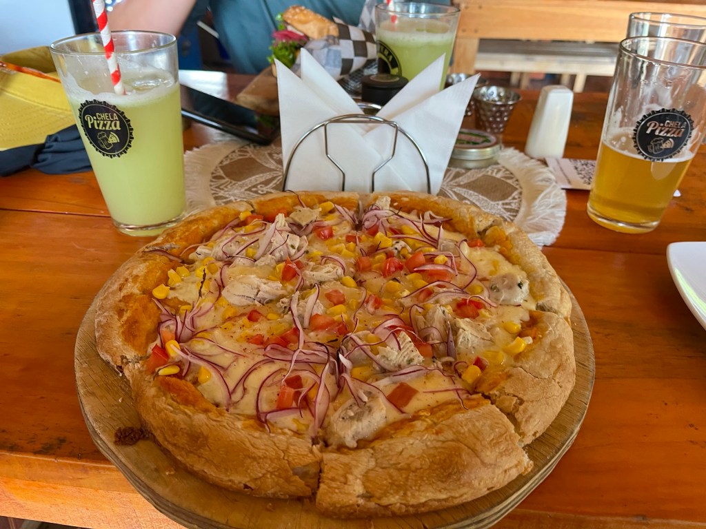
Uninspired by the food trucks on offer, we continued out of town and climbed steeply back up the hill to a pizza restaurant, a short climb that was definitely worth the effort.

After lunch, we had a look at the mount for Desiree’s handlebar bag, which had evidently been installed wrongly by the bike hire shop and the bag was now bouncing up and down on the front wheel, over the rough roads.

Unfortunately, the cable was so badly damaged that we couldn’t fully rectify the situation, but we did find the perfect piece of wood to take up the slack.

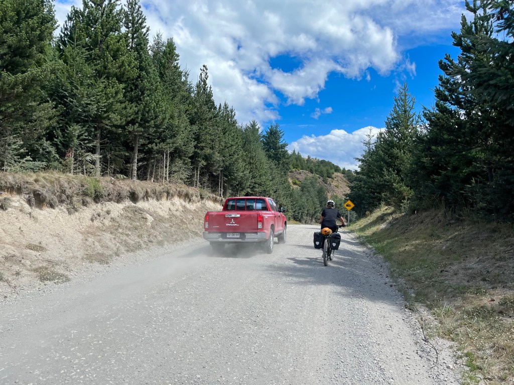
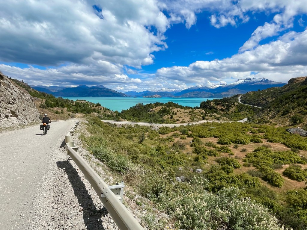
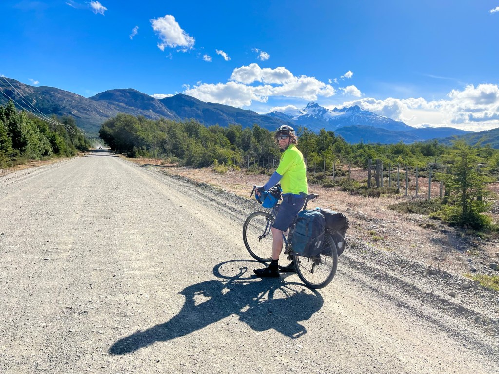
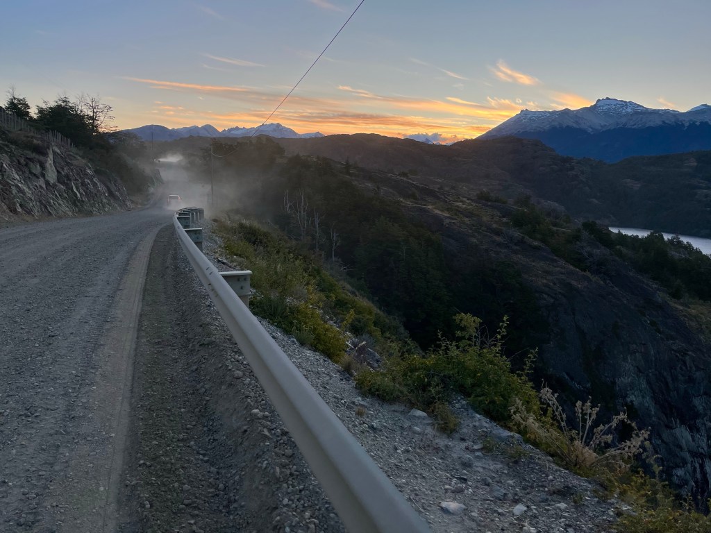
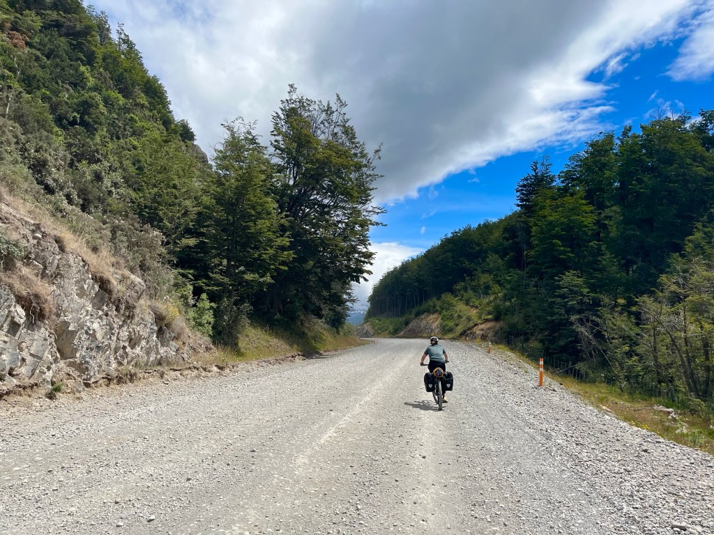
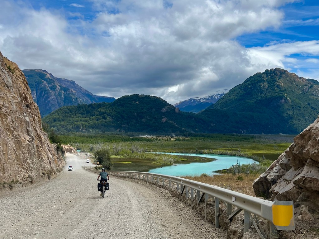
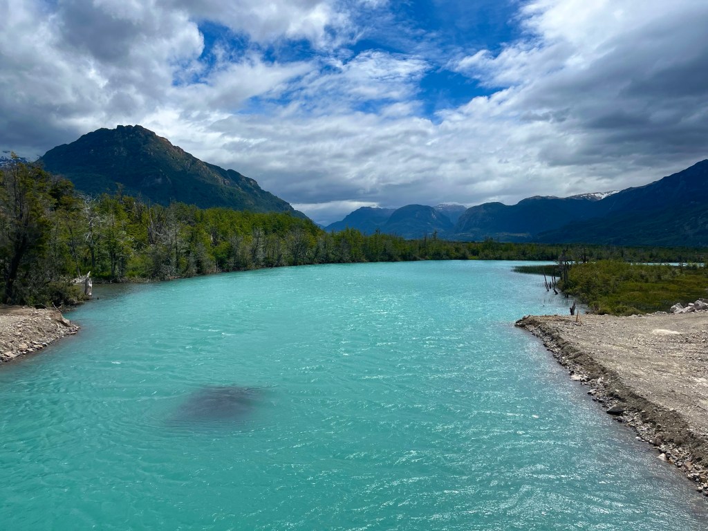
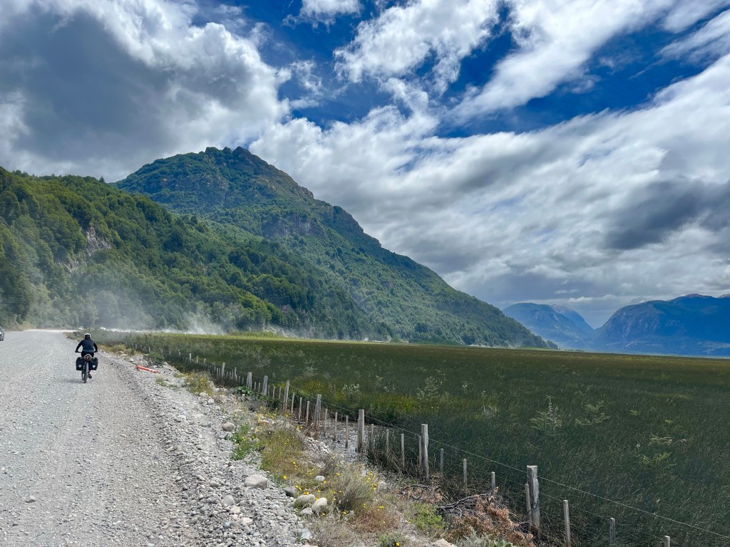
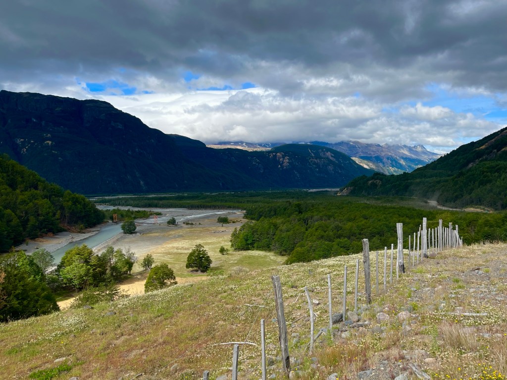
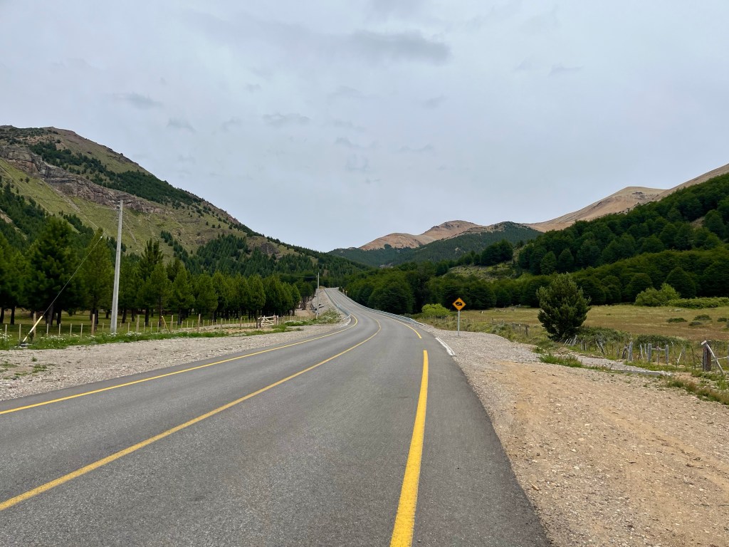
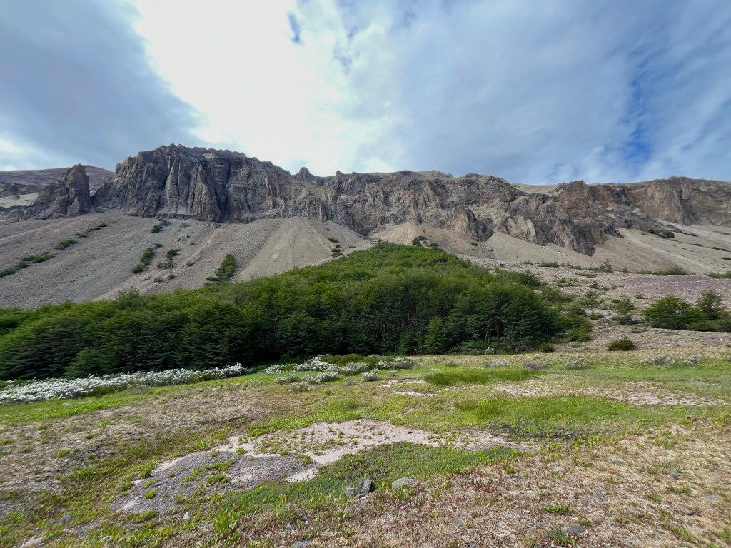
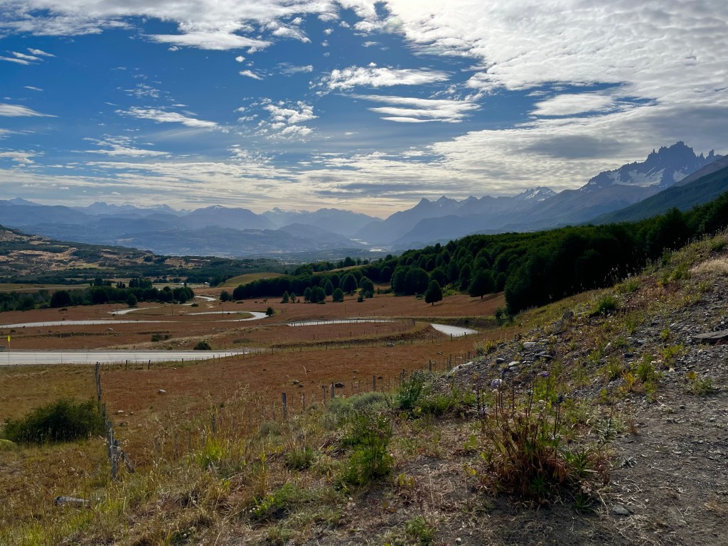
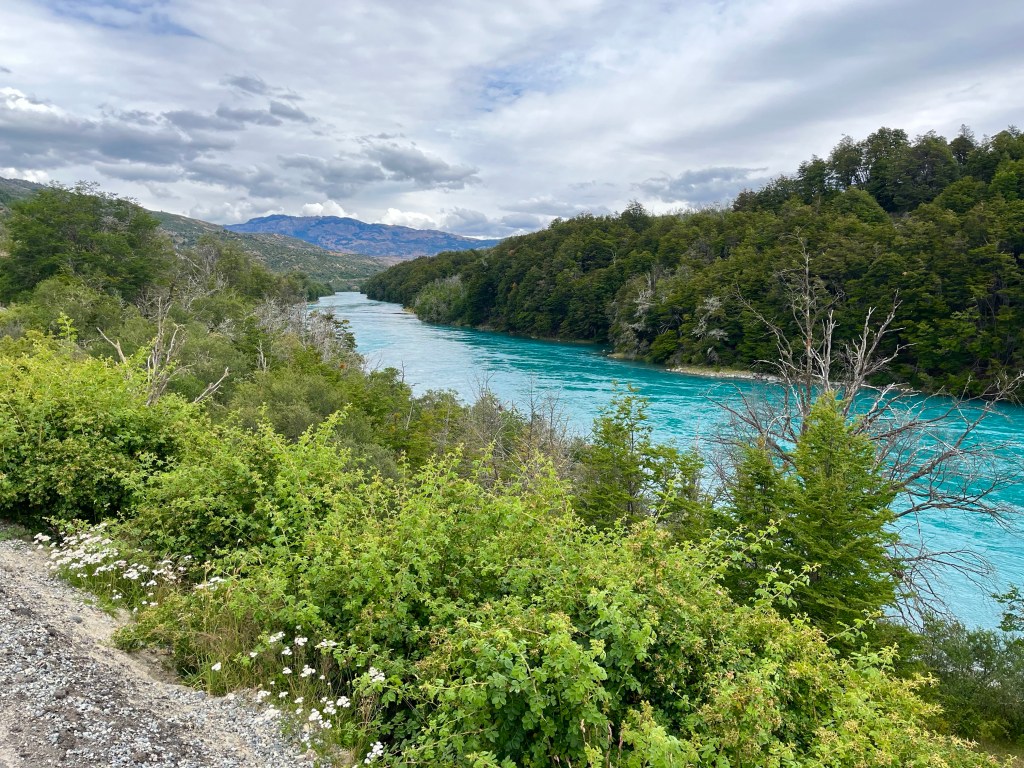
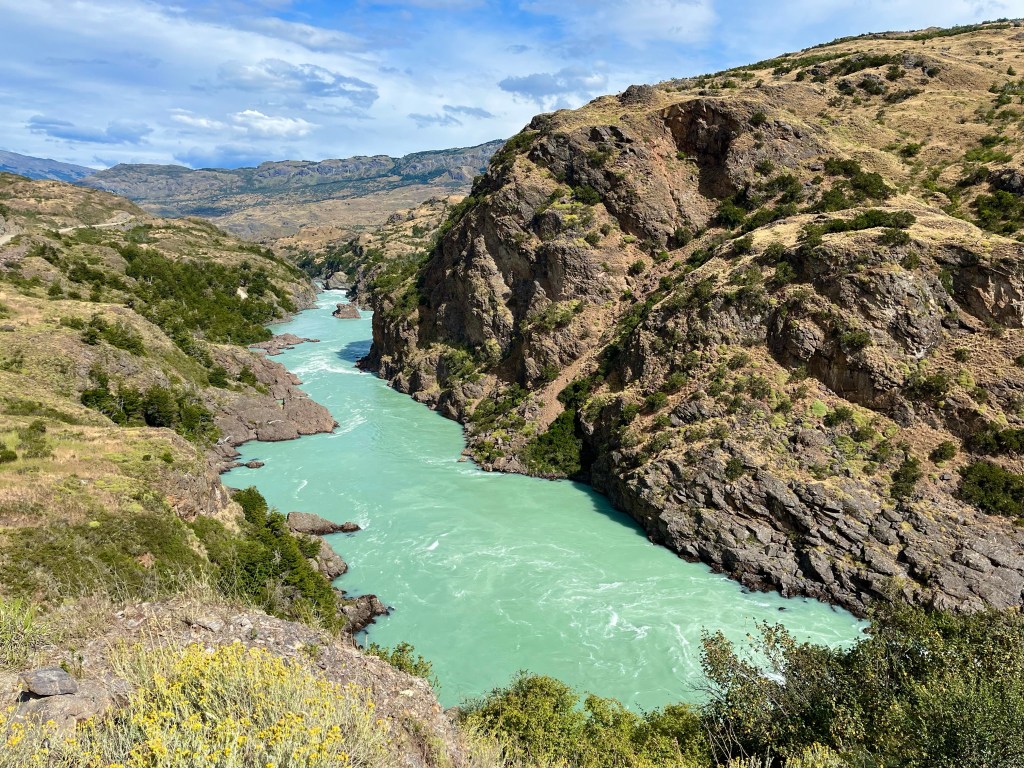
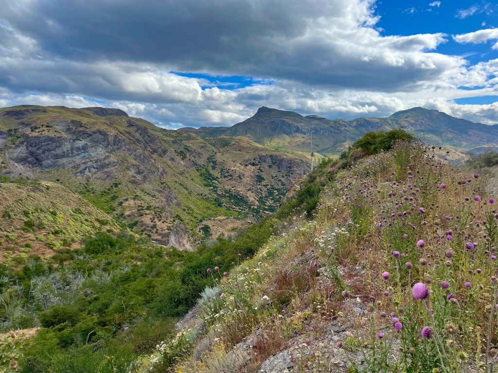
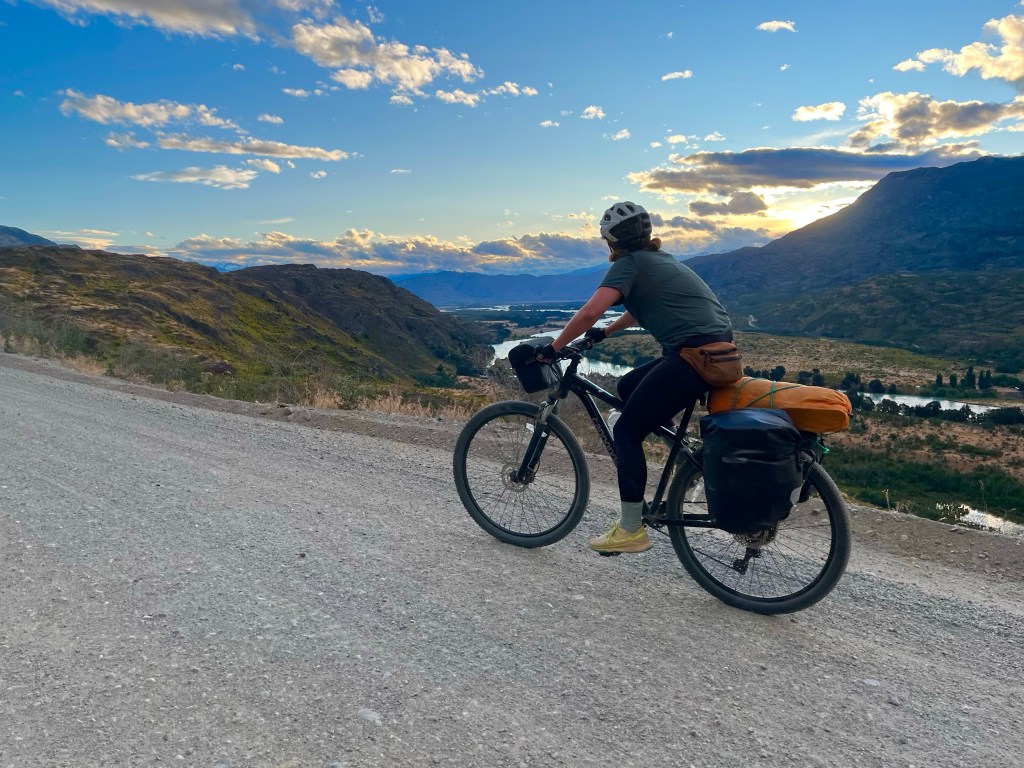
The onwards route followed the Río Baker upriver, not content to stick by its side, the road climbed high above the gorge, through rocky and fertile terrain.

Sitting in the shade near the top of the climb, my lack of phone signal meant I missed the fact that Desiree had messaged to let me know she was having a ‘little demoralisation emergency that only chocolate could cure’, just around the corner.

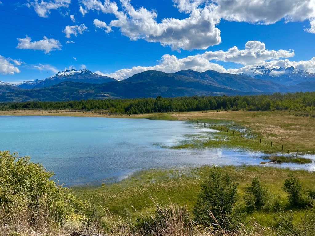
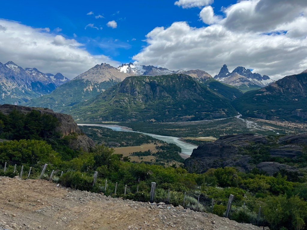
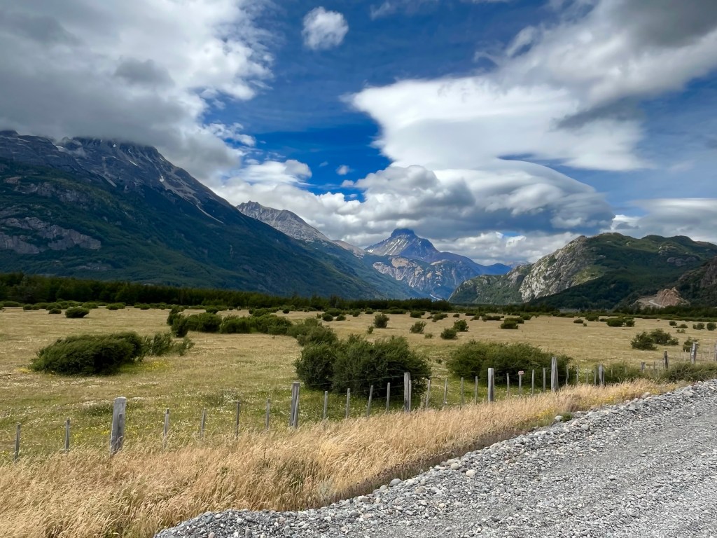
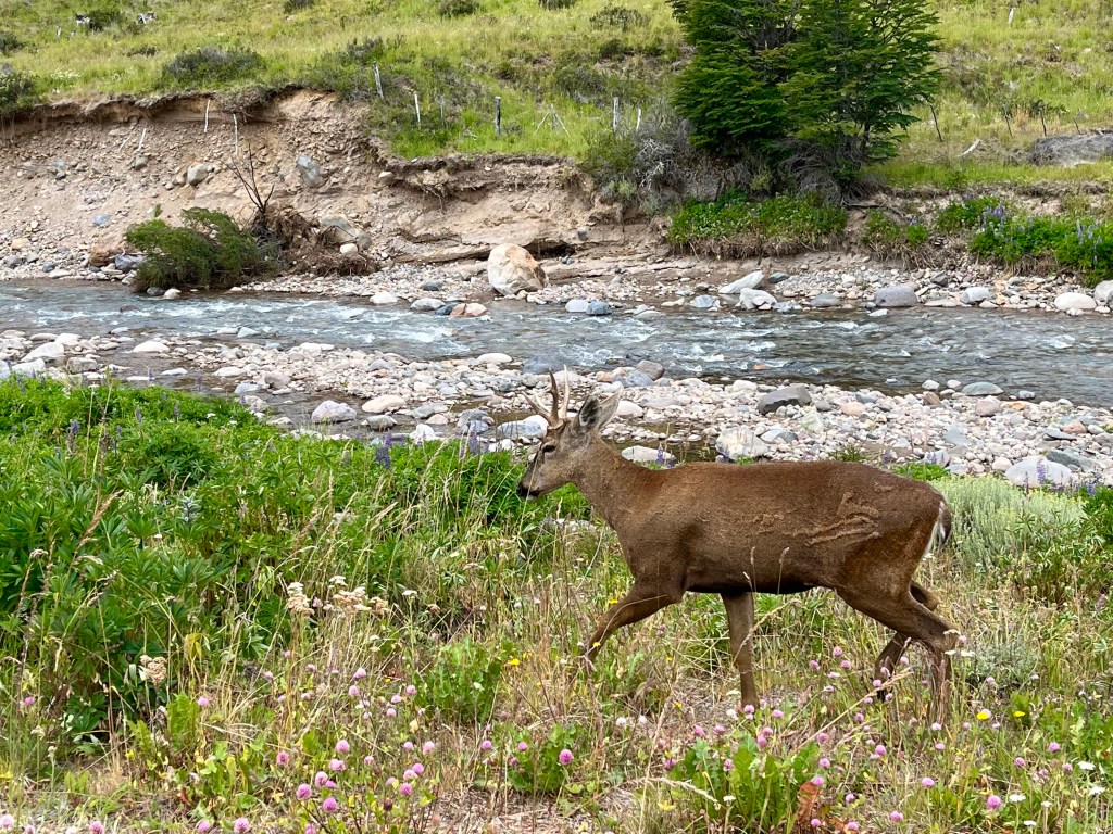
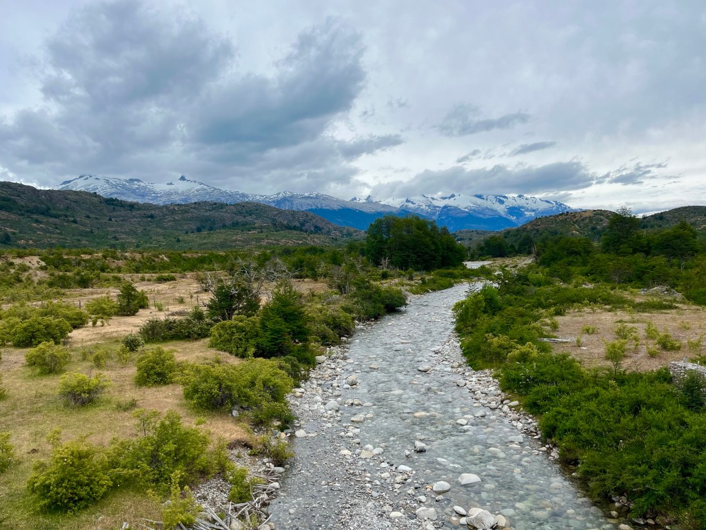
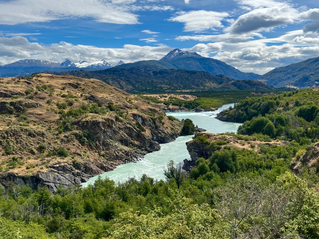
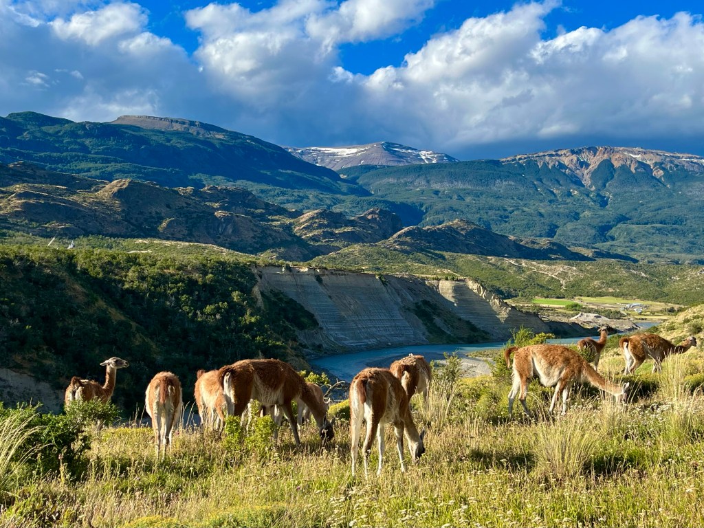
Dropping down to cross the Río Chacabuco, the road switched back steeply up the other side, soon bringing us level with a large group of Guanacos, near the road. Guanacos being the wild near ancestor of the domesticated Llama.

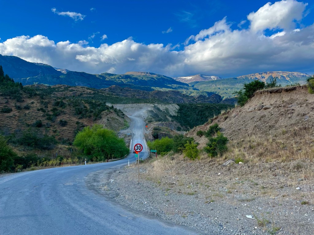
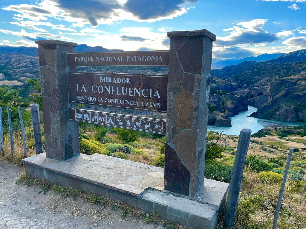
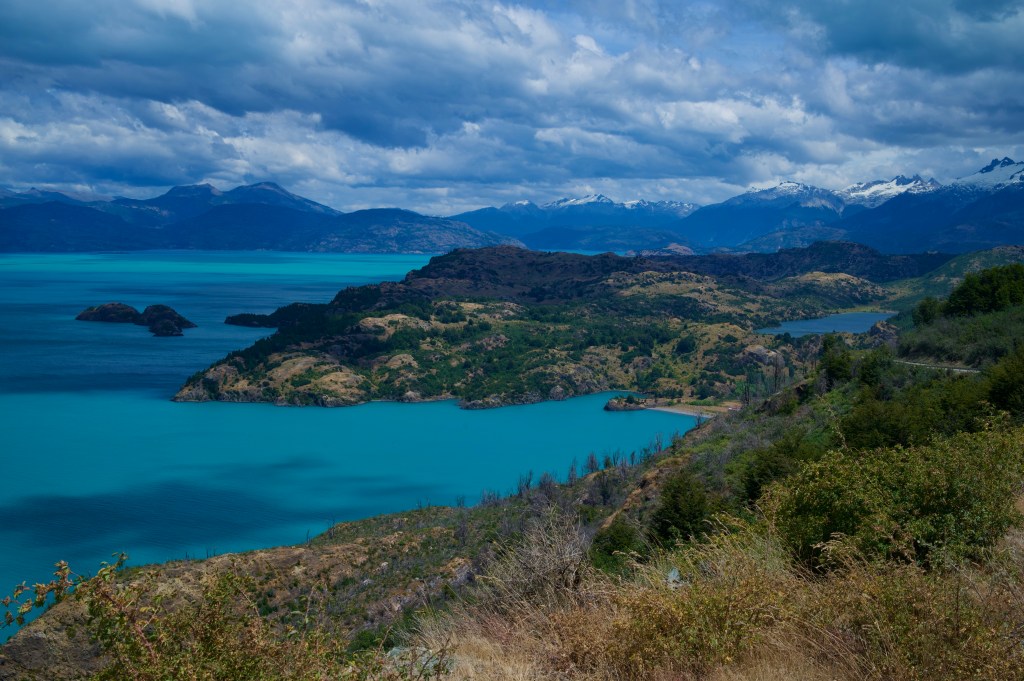
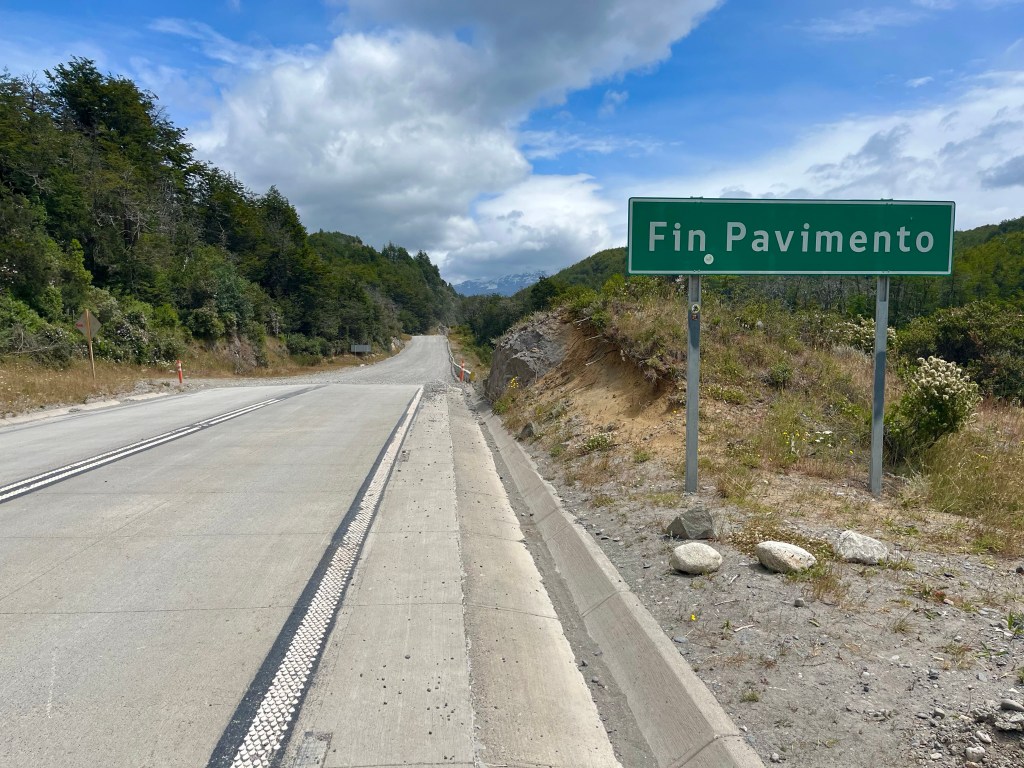
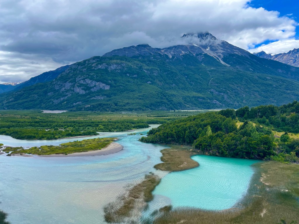
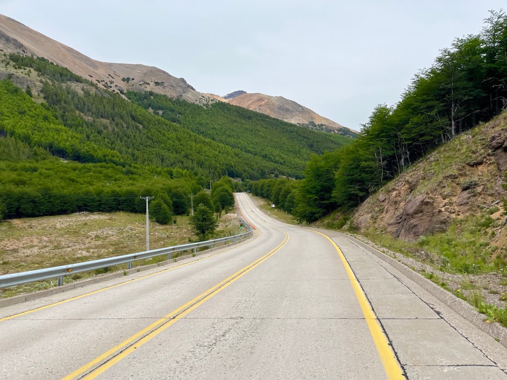
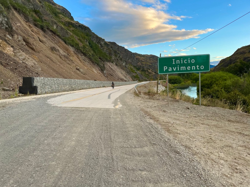
A few more metres of elevation led to a mirador, looking out over the confluence of the rivers Baker and Chacabuco, after which the road seemed to continue eking out every extra metre of elevation gain out of the landscape, even within the last few kilometres before Cochrane, when the highly satisfying ‘Inicio Pavimento’ signalled the beginning of a dream-like concrete surface, the road climbed sharply before dropping down into the town.

Finding ourselves at the edge of the centre of town, we started looking for places to stay. Desiree, tried a Cabaña, I got the easier job of checking out the hostel. Desiree disappeared into a restaurant, I carried on down the street, trying to keep on brief, only to return to find that the restaurant had Cabins in behind and that Desiree had scoped out an ideal 2 bed cabin with bike parking down the side. Perfecto.

Day 15: Puerto Río Tranquilo – Camping y Cabañas Cerro Color

Distance: 34.99 miles

Time: 5:54

Elevation Gain: 3,432 feet

Waking up in time to be picked up for the kayaking, at 6 AM, was a challenge, but we were soon on our way along the road out of town to a small sheltered bay, the starting off point for our paddle towards the Capillas de Mármol, marble caves.

We weren’t the only group there kayaking that morning, but our tour did provide the novelty that there were only two of us, along with our guide Gonzalo. Gonzalo was friendly and knowledgeable, and took lots of pictures of us to share later, just in case we hadn’t spent the morning photographing the trip ourselves, using the handily supplied waterproof phone cases.

It was a bright morning, and the mountains surrounding the lake were looking fine, and, as we approached, it was clear that this would be a good time to take the trip with the marble formations bathed in the early morning light.

We were educated on the names attributed to the various parts of the area, with the chapel, the cathedral, the tunnel and a large cliff behind. The various formations were spectacular, but as Desiree pointed out, the highlight was just being out on the lake in such a beautiful setting.

Having worked up an appetite during our almost 3 hour paddle, we headed for breakfast, as soon as we made it back into town, at cafe chirifo, which had been recommended as the best place in town, not something I’d try and discredit on the basis of the elegantly plated dishes of pancakes and berries, and avocado toast we were provided, they were excellent.

On packing up our bikes, I took a look at Desiree’s pannier rack as one of the bolts mounting it to the frame had evidently dropped out, and, after investigation, the one on the other side had rattled loose, too.

Needless to say, I hadn’t checked my own bike, and on jumping on to leave the site, I realised I had a completely flat back tyre, a little frustrating, but an excellent opportunity to try out my new secret weapon, a tiny motorised bike pump.

After setting off, we had already travelled these roads in the morning, so I wasn’t surprised to find a steepening collection of energy sapping climbs formed the opening part of the route.

The scenery along Lago General Carrera was outstanding, and the stunning green hue of the lake, breathtaking.

Enjoying the scenery at the top of one climb, we made a new cycling friend, Felipe from Argentina, he had initially asked me if I wanted my photo taken as he cycled past, but we soon turned the tables on him, as he was travelling alone, he’d be needing some photos taken of him.

As the day went on, I started to wonder just how big this lake was, before looking at the map and realising that it actually stretched into Argentina, so really quite big was the answer.

As the road dropped down to the lakeside at one particularly beautiful stretch, Desiree, suggested some lunch, and a swim, in the deeply-hued, but frigid looking waters. Still to be convinced, a couple of other tourists arrived and beat us to it. Maybe it wouldn’t be so bad…

After lunch the climbs continued, but eventually we reached the end of the lake and stopped for some food on a bridge, the sun now low in the sky, and Desiree commented that she wouldn’t usually ride this late. I always ride this late I sighed, apologetically, and as we trundled down a farm track, at sunset, to the initially abandoned looking, Camping y Cabañas Cerro Color, we were treated to my other long established cycle-touring habit, pitching tents in the dark.

Day 13: Villa Cerro Castillo – Camping Doña Dora

Distance: 51.93 miles

Time: 7:28

Elevation Gain: 3,878 feet

Although the next stop on my itinerary was Doña Dora campsite, more than 50 miles away, I was still riding with Desiree and was aware that she was a lot newer to this than me, so my thought for today was to split the 73 miles to Puerto Río Tranquilo more evenly into two days, and see where we ended up, with the possible option of a wild camp in what was quite a remote section.

We stopped off at a fruteria and the supermarket to stock up on supplies before setting off out of town, there was a long climb to start the day, but the views we were seeing, and the ones we were heading too, of the Cerro Castillo mountain massif made it all worthwhile.

Soon we reached the dreaded ‘fin pavimento’ sign, where, effectively, the tarmac ran out for the rest of the route. And, when it did, it was replaced with the worst surface imaginable, large chunky stones right across the carriageway, and with a regular procession of trucks and pick up trucks for company.

The views along the Río Ibáñez remained sensational, with one sweeping downhill bend offering incredible views of the river’s flood plain and an en-widened meander in the glacially-fed river.

Once we reached level ground, down alongside the river now, the going was tough. There was a strong headwind, the first occasional showers for a week or so, and the road surface itself was punishing, with an occasional smoother track near the middle, and with patches of washboard, alongside deep pools of dry dust as the road dropped towards the edges, oftentimes where we forced by the fast-moving oncoming traffic.

A little low in energy, and certainly in motivation, Desiree had stopped up off the road up ahead, to take on some fuel. She had already forewarned me for what might happen next, that she was going to try to get a lift in a pickup truck. Not happy at having to abandon her by the side of the road, I offered to stay until she found a ride. But she remained resolute, she did this all the time, and she’d be fine, and as someone who’d lived in Argentina, Peru, Ecuador, and Myanmar, she was probably in a better educated position to say that than most.

I re-evaluated the situation, it was nearly 4 o’clock and I’d only covered 15 miles or so, some of which had been extremely rough and punishing, however, I started to make strong progress in the challenging conditions, and quickly re-set my target for the day to Doña Dora campsite, which would be 50 miles for the day.

For 10 miles I pushed on, making good headway, until I reached a long steep slope of thick damp dirt, my wheels skidding on the peculiar surface, until I reached a layby, near the top, and stopped to take in the views of another fine bridge far below.

At that point, there was a toot from a passing pickup and I spotted Desiree happily waving from the passenger seat, it seemed likely she’d continue all the way to Puerto Río Tranquilo today.

After the long steep hill, the road started to undulate steeply along the side of Laguna Verde, and this trend in road profile remained, even when I reached a pronounced bend in the road, with my direction switching from West to South, and the delight of escaping the headwind, tempered by repeatedly energy sapping climbs.

The road was in a high valley along the river when I pedalled the last few miles to Doña Dora campsite at 10 o’clock, only shortly before dark. The camping spot was in sparsely populated forest-land at a farm, and the sole other occupants were an Argentinian couple with a campervan, who were hunkered down in a cosy communal cabin maintaining the fire, it was much appreciated when I was cooking up some pasta in the early hours of the morning.

Day 12: El Blanco – Villa Cerro Castillo

Distance: 39.55 miles

Time: 5:31

Elevation Gain: 3,530 feet

The campsite at El Blanco was a good one, with excellent facilities and a pleasant camping area with a mixture of hikers and a couple of other cyclists.

As I was clearing up my dishes at the end of the night, another cyclist, who had previously been conversing to some motorcyclists in some extremely fluent sounding-Spanish asked where I was from. She herself, was from Germany, but had been living in Peru, and before that Ecuador, and her name was Daisy, she said, when speaking to English speakers, but was actually Desiree. Even as an English speaker, I hoped I could manage that.

Desiree had just started her trip, that day from Coyhaique, and had actually cycled past me as I was readying to leave town. I was surprised to see her arrive at the campsite after me, but it transpired she’d had to return to her accommodation for her plug adapter, which she’d forgotten. She had set her sights on reaching Puerto Río Tranquilo, in the next couple of days, so it was likely that we would see each other on the road.

The next morning, I wasn’t feeling in too much of a rush, as although I knew today’s ride would reach the highest point of the whole route at over 3,500 feet, and the route profile showed it to be climbing all day, the distance was to be, only, around 40 miles, to Villa Cerro Castillo, and the forecast was for it to be a little cooler than the previous few days had been.

Leaving the campsite, at 10 to 12, I was already at 1200 feet, so some of the work had been done the day before. The road trended upwards for a while before a steep pull saw me reach the turn off, with ruta 7 continuing towards Villa Cerro Castillo, and the alternative route taking highway 245 to Balmaceda, and its airport, near the Argentinian border.

After the junction, the road continued to climb, but it was a while before the true nature of where the climb would lead revealed itself, as it began to aim squarely at a range of peaks on the horizon, first climbing gradually, before ramping up for a sustained effort towards the col.

As I was climbing up the steepest part, I had good visibility way up the road, and in amongst the road signs near the top, I could make out some shapes, that gradually it dawned on me must be stationary bicycles and their riders.

So distracted was I by trying to decipher what I was seeing, that I hadn’t thought too much about the climb at all, and as I eventually arrived alongside the German couple, Fabian and Helena, stopped at the side of the road, having their lunch, I realised that I was quite out of breath. ‘Wow, you were moving fast’, Fabian remarked. It took me a minute to respond.

Fortunately, the first of the two climbs was now, largely, done, and as I rolled up to a large sign promoting a nature reserve, at the top, I discovered Desiree’s bike leaning against it. Spotting a sign for a cafe, I made my way over to the reception building for the park, and campsite, and went inside, to find the host, her daughter, a work experience girl from London, called Lucy, and Desiree, who remarked that the soup was freshly made, and excellent. It certainly was, and the best meal of the trip so far.

After lunch, Desiree headed off, just as the German couple arrived, but they were stopping to check out walking opportunities, so I was soon underway. The road dropped down quickly, through a fine valley along a river, and it wasn’t long before I was drawn to a halt again by Desiree and a couple of cars parked up at the side of the road watching the far bank of the river fixatedly.

It was soon clear what had drawn their attention it was a Huemul, or South Andean deer, and it was grazing down by the river, before it eventually crossed over and came right past the assembled throng, which now included Fabian and Helena as well. I was surprised to see it was on its own, but now know it was an endangered species, and we were very lucky to see it.

The second climb wasn’t too bad at all, and the road climbed very gradually, before just as slowly starting to descend again, but soon Desiree and I found ourselves standing atop an exquisite set of switchbacks with the incredible mountain vista of Cerro Castillo, as its backdrop.

The road descended steeply into town and we made for El Nortino campsite, one that Desiree had seen recommended. It was a little hard to find, and full, but after Desiree exhibited her Spanish language mastery once more, the host, Felipe, found us a spot to stay.