
Distance: 32.18 miles
Time: 3:59
Elevation Gain: 2,644 feet
After a good sleep in the ‘Glamping’ pod, I heated water to have with some quite pleasant granola with cranberries that I’d picked up at the supermarket, before packing up to leave.

The entire stay including the evening meal and a local craft beer, had cost around £20, which definitely seemed like good value, especially when combined with our host’s good humour.
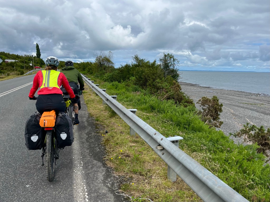
Setting off, with Marlen and Pablo again, we enjoyed a short stretch along the coast, the weather was fair, but there was a stiff breeze in our faces as we headed in the direction of Contao.
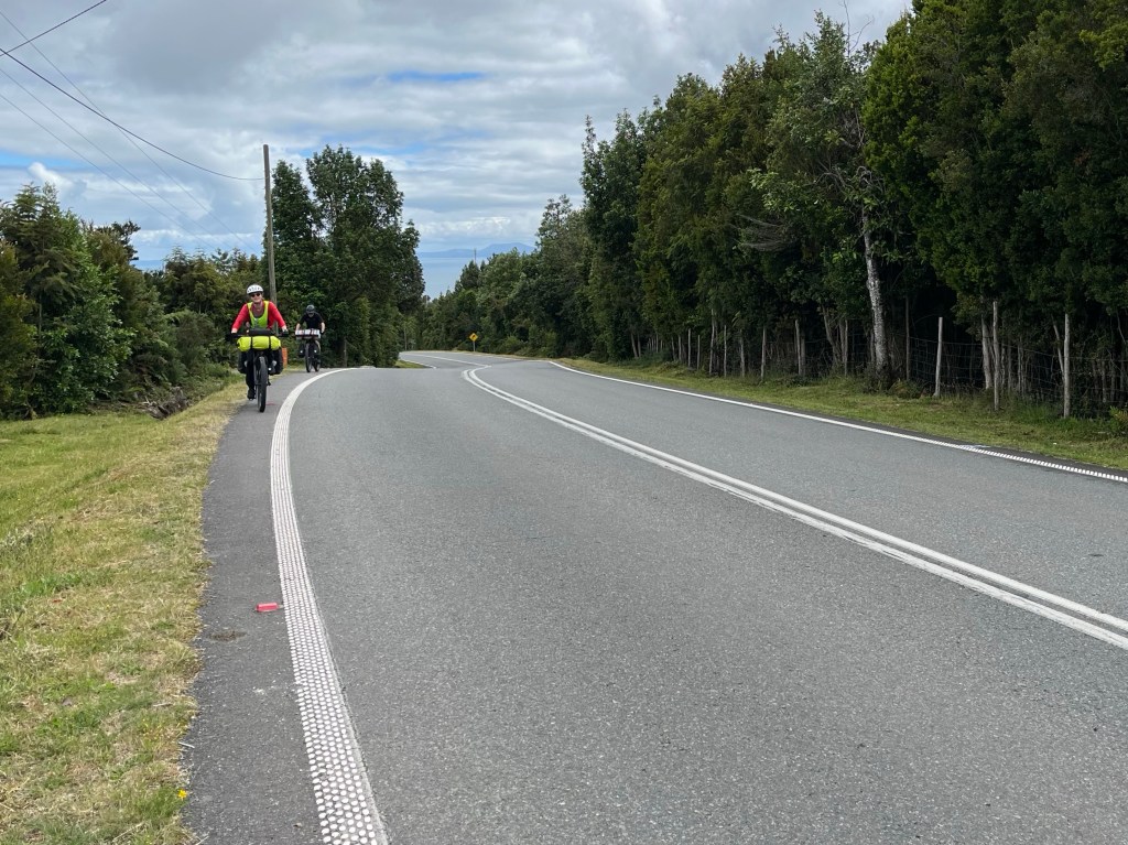
Soon, however, the road turned inland and started to climb, and we struggled up steepening gradients, working our way through the trees, into ever strengthening sunshine.


The windchill took the edge off as we crested an undulating plateau at 800 feet elevation, and views back out towards the sea emerged.

A lengthy downhill followed with Pablo and Marlen rocketing into the distance, confidence inspired by their background in mountain biking, and also their far superior hydraulic disc brakes.
Shortly afterwards, we stopped at a local minimarket for some snacks, the sign suggested that it was open, but there was no one inside, not until the shopkeeper emerged from the house nearby to open it up for us.

Pickings were slim, but I ended up with a packet of small scones, the hardness of which gave the impression that they’d been in the shop for a considerable amount of time.

Surprisingly, though, they did taste quite good, especially after Pablo produced a squeezable pouch of Manjar Tradicional as an accompaniment. It’s a type of Dulche de Leche also common in his home country of Argentina.

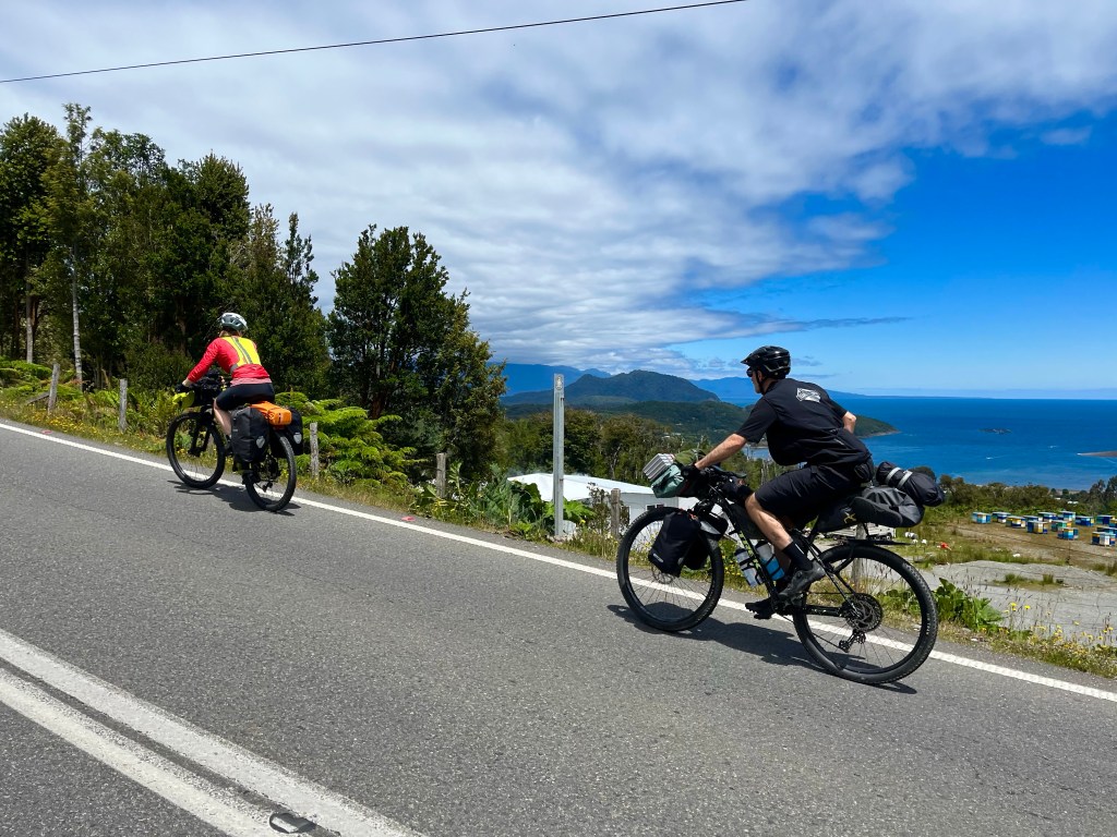
Another climb led to an attractive and fertile open valley, with horses stretching their legs in the fields that lay either side of the road.

The last descent, down into Hornopirén, was joyous, with a great road surface, and fantastic views of the happily situated bay starting to unfold.

First port of call was, in fact, the ferry terminal, as we strove to source the elusive tickets for the next part of the route, the Bi-modal ferry to Caleta Gonzalo. Elusive, in that we had spent the entirety of the previous ferry crossing – the day before – attempting to buy tickets online, before realising that the system would not be working any time soon.

And in case you’re wondering what a Bi-modal ferry is, it’s a ferry journey, in which we’d have to get out and cycle in the middle. I’m sure it’ll catch on…

Great blog! It was good that you had company. Enjoy the ferry journey today. Mum
LikeLike
Thanks beautiful day for it today!
LikeLike
I don’t know what I thought the landscape of Chile would look like but I’m pretty sure I did not expect the undulating countryside with greenery shown in your photos. I am also impressed by the condition of the road surface!
And I will have to Google ‘bimodal ferry’ as I would have thought 2 ferry journeys with cycling on the middle would just be two ferries not requiring a specialist term.
Great that you’ve got fellow cyclists for company even if they do have far superior hydraulic disc brakes!
LikeLike
Well, it is over 4000 kms long, so I guess that there is quite a variety of landscape, from the driest hot desert in the North to sub-Antarctic in the South. Perhaps fortunately, I will miss those extremes! The AI response for a bi-modal ferry gives this exact ferry as the example, so perhaps they made it up for this! I suppose it’s to differentiate it with another longer solely ferry route going a similar direction… 🤷♂️ The tarmac road surfaces have been great, it will definitely not be solely tarmac, however!
LikeLike
wow! A fair bit of climbing
LikeLike
There was enough, but I need the practice!
LikeLike